Welcome to the forums at MyJeepRocks.com. You'll need to log in or register
before you can post. If you're having trouble, please contact us. Happy trails!
Well, here are a few pictures I took...sorry if they are too big!:
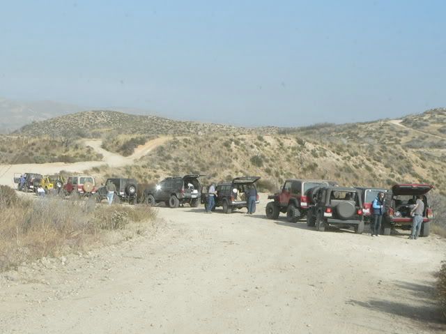
Group shot-
[sized]http://i9.photobucket.com/albums/a95/steelman_d/Wheelin/Cleghorn11-26-05GroupShot.jpg[/sized]
Fuelrod off in the distance...running back and forth and discovered that the Xterra needed to be recovered-
[sized]http://i9.photobucket.com/albums/a95/steelman_d/Wheelin/Cleghorn11-26-05Fuelrodinthedistanc.jpg[/sized]
Jeri Lyn had to be recovered after helping others, this is after she was uprighted- Pic 1-
[sized]http://i9.photobucket.com/albums/a95/steelman_d/Wheelin/Cleghorn11-26-05JeriLynafterrecover.jpg[/sized]
Greg on his way back to the "main road" after winching out others-
[sized]http://i9.photobucket.com/albums/a95/steelman_d/Wheelin/Cleghorn11-26-05CoyoteCircusafterco.jpg[/sized]
Mike with his A$$ in the air! -
[sized]http://i9.photobucket.com/albums/a95/steelman_d/Wheelin/Cleghorn11-26-05Mikewithhisintheair.jpg[/sized]
Even up here, there are a line of break lights! -
[sized]http://i9.photobucket.com/albums/a95/steelman_d/Wheelin/Cleghorn11-26-05TrafficJam.jpg[/sized]
[SIZED]http://i17.photobucket.com/albums/b53/UF92134/Cleghorn%20and%202N17X/P1010259.jpg[/SIZED]
Do you see that red Jeep way in the back? Is that a Liberty? :tongue:
You'd think it were a Liberty by the way that guy drives it......:homer:
I think I can get there quickly.
I was checking out the area with google earth. I think their new picture has Jeri Lyns jeep flopped over on one of the hills. Just kidding.
That area is about a 5 hour run for us to get there. We would drive to Bakersfield to Hwy 58 and go across to 395 to come down to the 15. So, about 5 hours for us towing our trailer.
Someday when we come down to do Big Bear also, we will make a day of Cleghorn also.
Todd
Navy-Jeepster
Proud to be an American! Sharetrails/BRC President.
Sponsors: BFG, Raceline, Advance Adapters, Currie, T&T Customs.
I think I can get there quickly.
I was checking out the area with google earth. I think their new picture has Jeri Lyns jeep flopped over on one of the hills. ...
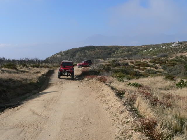
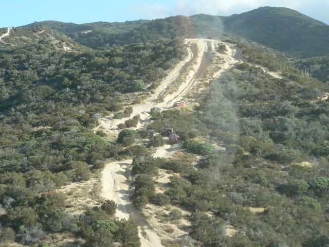
On Saturday, November 26, 2005, Jeri Lyn led trail runs along Cleghorn Ridge (2n47) and then to Pilot Rock via 2n17x. Cleghorn Ridge is in the San Bernardino Mountains about 60 miles east of Los Angeles. It runs east � west, and connects Interstate 15 in the Cajon Pass to Silverwood Lake. The Cleghorn Ridge trail (2n47) is a well-maintained graded dirt road that can be driven by ordinary passenger vehicles. The main attractions for MJR members are the scenic views of the San Bernardino and Apple Valley areas from the ridgeline, and the fact that there is a more challenging alternate route that runs parallel to, and often intersects the graded road. A driver can choose the alternate route or stay on the main road. Here�s a view of a section of the graded road. I believe that the first Jeep belongs to Karen, a member of the Hemet Jeep Club, and the second one is Fuel Rod�s Jeep:
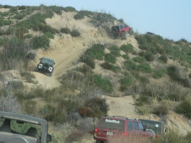
And views of the alternate route:
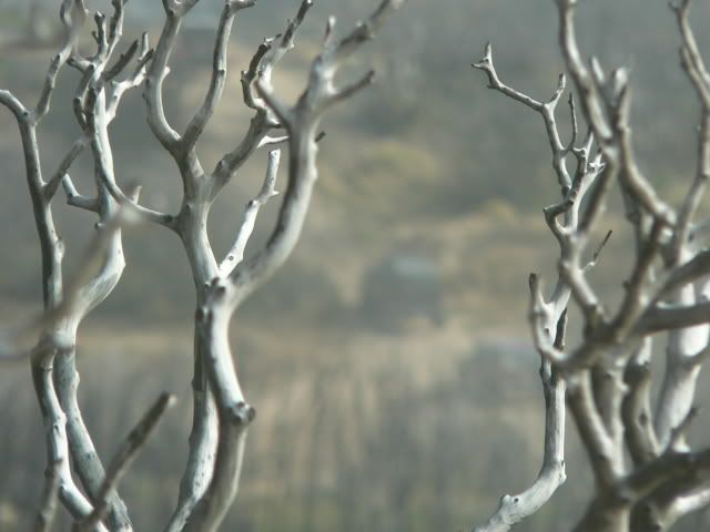
The group met at the Cleghorn exit to I-15, where Jeri conducted the drivers meeting. The run started with 12 vehicles; 10 short wheelbase Jeeps (CJs, YJs, and TJs), one XJ, and one Nissan xTerra. During the course of the day, a few more Jeeps joined us. Cleghorn Ridge was recently reopened after having been closed due to fire and erosion damage from the 2003 fire and the winter rains. The signs of the fire are still evident:
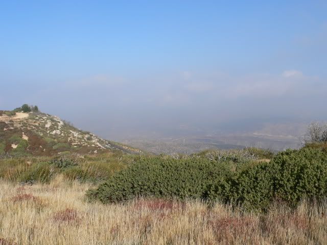
At the start of the run, the weather was hazy (but the forecast called for windy conditions and improving visibility later in the day). In this photo, we could barely see the Cajon Pass. Normally, we could see beyond the pass to Victorville and the Apple Valley:
If you don't like the way I drive, stay out of the bushes!
KI6MLU
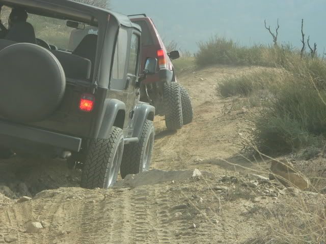
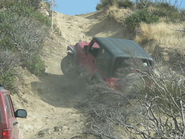
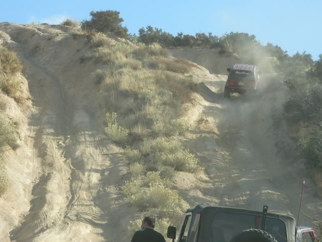
Whenever the alternate route crossed the main route, each driver would decide which route to take, and then the group would reassemble once the routes reconverged. We had only gone about three miles and were waiting for a few vehicles that had taken the alternate route to rejoin the group when we heard on the CB that the xTerra had overturned. Some of the Jeeps backtracked on the alternate to the site of the incident, and the rest of the Jeeps went down the main road. Here�s Jeri Lyn on the alternate trail enroute to the xTerra:
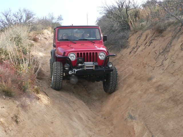
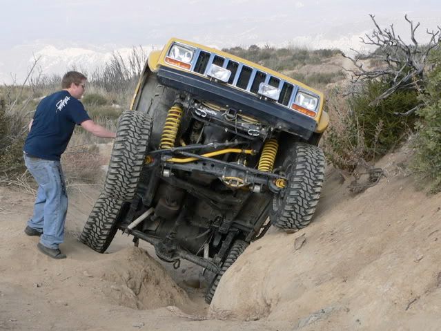
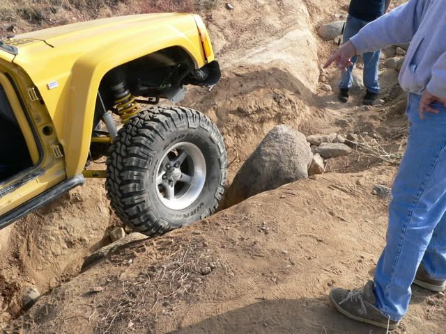
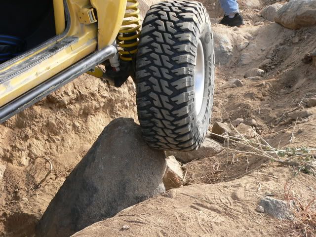
The xTerra had not overturned; it had slid onto its side while attempting to negotiate a v-notch:
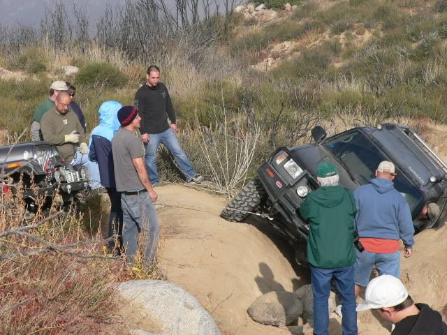
After the xTerra was recovered, I returned to my Jeep, which was parked about � mile away. By the time I got to my Jeep, I heard on the CB that Jeri Lyn�s Jeep had fallen victim to that v-notch. By the time that I returned to the site, her Jeep had already been recovered, so I didn�t get any pictures of her �oops�, but the damage was relatively minor:
If you don't like the way I drive, stay out of the bushes!
KI6MLU
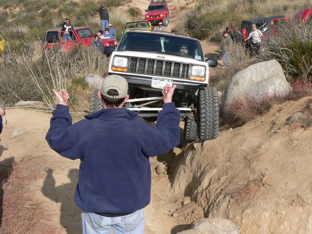
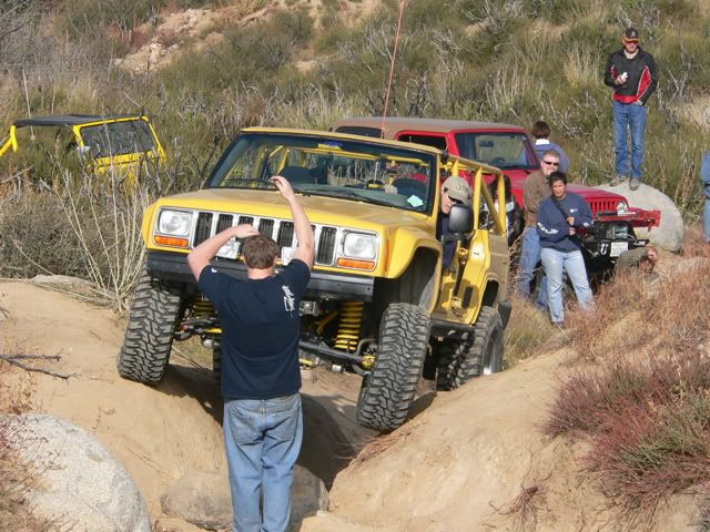
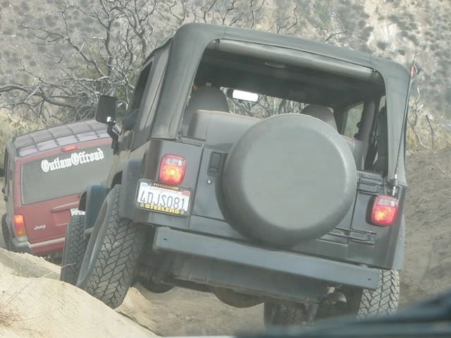
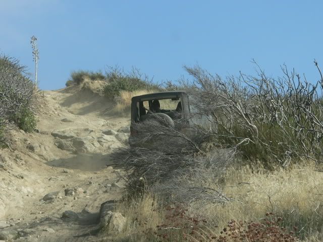
Meanwhile, a group of three XJs which included MJR member Saki993 came up to the v-notch. After a ground reconnaissance, two of them decided to take the alternate. Saki993 spotted the white XJ and drove the yellow XJ (I don�t know the name of the other driver):
If you don't like the way I drive, stay out of the bushes!
KI6MLU
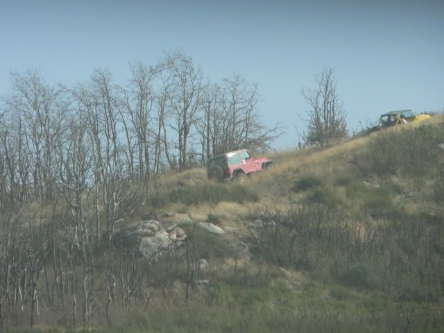
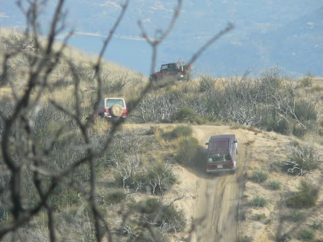
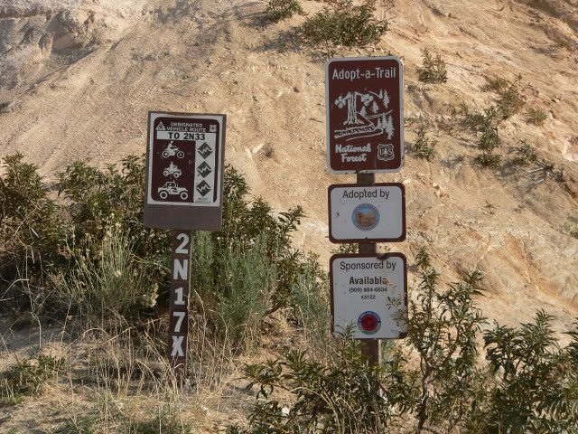
After reaching the end of the Cleghorn Ridge trail, we drove around the north end of Silverwood lake until we got to the trailhead of 2n17x. 2n17x is a �shortcut� between Silverwood Lake and Lake Arrowhead. It starts off of 2n33 at Silverwood Lake, and rejoins 2n33 near Pilot Knob, about halfway between Silverwood and Arrowhead. Whereas 2n33 is an easy, graded dirt road that follows the shoreline of Silverwood Lake and makes a gentle climb to Pilot Knob, 2n17x is a black diamond rated trail that follows a more direct route to Pilot Knob.
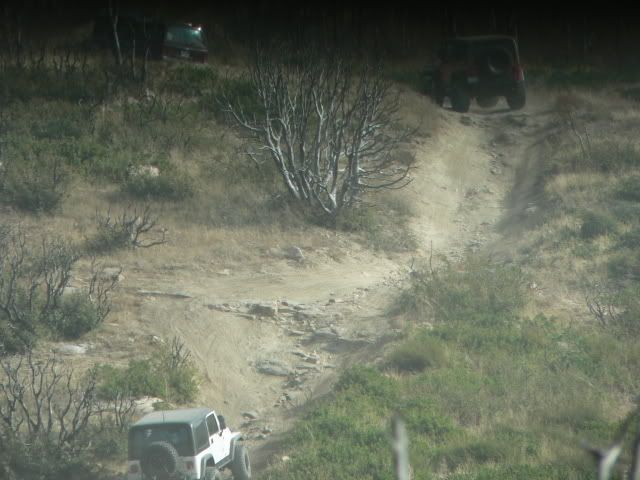
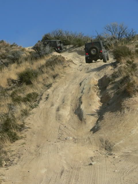
This obstacle is called �Gatekeeper Hill�. Most of the Jeeps chose the bypass to the right or the rightmost track up the hill:
If you don't like the way I drive, stay out of the bushes!
KI6MLU
 Tweet
Tweet

 : http://i9.photobucket.com/albums/a95...n/DSC06310.jpg


Comment