 Tweet
Tweet
WOW!!! Black bear pass, helicopter rides - Alycia you look so cold half the time! Amazing pics, and I know how hard those group shots are to get sometimes - everyone's pics are amazing, PLEASE PHOTOSHOP ME IN!!!!
-
:gun:'99 TJ Sport:gun: -
like herding cats!Originally posted by sarah View Post[CENTER][COLOR=#ff0000]Resistance Off Road
[/COLOR]Join the Resistance...
http://www.resistanceoffroad.us[/CENTER]Comment
-
I haven't post pic yet...been busy cleaning deer from my truck and getting it fixed. And not to mentioned we sold our house and need to move out by early sept. I need a vacation! Will post pics soonComment
-
Hey, save that deer meat. Sausage anyone??? Congrats on the house too!Originally posted by Hook&Ladder View Post[CENTER][COLOR=#ff0000]Resistance Off Road
[/COLOR]Join the Resistance...
http://www.resistanceoffroad.us[/CENTER]Comment
-
On Friday August 10 we ran 8 trails. The first was Mineral Creek
The entrance to the trail is very close to Ouray and we decided to stop in the big vista area on the Million Dollar Highway to check out the Idarado Mine.
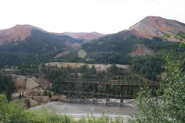
The Idarado Mine has a tunnel over 5-1/2 miles long that goes all the way to Telluride
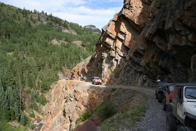
Fun shelf road next to the Uncompahgre River
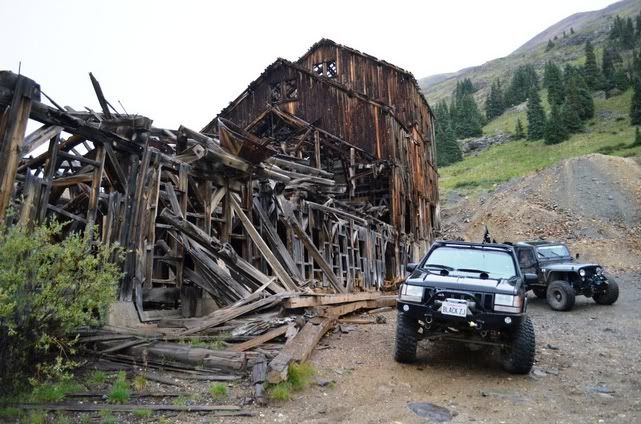
The Mickey Breene Mine
The Mickey Breene Mine has an old tram cable strung across the road that limits any tall vehicles from using the trail.
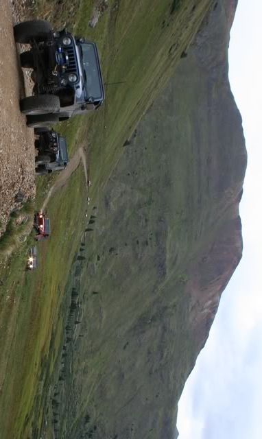
Almost to the next trail
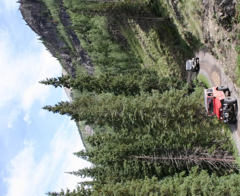
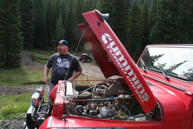
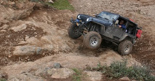
The YJ with a Cummins Turbo Diesel engine out of a Frito Lay truck was way cool. Jeep porn!
More Mineral Creek photos can be seen here
To be continued...Over 2500 hours donated to the San Bernardino National Forest. Life member of CA4WD, CORVA & BRC. Tread Lightly Trainer. Reforestation Supervisor. CASSPComment
-
Friday
Man! This is painful waiting for you to get to the best trail of the trip!
Come on Doug, get to Poughkeepsie!
Fine! I give...
Here's a video.....
http://www.youtube.com/watch?v=iTFtI...1&feature=plcp[COLOR=#ff8c00]MYJEEP(crawls)ROCKS(again).com
I have finally stopped drinking for good.
Now I drink for evil..... :devil:[/COLOR]Comment
-
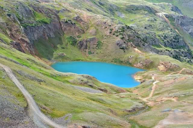
Sweet vid!! Those winch points are new! When we went up that it was raining, and they made me drive the XJ up it because I was the "lightest one" - we made it but the other groups didn't. I love the turquoise lake on that trail too!!
:gun:'99 TJ Sport:gun:
but the other groups didn't. I love the turquoise lake on that trail too!!
:gun:'99 TJ Sport:gun:Comment
-
About 1/2 way up the Mineral Creek trail we turned right onto Poughkeepsie Gulch
Until today most of the trails we have been on are of the fire road type. Very scenic but not much technical challenge. Mineral Creek has some tougher sections and Poughkeepsie Gulch has a genuine black diamond obstacle.
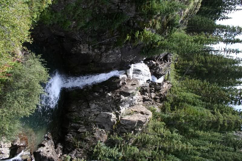
Waterfall near the start of Poughkeepsie Gulch
This could easily be a magazine cover
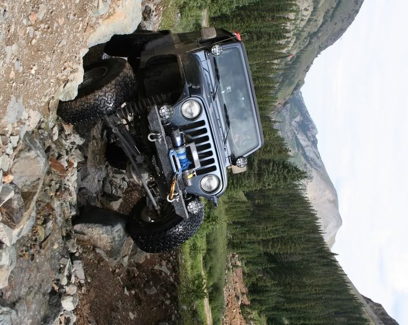
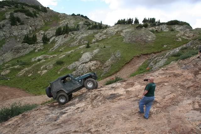
The Obstacle - the middle line

The Obstacle - line to the right
The Obstacle - line to the left. Mike made it look easy and never spun his tires once.
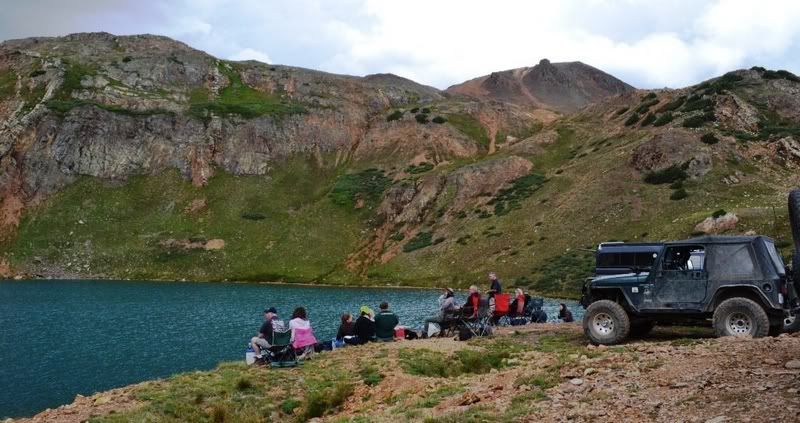
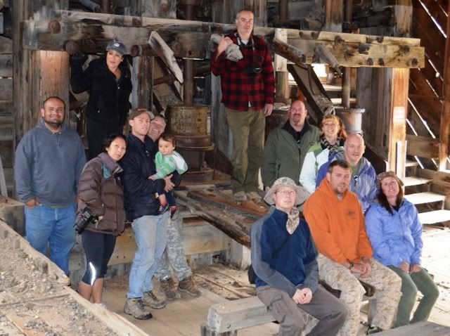
Lunch at Lake Como
More Poughkeepsie Gulch photos can be seen here
To be continued...Over 2500 hours donated to the San Bernardino National Forest. Life member of CA4WD, CORVA & BRC. Tread Lightly Trainer. Reforestation Supervisor. CASSPComment
-
Linda is still on vacation and not sure when she will get back. I have all her photos I am sorting through as well as my own. Together we had over 600 shots on Poughkeepsie Gulch aloneOriginally posted by Mike View Post I already have 30+ hours invested in photos and trip reports up to this point and we have a pretty big week at the shop.
My one regret from the 2009 trip was that I did not sort my photos better and I am remedying that this trip but it takes a while.
BTW that is an awesome video you and Sharon have from Poughkeepsie and I can't wait until more of the videos start rolling in. Every photo and every video is like reliving the adventure all over again
Over 2500 hours donated to the San Bernardino National Forest. Life member of CA4WD, CORVA & BRC. Tread Lightly Trainer. Reforestation Supervisor. CASSPComment
-
Great pictures and stories so far, keep 'em coming. Like Sarah said, somebody please photoshop me in a picture.
Did anyone get altitude sickness? You folks spent alot of time way above sea level. More than most people can handle for a day.Comment
-
Everyone had some adjusting to do for the altitude. Chuck is the only one that seemed to struggle for a bit, but he adapted pretty quickly after the first couple of days. The cool part was on the way home, we stopped at Mesa Verde and the rangers were talking about how people have difficulty with the tours due to the 7000 foot elevation. We weren't even winded from the tours.Originally posted by Jason View Post [COLOR=#ff8c00]MYJEEP(crawls)ROCKS(again).com
I have finally stopped drinking for good.
Now I drink for evil..... :devil:[/COLOR]Comment
-
I'm glad to hear that. I wondered about you guys on that trip. A day or two is one thing that high up. Russ, he's a traveling animal, but the rest of you....
Comment
-
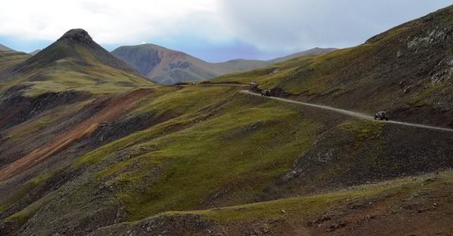
Poughkeepsie Gulch ends at a 3 way intersection with Hurricane Pass and California Gulch. We took California Gulch
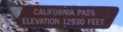
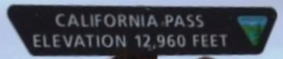
At California Pass 12,960'
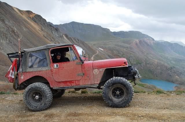
View of Lake Como from California Pass
2009 Elevation sign
2012 Elevation sign
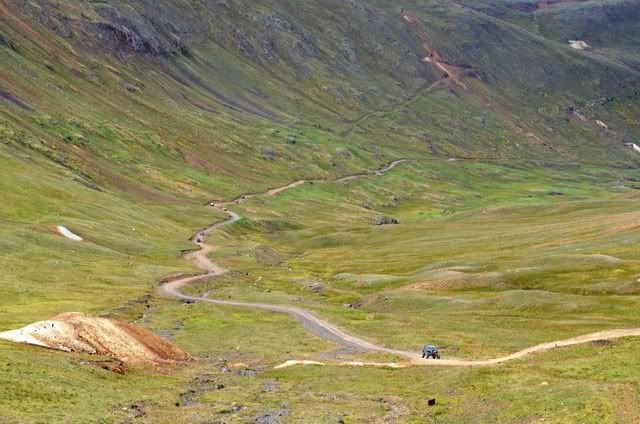
Trail from California Pass down into California Gulch
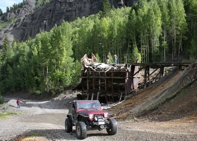
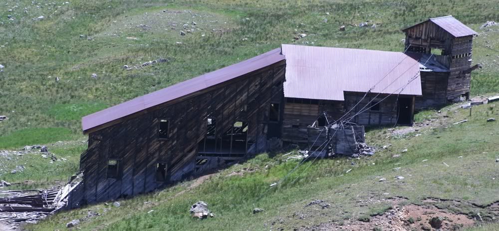
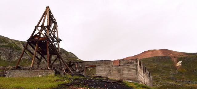
Frisco Mill in California Gulch
More California Gulch photos can be seen here
To be continued...Last edited by FishPOET; 08-17-12, 04:13 PM.Over 2500 hours donated to the San Bernardino National Forest. Life member of CA4WD, CORVA & BRC. Tread Lightly Trainer. Reforestation Supervisor. CASSPComment
-
Heading down California Gulch we took the fork to the right which put us into Placer Gulch
Looking down Placer Gulch towards California Gulch
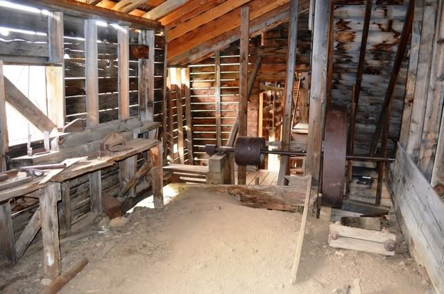
Sound Democrat Mill is the highlight of Placer Gulch
There are a couple of different tramways located in Placer Gulch
More Placer Gulch photos can be seen here
The climb out of Placer Gulch
To be continued...Last edited by FishPOET; 08-18-12, 02:24 PM.Over 2500 hours donated to the San Bernardino National Forest. Life member of CA4WD, CORVA & BRC. Tread Lightly Trainer. Reforestation Supervisor. CASSPComment
-
Last edited by RAT; 08-18-12, 01:38 PM.[CENTER][COLOR=#ff0000]Resistance Off Road
[/COLOR]Join the Resistance...
http://www.resistanceoffroad.us[/CENTER]Comment
Comment