 Tweet
Tweet
Back in April of 2006, when I first started Jeeping, a Ranger gave me a map and recommended that I try the Desert Front Trail from CA 138 over to Baldy Mesa. He marked the trail on the map and said that Cleghorn was also a good trail to start on.
Well I went to Cleghorn first, started playing on the side trails, and then moved on to harder things. I never did drive the Desert Front Trail.
Since today was such a beautiful day in the Inland Empire, I wanted to get outside and Jeepin' is my favorite outdoor activity. I grabbed my old map to see what was close by that I hadn't been on before. The little red markings from the Ranger that gave me the map jumped out at me. So what the heck? Sharon and took off for places yet to be traveled.
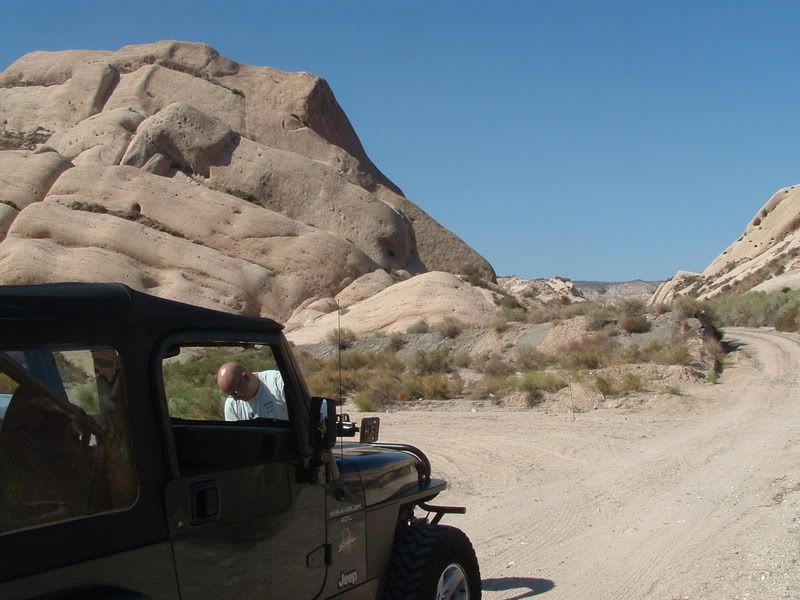
We exited I-15 at CA-138 and headed toward the Mormon Rocks. We turned off on 3N53 at the base of the rocks. After crossing a wash, we stopped to disconnect the sway bar:
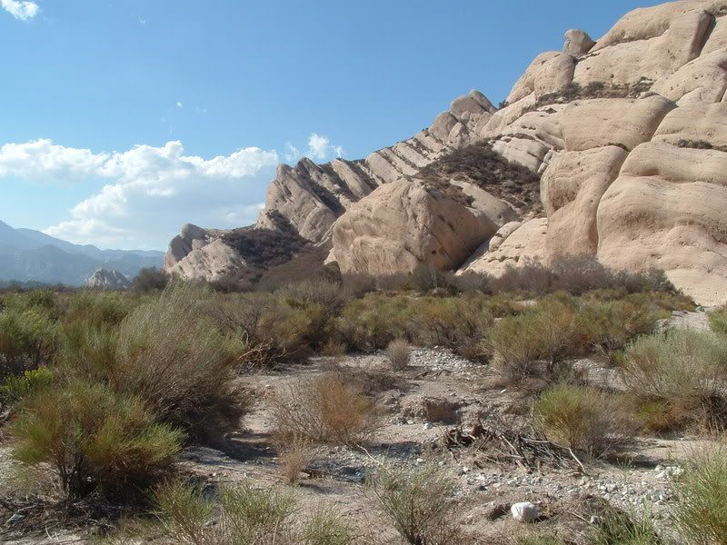
The view of Mormon Rocks in the late afternoon was excellent:
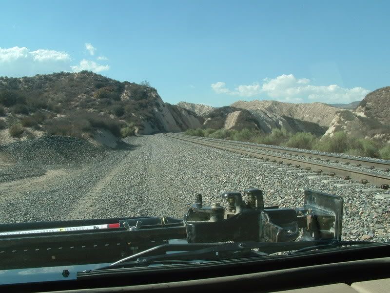
3N53 soon started following the railroad tracks. There were some places that I really would not want to be in when a train came. The gravel was deep in places and the Jeep handled like it was deep sand:
We followed this trail over to the Baldy Mesa staging area. We then turned onto 3N21 and headed north on what was obviously a trail that was mostly used for ATVs and Motorcycles. We by-passed one section by making a quick hop over to 3N55, which parallels 3N21 for a while before it joins back into it.
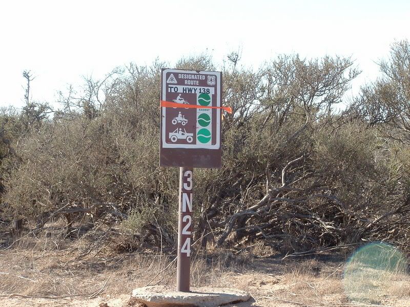
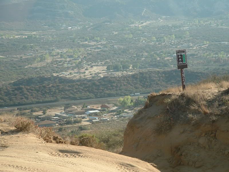
Climbing up into the hills, we finally found 3N24, The Desert Front Trail:
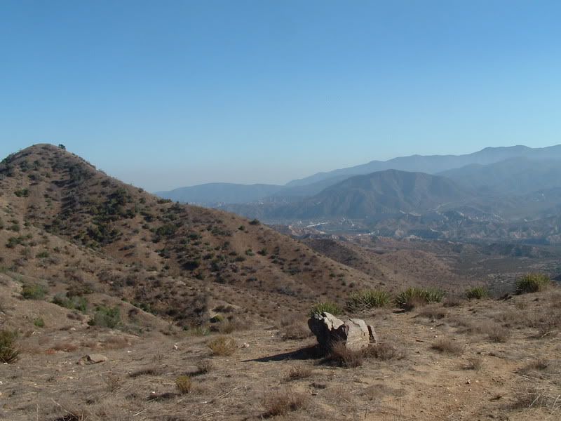
Unfortunately, it was a bit hazy so the views were not crisp, but there are some good views of both the Cajon Canyon:
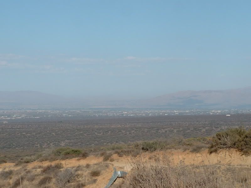
and the Mojave Desert:
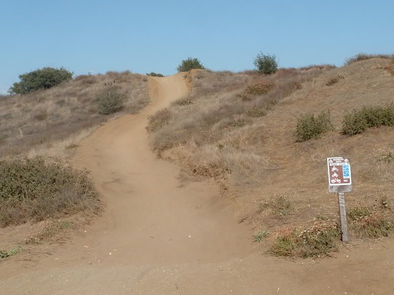
The trail is easy, but definitely lends itself to ATVs and Motorcycles more than Jeeps. There are lots of side trails but all are clearly marked as NO JEEPS!:
I'd like to go back on a motorcycle or ATV. The side trails are almost all marked as moderate and there is at least one black diamond that we saw.
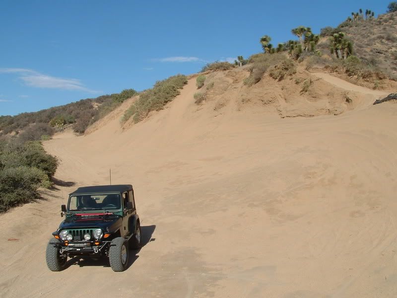
The toughest thing that the crossed on the main trail were some deep sand areas. One looked like this:
The signs on I-15 said that CA-138 was still closed, but when we got to the end of the trail, we saw that there was traffic on the 138:
So we took the 138 back down the canyon. Since we were making good time, we took 2N89 at the Lone Pine Road intersection. The trail follows the railroad to some great rock formations:
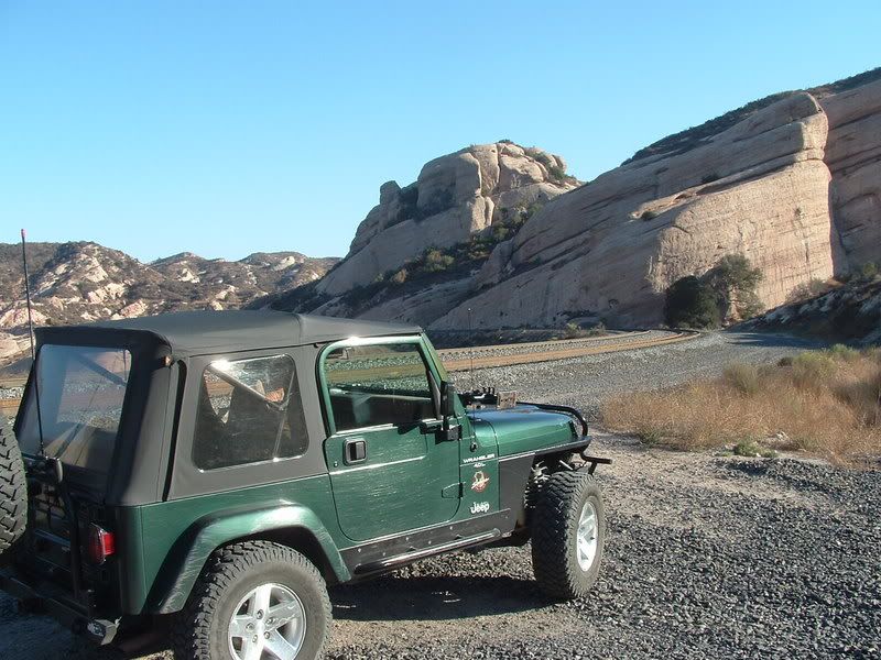
This is another trail with deep gravel and narrow spots that I would rather not share with a train. We made it to Swarthout Canyon Road, where we could cross the tracks, just before a train came. Swarthout Cyn dropped us out onto Kendall Road (Paved) and then we got back onto I-15 for the trip home.
It was a nice way to spend three hours on a beautiful afternoon. We never had to air down or even get out of two wheel drive, but it was still a nice distraction on trails that were new to us.
The rest of the photos can be viewed at this link:
http://s139.photobucket.com/albums/q...-9-07/?start=0
Well I went to Cleghorn first, started playing on the side trails, and then moved on to harder things. I never did drive the Desert Front Trail.
Since today was such a beautiful day in the Inland Empire, I wanted to get outside and Jeepin' is my favorite outdoor activity. I grabbed my old map to see what was close by that I hadn't been on before. The little red markings from the Ranger that gave me the map jumped out at me. So what the heck? Sharon and took off for places yet to be traveled.
We exited I-15 at CA-138 and headed toward the Mormon Rocks. We turned off on 3N53 at the base of the rocks. After crossing a wash, we stopped to disconnect the sway bar:
The view of Mormon Rocks in the late afternoon was excellent:
3N53 soon started following the railroad tracks. There were some places that I really would not want to be in when a train came. The gravel was deep in places and the Jeep handled like it was deep sand:
We followed this trail over to the Baldy Mesa staging area. We then turned onto 3N21 and headed north on what was obviously a trail that was mostly used for ATVs and Motorcycles. We by-passed one section by making a quick hop over to 3N55, which parallels 3N21 for a while before it joins back into it.
Climbing up into the hills, we finally found 3N24, The Desert Front Trail:
Unfortunately, it was a bit hazy so the views were not crisp, but there are some good views of both the Cajon Canyon:
and the Mojave Desert:
The trail is easy, but definitely lends itself to ATVs and Motorcycles more than Jeeps. There are lots of side trails but all are clearly marked as NO JEEPS!:
I'd like to go back on a motorcycle or ATV. The side trails are almost all marked as moderate and there is at least one black diamond that we saw.
The toughest thing that the crossed on the main trail were some deep sand areas. One looked like this:
The signs on I-15 said that CA-138 was still closed, but when we got to the end of the trail, we saw that there was traffic on the 138:
So we took the 138 back down the canyon. Since we were making good time, we took 2N89 at the Lone Pine Road intersection. The trail follows the railroad to some great rock formations:
This is another trail with deep gravel and narrow spots that I would rather not share with a train. We made it to Swarthout Canyon Road, where we could cross the tracks, just before a train came. Swarthout Cyn dropped us out onto Kendall Road (Paved) and then we got back onto I-15 for the trip home.
It was a nice way to spend three hours on a beautiful afternoon. We never had to air down or even get out of two wheel drive, but it was still a nice distraction on trails that were new to us.
The rest of the photos can be viewed at this link:
http://s139.photobucket.com/albums/q...-9-07/?start=0


Comment