 Tweet
Tweet
Ditto.
-
-
Some of the Roughwheelers will be out there this Sat /SUN . week-end of 17/18th. ck out our trail and to scout into some of the other Canyons. Will be on CB chanel 4. Will be camped below the Crows nest and will hit the trail @ 9 am .06 UNL RUBI 4.5 LA,KM 2-35's/ 4.88 BEADLOCKS/SKIDS/WINCH
07 AT CHASER TRAILERComment
-
What a coincidence....
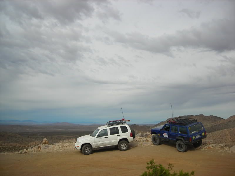
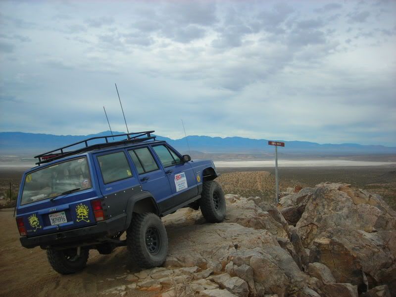
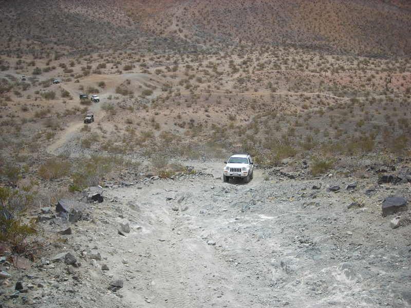
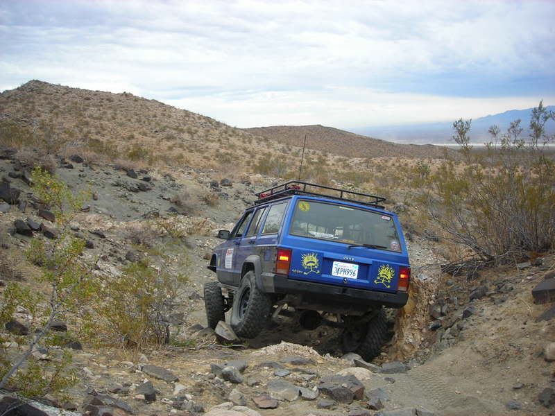
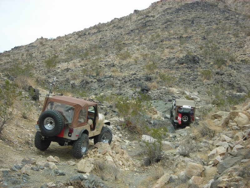
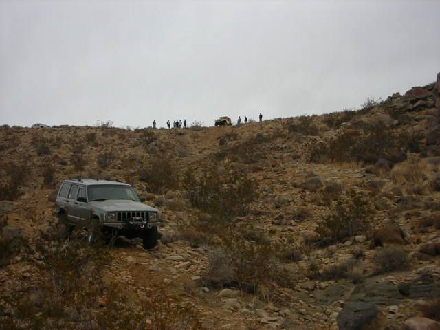
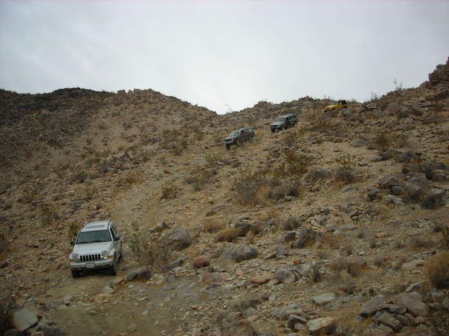
Myself, a few L.O.S.T. and NAXJA folks will be out there on the 18th to wheel. Hope we won't be in the way. Here are some pics from a previous run I made out there.
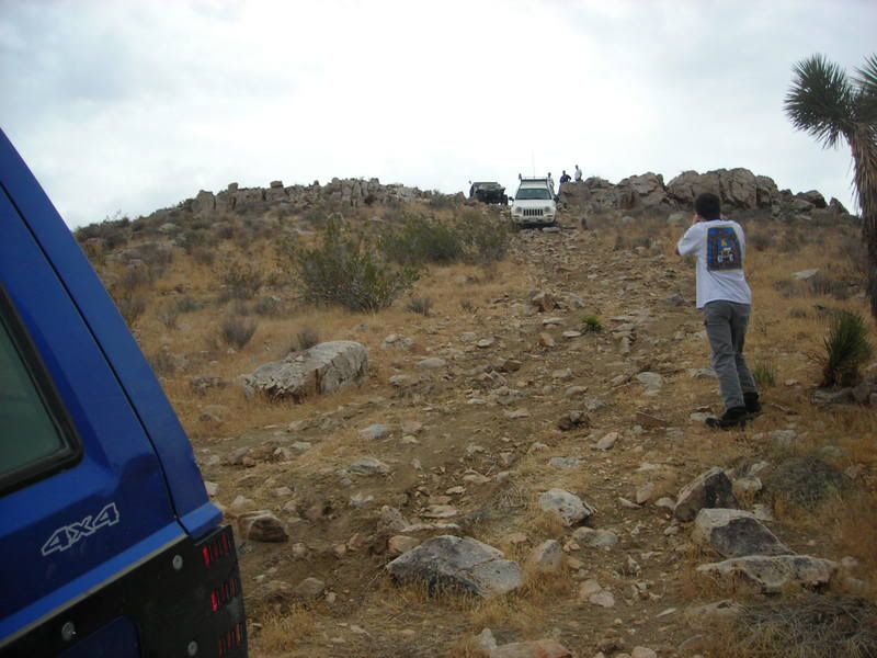
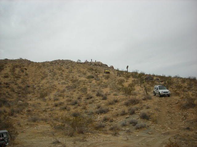
This is a pic showing the angle of the hill in the previous pic.

We ran into a few of the Roughwheelers while we were there too.
See you all there!Last edited by sarah; 02-11-07, 06:07 PM.Comment
-
Hats Off to the Roughwheelers
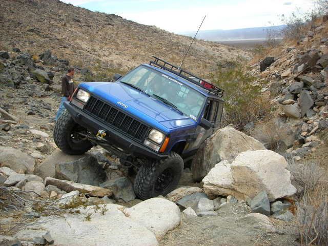
Today, 2-11-07, our club, the High Desert Four Wheelers ran the Fearless Folly trail. It was a great trail! The trail markings were easy to follow, the GPS coordinates were right on, and the trail description was perfect. We had 8 Jeeps, 7 of them were Wranglers (TJs and YJs), one was a Cherokee. We all had a great time with only a busted fuel line which was not the trail's fault. We took the difficult routes all the way through and two of our group (YJ and the Cherokee) went all the way up the FF022a spur (Snoopy's Gulch). They took some great lines and made it look easy. The High Desert Four Wheelers give a huge thank you to the Roughwheelers for mapping this out and then sharing it. Rock On !
Lots of pictures at:
http://s135.photobucket.com/albums/q...dana/20070211/
http://s109.photobucket.com/albums/n...4/EL%20Mirage/
http://s113.photobucket.com/albums/n...rless%20Folly/Comment
-
Got pics?! I would like to see the XJ on Snoopy's Gulch. I am debating on running my XJ up there. I am sure I can do it I just need a spotter to help and I should have one next Sunday.Comment
-
Pics from 2/18/07 run. Had a great time and this time I ran all of Snoopys. Kinda dissapointed that it was so short. It would be great if the trail could be continued on from the top of Snoopys.


 [/quote]
 Last edited by JJsKJ; 02-19-07, 07:59 PM.
Comment
-
BTW, There were ATV's and cycles everywhere! It was a madhouse! One thing I think this trail needs is Fewer sections that you have to cross the main roads or atv trails to get to. If the trail could be contained to the Northern portions and the rocky canyons it would be great. Having to dodge quads and fast moving cycles waas more nerveracking than the trail. What are the rules for cutting the trail? Does the BLM have to give permission for each section that gets added?
Regardless it Sure is nice having a decent trail only 45 mins from home though.Comment
-
i like the lake bed personally.-Burchie
LOST JEEPS So Cal PresidentComment
-
Sweet pics! Looks like another trail me and TJ have to go rolling over. Thanks to everyone for the great write ups and the folks who blazed the trails. Looks like fun!
Rat[CENTER][COLOR=#ff0000]Resistance Off Road
[/COLOR]Join the Resistance...
http://www.resistanceoffroad.us[/CENTER]Comment
-
lets put a run up for this trail, looks like lots of funThe Second Amendment protects all the rest!
HI-LIFTS never go jeepin without itComment
-
A couple of us are going to drive down from Ridgecrest to check out the trail. I know we're supposed to access from the south, but since we're driving right past Shadow Mountain Rd, is there a shortcut in for us northerners? We'll be there Sunday March 25 if anyone else is planning on being there, or wants to join us. -- Bill
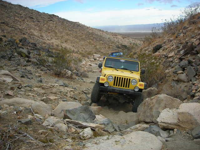
Okay, did that. It's an interesting and entertaining trail. Thanx Roughwheelers for putting it together. For those who haven't been, here's a few notes. Northern access? Yes and No. The park has the perimeter entirely fenced. On the other hand I saw no crossing trail where the fence hadn't been knocked down, so it's a perfectly good fence wherever it's not needed. Your taxpayer money at work. What did they think would happen? Also concerning the fence, it's somewhat confusing that the Roughwheeler map shows the trail crossing the fenceline twice. Well it doesn't. I think the trail is probably a GPS overlay, so it's probably correct. But the fence is improperly drawn in on the master map. You can almost run this trail just from the blue flags. But on rare occasions, you can't find one and you only have to turn wrong once. So I recommend using the GPS waypoints, at least when necessary. Also, they seem to have run out of blue tape for the final part of the trail. You'll need GPS or something to find your way back.
I wouldn't have rated it difficult. There are many sections that require concentration, and none of it is a cakewalk. But nothing that would stop any serious Jeeper. Novices another story. Closest thing to difficult for me was at the top of a somewhat serious climb, there was a final climbout, much steeper, on eroded surface. I was psyched out and stopped, thinking this is bad news. But when I got out, walked around, picked a line and got in the mood, the Jeep never spun a tire, even a little. Intimidating but not really difficult. It's really a pretty cool trail. -- Bill
ps -- You said you wanted feedback. It would be easy and cool to mark some of the critical waypoint names (FF-14 etc) on the flags with a magic marker. That would help people to interpret your directions. And maybe you could flag the egress off the mountain and especially the hard-to-see 90 left heading back to Start/Finish. Once they've made that turn they'll probably make it back no matter which routes they choose.Last edited by WAM; 03-25-07, 04:51 PM.Comment
-
Thank you so much!!!!! That was the trail I was looking for. Thinking about doing it SundayComment
-
more too Fearless Folly
My friend and I are going down to Fearless Folly this weekend to do a pre-run and I heard that it is only a
2 hour run so I was wondering if there were additional
trails down there that we could add to make it a full day. Any recommendations would be helpful.
Thank you
MattComment
Comment