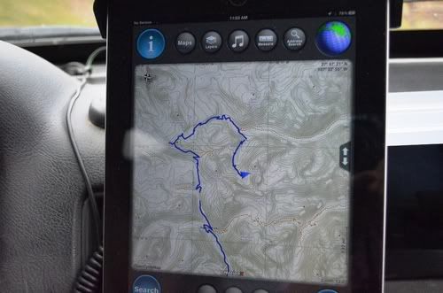
I’m wondering if the tablet apps have progressed to the point where they are viable wilderness navigation tools. “Gaia” and “Back Country Navigator” apps have been around for a couple years now and supposedly allow down loading topo maps when connected, for use when not connected (i.e. out of cell range).
For years I’ve wished for a full featured GPS with a large easy to read screen. Full featured meaning it can create/upload/download tracks and have access to good topo maps (i.e. USGS maps, Delorme, or even cached GoogleEarth images). The larger Nuvi’s are relatively easy to read, but don’t work with tracks (the 500 can create and upload tracks, but not down load them from someone else). The 60/62csx is powerful, but has a small screen and no touch screen for easy use on the road. The Lowrance Baja probably is the best combination of features and readable screen, but it’s expensive and bulky.
7” tablets are less than $200, are light, and have a very readable screens. Has anyone mounted one in their Jeep, loaded one of the topo map apps, and determined if how good they really are when away from a cell signal?
Cliff

Comment