Announcement

Collapse
No announcement yet.

Rest In Peace Hill

Collapse

Forum Thread First Post

Collapse
X
 
  • Filter
  • Time
  • Show
Clear All
new posts

  • Rest In Peace Hill

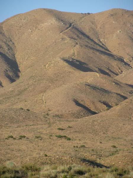
    Rest In Peace Hill is on BLM land just on the edge of Hesperia, CA. From Hwy 173, it looks like this:


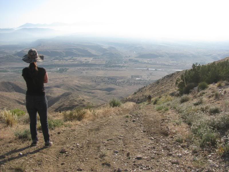
    The trail is easier going downhill, but the view from the top will make you pause far longer than the view from the bottom:


    The trail is 2.2 miles long from the top to Hwy 173. Additional travel will be needed to get to or from the top of the trail.

    Very low gears are recommended. The road is steep and very narrow with little or no room for error. Rock crawling is minimal but there is one obstacle that will require high clearance. Very high shelf and ridge road for the majority of the drive.

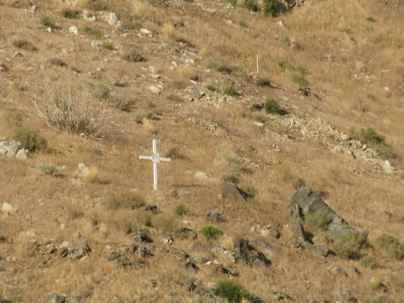
    The trail is named for the life that it claimed:


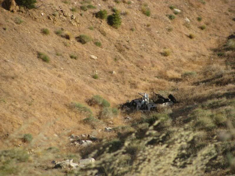
    The Land Cruiser is still there, wadded up in the canyon near the top:


    This is my first .gpx posting so please let me know if you have any issues with the file.
    Attached Files
    [COLOR=#ff8c00]MYJEEP(crawls)ROCKS(again).com

    I have finally stopped drinking for good.
    Now I drink for evil..... :devil:
    [/COLOR]

  • #2
    Mike,

    Sounds like a fun trail! All of my favorite things in one trail. Steep, Narrow, No margin for error, A cross for a fatality, Crunched vehicle at the bottom of the gorge, And a cute calming name. Oh goody. I wish I could go tonight.

    Mitch

    The attached file won't open on my computer.

    Comment


    • #3
      OOOooo! A night run would be much easier! You can't see how painful a mistake would be!

      :devil:
      [COLOR=#ff8c00]MYJEEP(crawls)ROCKS(again).com

      I have finally stopped drinking for good.
      Now I drink for evil..... :devil:
      [/COLOR]

      Comment


      • #4
        Not sure I want this one but it worked for me.
        Mike, are you able to view those tracks in your 500?
        Check out .

        Comment


        • #5
          Originally posted by dirtman13 View Post
          Not sure I want this one but it worked for me.
          Mike, are you able to view those tracks in your 500?
          Yeah, but I made them with the nuvi 500. I'm still not sure that others can see them. I have been able to view the tracks in Google Earth, so I think that others should be able to use them based on the interaction with different software.
          [COLOR=#ff8c00]MYJEEP(crawls)ROCKS(again).com

          I have finally stopped drinking for good.
          Now I drink for evil..... :devil:
          [/COLOR]

          Comment


          • #6
            Everyone i know calls that Land Cruiser Trail. Never been on it but my son tells me the lip at the top is what did in Land Cruiser. He's been up it in a Rhino and said you have to lean way over the front at the top to keep from flipping backwards!

            Comment


            • #7
              "let's go run rest in peace hill"

              -No Thank You!!!!!

              Thanks for the file Mike!

              I See Detroit's in My Future:gun:

              Comment

              Working...
              X