 Tweet
Tweet
So when you wake up to a home invasion by thousands of six-legged critters trying to find food in your kitchen, you tend to have a less than a USUAL day.
My day started out with killing (or at least deterring) the ants that were trampsing through my house. I was determined to declare war on the invaders, but I needed some Weapons of Mass Destruction first. After an early escape from work, I purchased the said WMD's and proceeded to "nuke" the house.
Only problem was that I needed to find something to do for 4 hours while the "fallout" cleared. Hhmmmm.... 4 hours. What to do... what to do. HEY! Mr. Green looks bored. Let's go Jeepin'!
Sharon and I headed for the mountains (imagine that!). I have been wanting to explore the Carbine Flats area, so we headed in that direction. For those that are not familiar with this area, it is a stretch of trail that borders the USFS San Bernardino Forest area and the BLM area of the Ord Mtns. The area is North and East of Silverwood Lake.
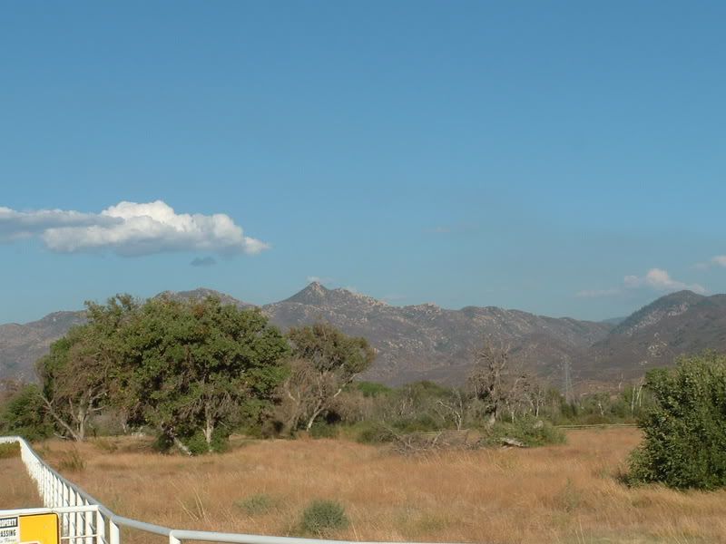
To get there, we took the 138 to 173. But before we got that far, we had a great view of the Pinnacles Mtn.:
We also stopped to have dinner at a great little sushi place on the 138 called the Silverwood Japanese Grill. Good food AND it is close to the Cleghorn and 2N17X trails! (definitely a good trail stop, shameless plug!)
The road that would easily allow a cut over from 173 to the BLM trails that lead to the Carbine Flat area had a gate. I have had more than my fair share of luck finding gates, but not so much luck at finding them open.
Luckily, we did find a path across to Deep Creek Road. It was not a conventional path, but it was not restricted:
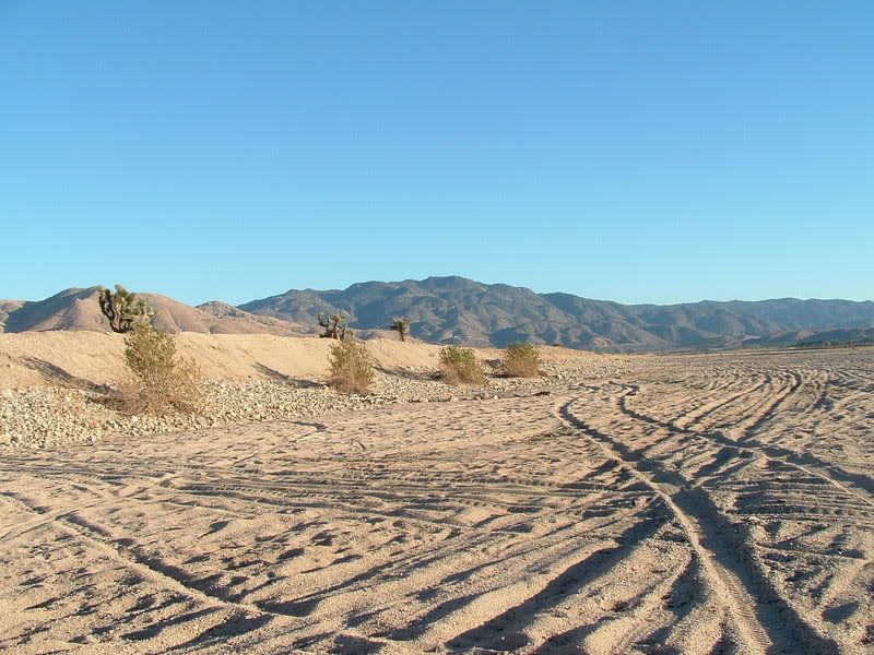
Four-Wheel Drive was needed because the sand was very deep. This was probably the most difficult thing that we encountered on the run.
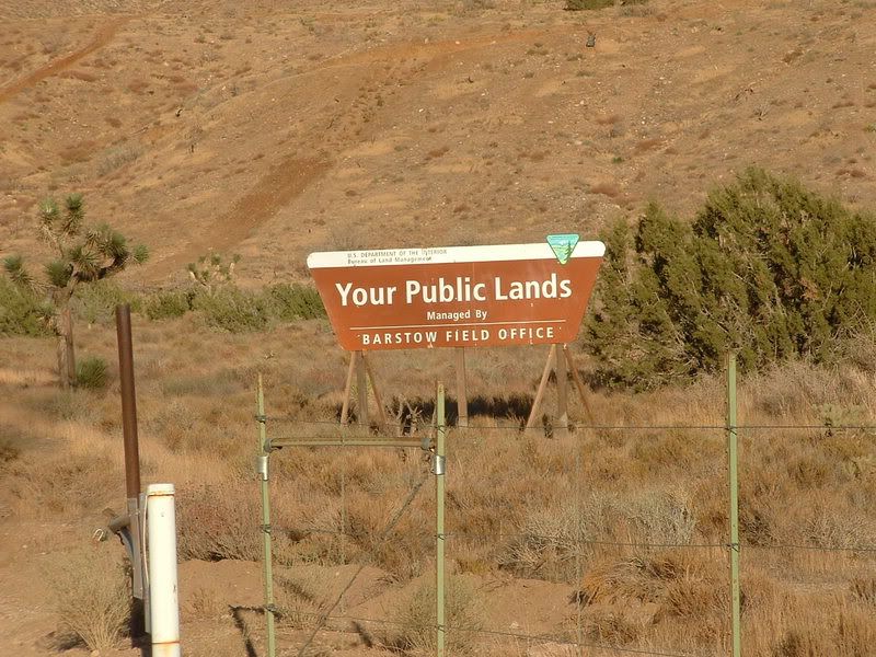
After getting over to Deep Creek road, we found the BLM road that we were looking for from satellite maps printed from MSN's Virtual Earth site. As it turns out, the BLM roads in that area are marked very well:
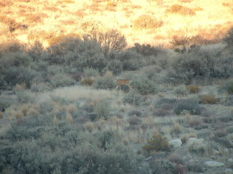
The nicest thing about travelling on trails at off times is that the wild life tends to have more of a presence:
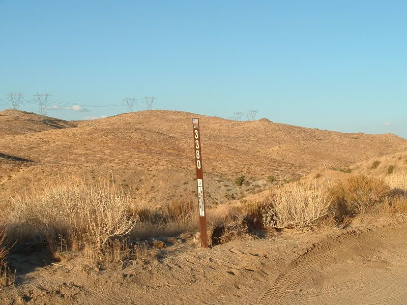
We took the back way into the USFS trails using the BLM trails that criss-cross the area. The main trail that we followed was JF 3380:
This is a mild trail suitable for any high-clearance vehicle. In fact, all of the trails in this report (with the exception of the Mojave River bed crossing) can be done with a 2WD high clearance vehicle.
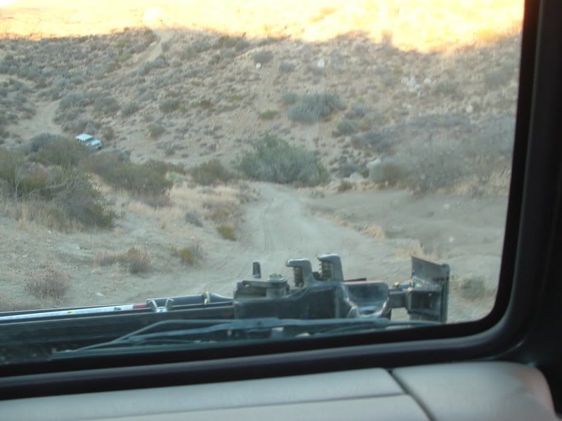
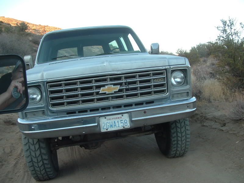
As we approached the USFS land, we found a Suburban blocking the trail:
If anyone knows this tag, please ask the owner to respect the Blue Ribbon ideals and NOT block the trail!
Once we got to the Carbine Flat Spur (3N59A), we found the trail to be well marked. The trail is marked Moderate by the USFS because there are some areas that require some flex and some traction, but a stock Jeep should be able to run the whole trail without damage or difficulty. The trail has a general look like this:
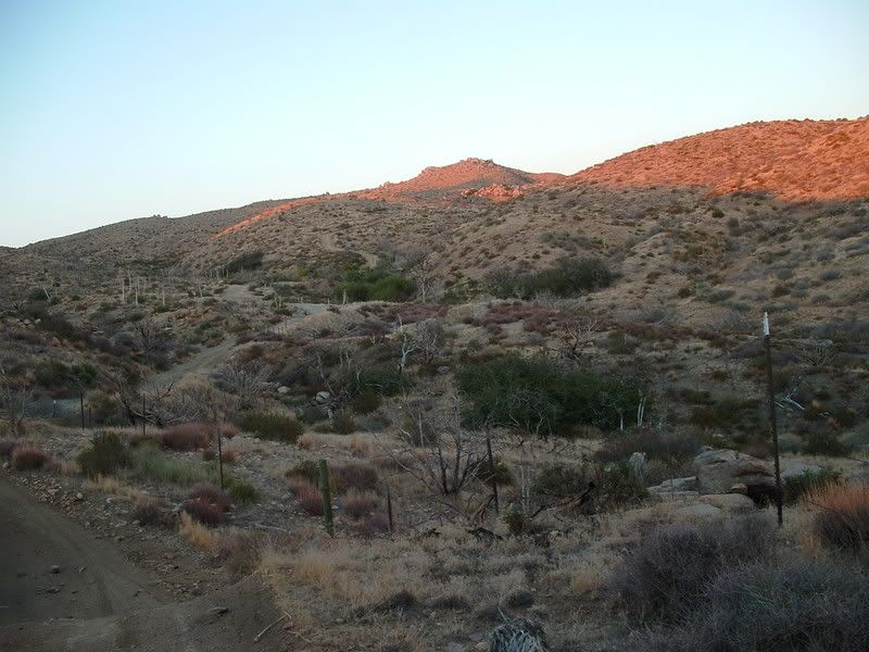
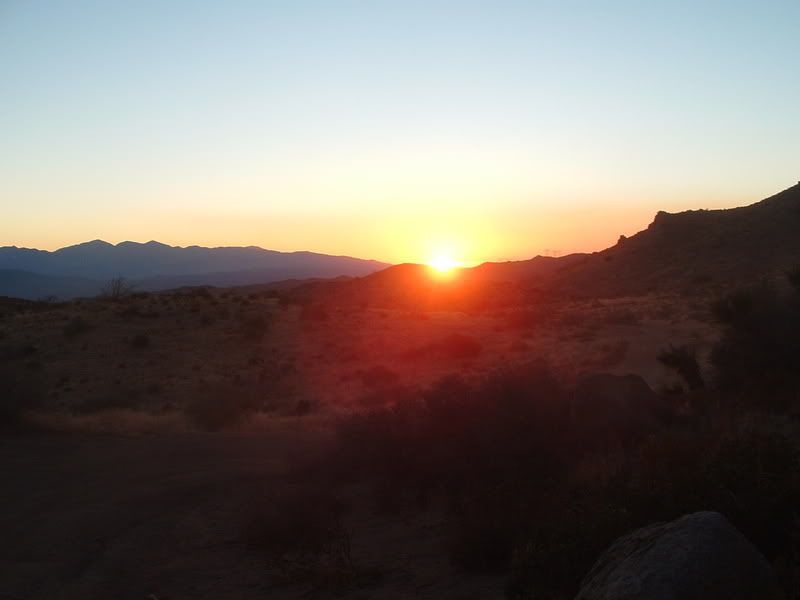
The day waned more quickly that I would have desired, but we captured some great sunset views:
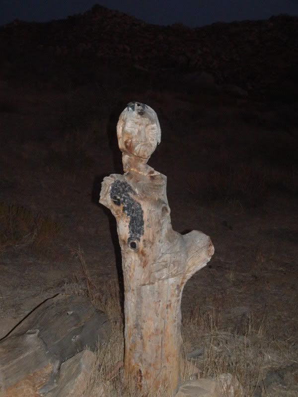
In the twilight, we travelled on and found a cool carving beside the trail:
Unfortunately, the light ran out and we were not able to capture the sights on the rest of 3N59A or on 4N16 and the Grapevine Canyon on our way out to the paved roads.
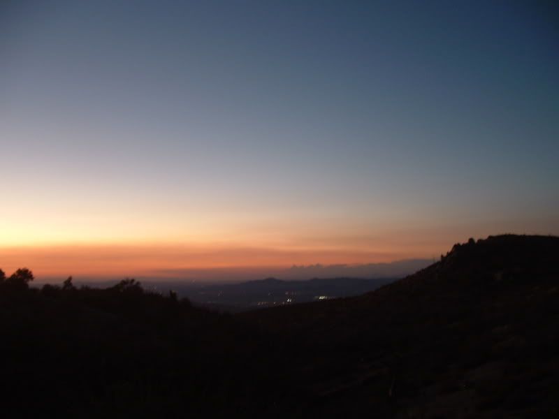
The full moon gave us some great views that we would like to go back in the daylight to capture. The fading light gave some great views, but our camera could only capture a portion of the beauty:
All-in-all, this was not a bad way to spend 4 hours. If you are interested, all of the pics that took are at this link:
http://s139.photobucket.com/albums/q...8-07/?start=20
My day started out with killing (or at least deterring) the ants that were trampsing through my house. I was determined to declare war on the invaders, but I needed some Weapons of Mass Destruction first. After an early escape from work, I purchased the said WMD's and proceeded to "nuke" the house.
Only problem was that I needed to find something to do for 4 hours while the "fallout" cleared. Hhmmmm.... 4 hours. What to do... what to do. HEY! Mr. Green looks bored. Let's go Jeepin'!
Sharon and I headed for the mountains (imagine that!). I have been wanting to explore the Carbine Flats area, so we headed in that direction. For those that are not familiar with this area, it is a stretch of trail that borders the USFS San Bernardino Forest area and the BLM area of the Ord Mtns. The area is North and East of Silverwood Lake.
To get there, we took the 138 to 173. But before we got that far, we had a great view of the Pinnacles Mtn.:
We also stopped to have dinner at a great little sushi place on the 138 called the Silverwood Japanese Grill. Good food AND it is close to the Cleghorn and 2N17X trails! (definitely a good trail stop, shameless plug!)
The road that would easily allow a cut over from 173 to the BLM trails that lead to the Carbine Flat area had a gate. I have had more than my fair share of luck finding gates, but not so much luck at finding them open.
Luckily, we did find a path across to Deep Creek Road. It was not a conventional path, but it was not restricted:
Four-Wheel Drive was needed because the sand was very deep. This was probably the most difficult thing that we encountered on the run.
After getting over to Deep Creek road, we found the BLM road that we were looking for from satellite maps printed from MSN's Virtual Earth site. As it turns out, the BLM roads in that area are marked very well:
The nicest thing about travelling on trails at off times is that the wild life tends to have more of a presence:
We took the back way into the USFS trails using the BLM trails that criss-cross the area. The main trail that we followed was JF 3380:
This is a mild trail suitable for any high-clearance vehicle. In fact, all of the trails in this report (with the exception of the Mojave River bed crossing) can be done with a 2WD high clearance vehicle.
As we approached the USFS land, we found a Suburban blocking the trail:
If anyone knows this tag, please ask the owner to respect the Blue Ribbon ideals and NOT block the trail!
Once we got to the Carbine Flat Spur (3N59A), we found the trail to be well marked. The trail is marked Moderate by the USFS because there are some areas that require some flex and some traction, but a stock Jeep should be able to run the whole trail without damage or difficulty. The trail has a general look like this:
The day waned more quickly that I would have desired, but we captured some great sunset views:
In the twilight, we travelled on and found a cool carving beside the trail:
Unfortunately, the light ran out and we were not able to capture the sights on the rest of 3N59A or on 4N16 and the Grapevine Canyon on our way out to the paved roads.
The full moon gave us some great views that we would like to go back in the daylight to capture. The fading light gave some great views, but our camera could only capture a portion of the beauty:
All-in-all, this was not a bad way to spend 4 hours. If you are interested, all of the pics that took are at this link:
http://s139.photobucket.com/albums/q...8-07/?start=20
Comment