 Tweet
Tweet
On the way back from the Oceano Dunes on Sunday, Sharon and I decided to try to find the Big Caliente Spring. It is a natural Hot Spring that the FS has welled in for public use. There is also a less used spring called Little Caliente Spring, but as we discovered, it is actually bigger than it's sister spring!
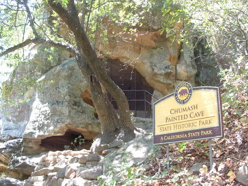
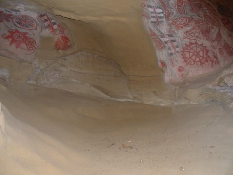
We exited US 101 on CA 154 north. About 5 miles up is a right turn named Painted Cave Road. This is a very narrow, paved road that steeply climbs the slopes of the Santa Ynez Mtns. The road gets it's name from ancient Chumash paintings in a cave along side the road:
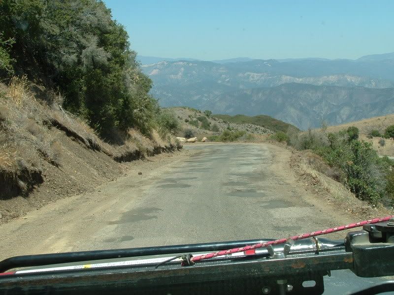
The road climbs to the ridge of the mountains and passes through a small community before ending at 5N12. Turning East onto 5N12, we followed the roughly "paved" road along the ridge line. The views of Santa Barbara and the Santa Ynez range are excellent:

But the road was so rough that I disconnected my sway bars to smooth out the ride some:
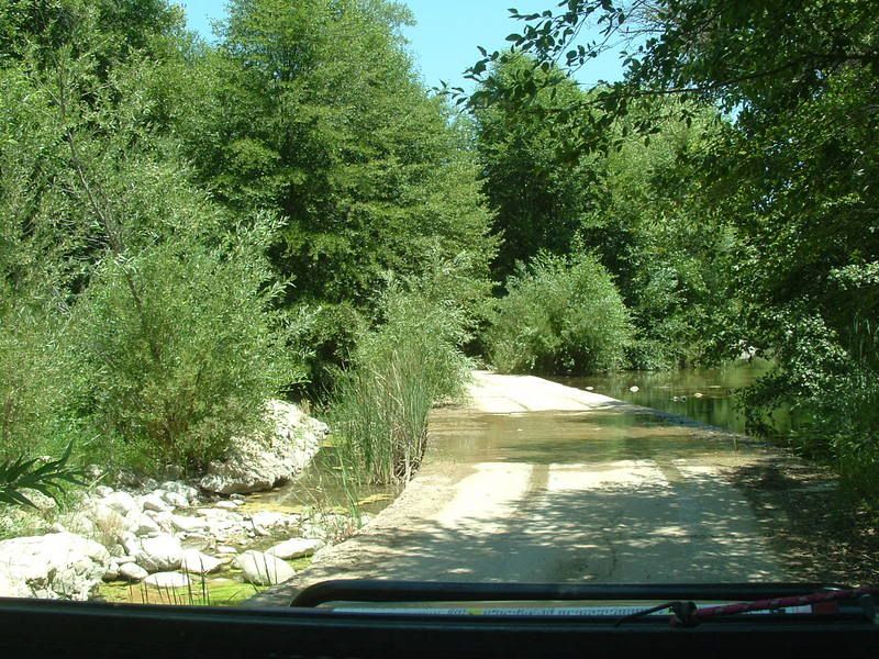
The road is LONG and travel is slow on the winding ridge. Eventually, we made it to one of the signs that makes me happy: Pavement Ends. Even so, 5N12 continued on for several more miles until we reached a water crossing:
After the water crossing, 5N12 ends at a gate. The trail turns northwest onto 5N15. Both the trails are dusty, rough, and rocky, but a 2wd car can make it; high clearance makes the trip faster.
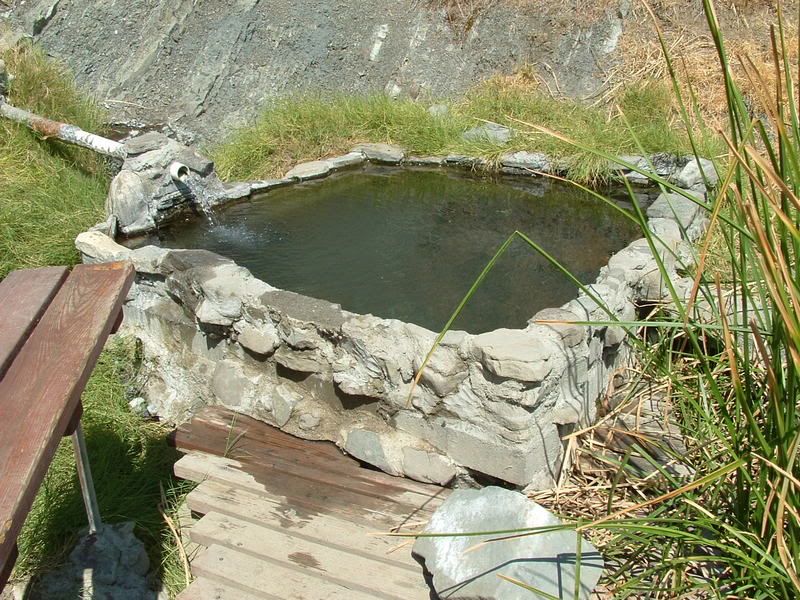
At the Pendola Ranger station, the road forks. The trail to the right is 5N16 and it leads to Big Caliente Spring:
(The Chargers towel on the ladder belongs to someone that was also visiting the spring.)
The area has a picnic table, open air changing rooms, and shade. The spring is not very large, probably about 6' x 9'.
We soaked our feet in the very hot water for a few minutes before setting out to find the Little Caliente Spring.
We traced our route back to the Ranger station and then continued northwest on 5N15 (which I think is called Camuesa Road). Along the way we came to a high point that overlooked a very green valley surrounded by very dry mountains. It was an interesting view:
About 20 minutes after leaving the ranger station, we came to a small sign in a fork in the road pointing to the right for Little Caliente:
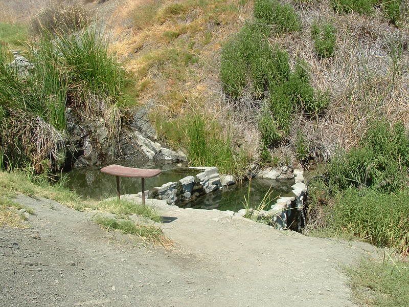
This trail is best traveled in a high clearance vehicle due to the rutted and washed out conditions. The road ends at a small parking area. The trail to the spring is near the FS sign. The springs are hidden around a rise. There are no changing rooms or shade at this spring. There are three pools all fed by the same spring. The upper one is the hottest:
The lower ones are cooler (but still hot), so we soaked in those for a little while:
On the way out I found out that somewhere over the weekend, I had sheared the front bolts that hold my gas tank. It made a horrible banging noise as we climbed back up the paved ridge road. We limped slowly into Santa Barbara by taking 5N25 (Gibraltar Road) down Rattlesnake Canyon into a very nice neighborhood. The views coming down the canyon are worth a look.
After a make-shift repair in the parking lot of an Autozone, we finally finished our trip home.
The path that we took from the 101 out to the Big Spring took us 2 hours, so this is not a short trip. But I think that the long, rough, and dusty roads are one reason that these springs are in such good condition.
The rest of the photos can be seen at this link:
http://s139.photobucket.com/albums/q...15-07/?start=0
We exited US 101 on CA 154 north. About 5 miles up is a right turn named Painted Cave Road. This is a very narrow, paved road that steeply climbs the slopes of the Santa Ynez Mtns. The road gets it's name from ancient Chumash paintings in a cave along side the road:
The road climbs to the ridge of the mountains and passes through a small community before ending at 5N12. Turning East onto 5N12, we followed the roughly "paved" road along the ridge line. The views of Santa Barbara and the Santa Ynez range are excellent:
But the road was so rough that I disconnected my sway bars to smooth out the ride some:
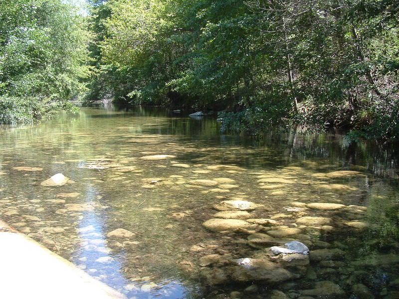
The road is LONG and travel is slow on the winding ridge. Eventually, we made it to one of the signs that makes me happy: Pavement Ends. Even so, 5N12 continued on for several more miles until we reached a water crossing:
After the water crossing, 5N12 ends at a gate. The trail turns northwest onto 5N15. Both the trails are dusty, rough, and rocky, but a 2wd car can make it; high clearance makes the trip faster.
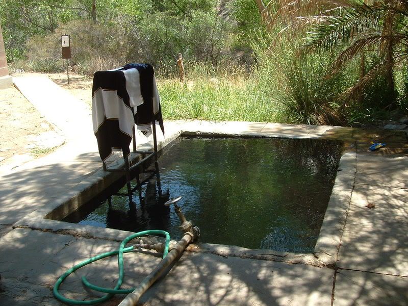
At the Pendola Ranger station, the road forks. The trail to the right is 5N16 and it leads to Big Caliente Spring:
(The Chargers towel on the ladder belongs to someone that was also visiting the spring.)
The area has a picnic table, open air changing rooms, and shade. The spring is not very large, probably about 6' x 9'.
We soaked our feet in the very hot water for a few minutes before setting out to find the Little Caliente Spring.
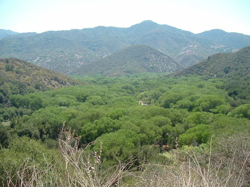
We traced our route back to the Ranger station and then continued northwest on 5N15 (which I think is called Camuesa Road). Along the way we came to a high point that overlooked a very green valley surrounded by very dry mountains. It was an interesting view:
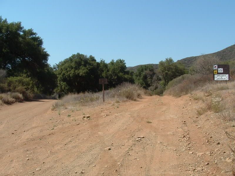
About 20 minutes after leaving the ranger station, we came to a small sign in a fork in the road pointing to the right for Little Caliente:
This trail is best traveled in a high clearance vehicle due to the rutted and washed out conditions. The road ends at a small parking area. The trail to the spring is near the FS sign. The springs are hidden around a rise. There are no changing rooms or shade at this spring. There are three pools all fed by the same spring. The upper one is the hottest:
The lower ones are cooler (but still hot), so we soaked in those for a little while:
On the way out I found out that somewhere over the weekend, I had sheared the front bolts that hold my gas tank. It made a horrible banging noise as we climbed back up the paved ridge road. We limped slowly into Santa Barbara by taking 5N25 (Gibraltar Road) down Rattlesnake Canyon into a very nice neighborhood. The views coming down the canyon are worth a look.
After a make-shift repair in the parking lot of an Autozone, we finally finished our trip home.
The path that we took from the 101 out to the Big Spring took us 2 hours, so this is not a short trip. But I think that the long, rough, and dusty roads are one reason that these springs are in such good condition.
The rest of the photos can be seen at this link:
http://s139.photobucket.com/albums/q...15-07/?start=0
Comment