 Tweet
Tweet
Weird Day! I went Jeeping alone because Sharon had an outting that she had to attend. So I thought that I would just explore the Eastern San Gabriel Mtns since they are close to my house.
I now know why I spend most of my time in the San Bernadino Mtns, it is because of gates and dead ends! The San Gabriel Mtns seem to be full of them!
Here's how my day went:
From an ATV play area near my house, I found a trail that headed up into the mtns. There were some great views along the way but the fun ended when the trail came to a 15 foot drop!

From the tree growth in the creek bed, I would say that the trail had washed out many years ago. The trail could be continued but only if you were on a motorcyle.
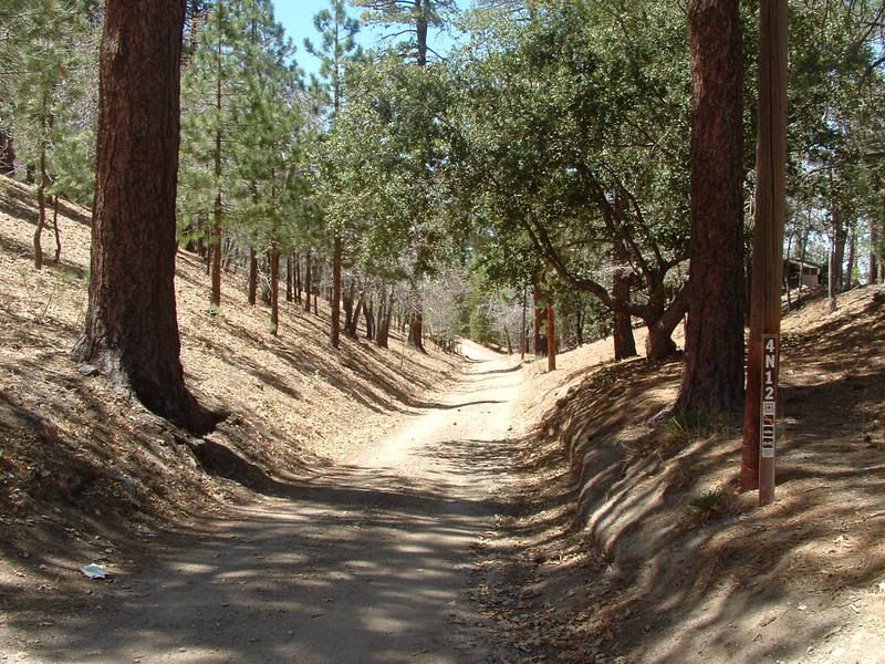
Having no luck by just striking out on my own, I used the "Backcountry Adventures" book by Massey & Wilson to find my way past Wrightwood in search of the Pinyon Ridge Trail. Winding my way down Big Pines Highway, I found the beginning of 4N12 which leads to the Pinyon Ridge:
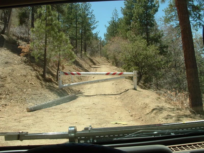
It was a beautiful day with a crisp coolness and a strong smell of pine boughs at the beginning of the trail. I had high hopes for what was ahead. Unfortunately, just half a mile into the trail, I was stopped by a gate!:
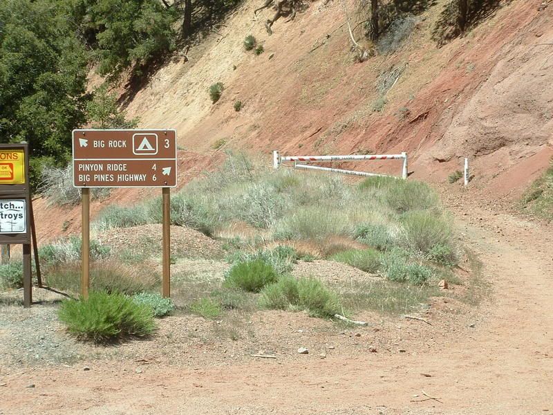
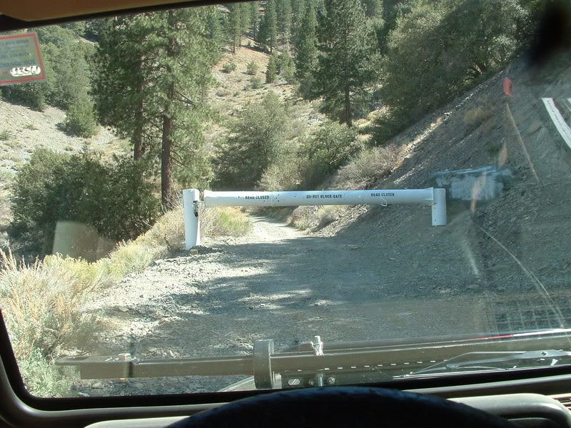
So I tried a different approach. Since the trail has an entrance from State Hwy 2, I went to the 4N11 trailhead. Again, I was met by a gate!:
Not having any luck here, I flipped a page in the book and found the Upper Lytle Creek Ridge Trail. So I headed back down Lone Pine Canyon road to 3N31. Since I was back in the San Bernardino Forest, the gate was open. :wink:
The first right turn was unmarked (I later learned that it was 3N31A) but it led to a great campsite overlooking the Lone Pine Canyon:
The best campsite is at the top of a steep climb. I am guessing that this is an unauthorized road:

I made my way down 3N33 to the 3N06 trail.
I had tried to climb 3N06 a few weeks ago but ran into a fallen tree. 3N06 goes up the back side of San Antonio peak to the Top of the Notch. At that time the gate to the top was gone, probably due to the winter storms. When I got there this time, a shiney new gate was in place:
Okay... the day is fading and I am tired of seeing blocked trails. I check the map and find that 3N06 has a A, B, and D spur (C is a short spur that leads to a yellow post campsite that you can see from the main trail). I never could find the trailhead to the D spur, but with a little luck, I found the B spur.
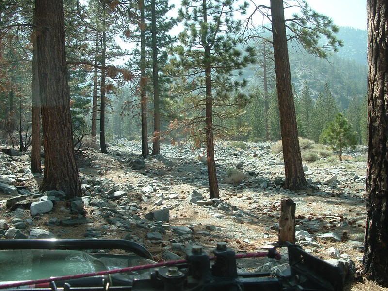
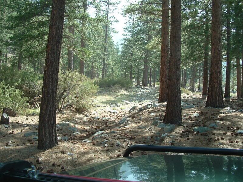
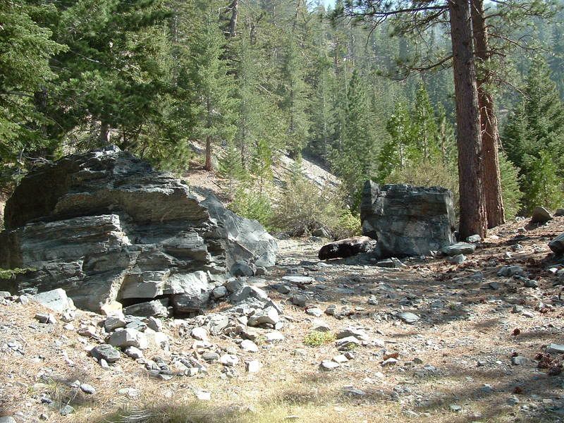
3N06B turned out to be a gem of a trail. It is long for a spur! From 3N06, it is about 2.5 miles up a tree filled wash. Path-finding is not always obvious but if you just keep heading uphill in the wash, you will find tracks. After about 2 miles you come to a yellow post campsite. The trail goes on, but you will need a narrow vehicle to explore it. There are two gatekeepers to cross before you get to the rock garden at the top:


The grotto at the top is worth staying for a while. See the rest of my pics, for photos.
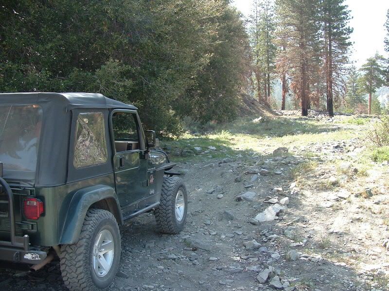
After working my way back down 3N06B, I found 3N06A to explore. The USFS has marked it as a Moderate trail. This is mostly due to the loose rock climb that leads to the Coldwater campground:

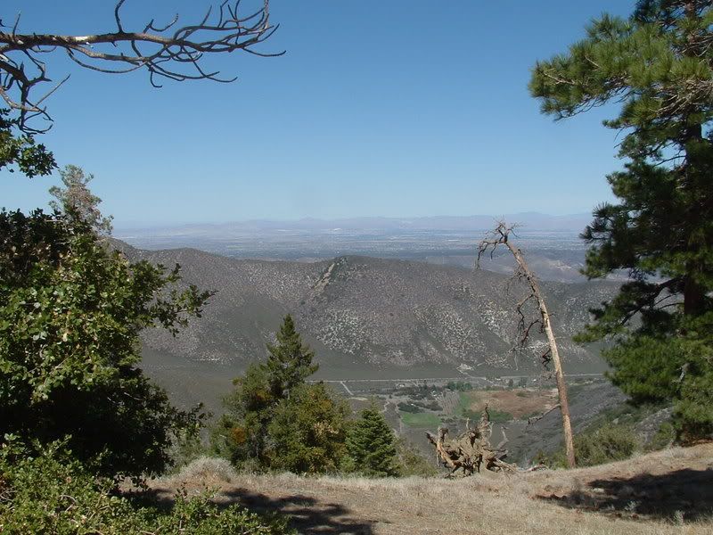
At the campground I found another gate, but this time it was open! You gotta love the San Bernardino Forest Service! The trail lead to a dead end, but what a view!:

All-in-all, it was a good day. Despite the gates and dead ends, the San Gabriel Mtns have some wonderful places.
All the photos can be seen here:
http://s139.photobucket.com/albums/q...-07/?start=all
I now know why I spend most of my time in the San Bernadino Mtns, it is because of gates and dead ends! The San Gabriel Mtns seem to be full of them!
Here's how my day went:
From an ATV play area near my house, I found a trail that headed up into the mtns. There were some great views along the way but the fun ended when the trail came to a 15 foot drop!
From the tree growth in the creek bed, I would say that the trail had washed out many years ago. The trail could be continued but only if you were on a motorcyle.
Having no luck by just striking out on my own, I used the "Backcountry Adventures" book by Massey & Wilson to find my way past Wrightwood in search of the Pinyon Ridge Trail. Winding my way down Big Pines Highway, I found the beginning of 4N12 which leads to the Pinyon Ridge:
It was a beautiful day with a crisp coolness and a strong smell of pine boughs at the beginning of the trail. I had high hopes for what was ahead. Unfortunately, just half a mile into the trail, I was stopped by a gate!:
So I tried a different approach. Since the trail has an entrance from State Hwy 2, I went to the 4N11 trailhead. Again, I was met by a gate!:
Not having any luck here, I flipped a page in the book and found the Upper Lytle Creek Ridge Trail. So I headed back down Lone Pine Canyon road to 3N31. Since I was back in the San Bernardino Forest, the gate was open. :wink:
The first right turn was unmarked (I later learned that it was 3N31A) but it led to a great campsite overlooking the Lone Pine Canyon:
The best campsite is at the top of a steep climb. I am guessing that this is an unauthorized road:
I made my way down 3N33 to the 3N06 trail.
I had tried to climb 3N06 a few weeks ago but ran into a fallen tree. 3N06 goes up the back side of San Antonio peak to the Top of the Notch. At that time the gate to the top was gone, probably due to the winter storms. When I got there this time, a shiney new gate was in place:
Okay... the day is fading and I am tired of seeing blocked trails. I check the map and find that 3N06 has a A, B, and D spur (C is a short spur that leads to a yellow post campsite that you can see from the main trail). I never could find the trailhead to the D spur, but with a little luck, I found the B spur.
3N06B turned out to be a gem of a trail. It is long for a spur! From 3N06, it is about 2.5 miles up a tree filled wash. Path-finding is not always obvious but if you just keep heading uphill in the wash, you will find tracks. After about 2 miles you come to a yellow post campsite. The trail goes on, but you will need a narrow vehicle to explore it. There are two gatekeepers to cross before you get to the rock garden at the top:
The grotto at the top is worth staying for a while. See the rest of my pics, for photos.
After working my way back down 3N06B, I found 3N06A to explore. The USFS has marked it as a Moderate trail. This is mostly due to the loose rock climb that leads to the Coldwater campground:
At the campground I found another gate, but this time it was open! You gotta love the San Bernardino Forest Service! The trail lead to a dead end, but what a view!:
All-in-all, it was a good day. Despite the gates and dead ends, the San Gabriel Mtns have some wonderful places.
All the photos can be seen here:
http://s139.photobucket.com/albums/q...-07/?start=all


Comment