Announcement

Collapse
No announcement yet.

Big Bear

Collapse

Forum Thread First Post

Collapse
X
 
  • Filter
  • Time
  • Show
Clear All
new posts

  • Big Bear

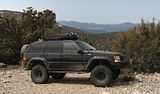
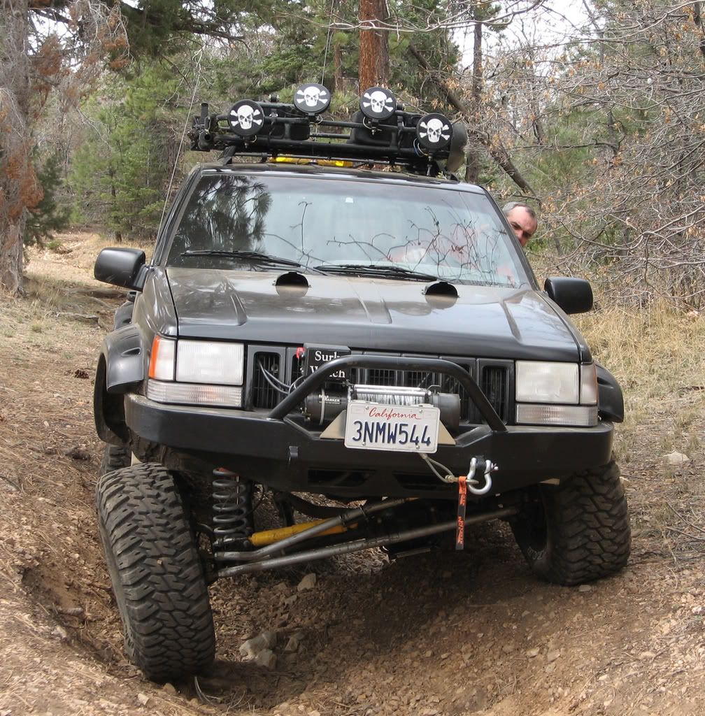
    Tracy and I had our weekend plans go awry so we ended up in Big Bear as a backup. We left La Habra at noon on Saturday and took Hwy 38 up the hill. We stopped at the Mill Creek Ranger station to inquire if the winter closures had been re-opened and the rangers behind the counter told us no.
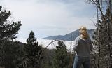
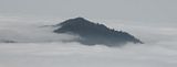
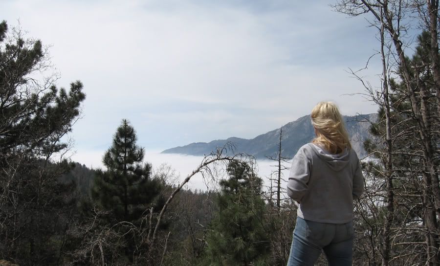
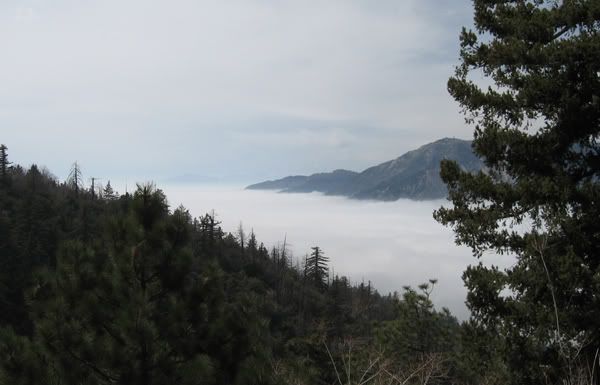
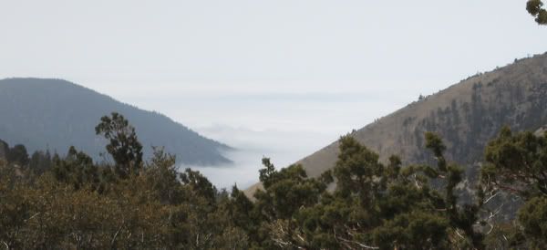
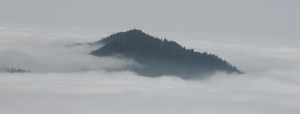
    The clouds on the way up were really cool the way they were sitting in the Santa Ana River valley.


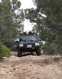
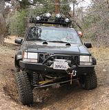
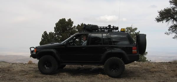
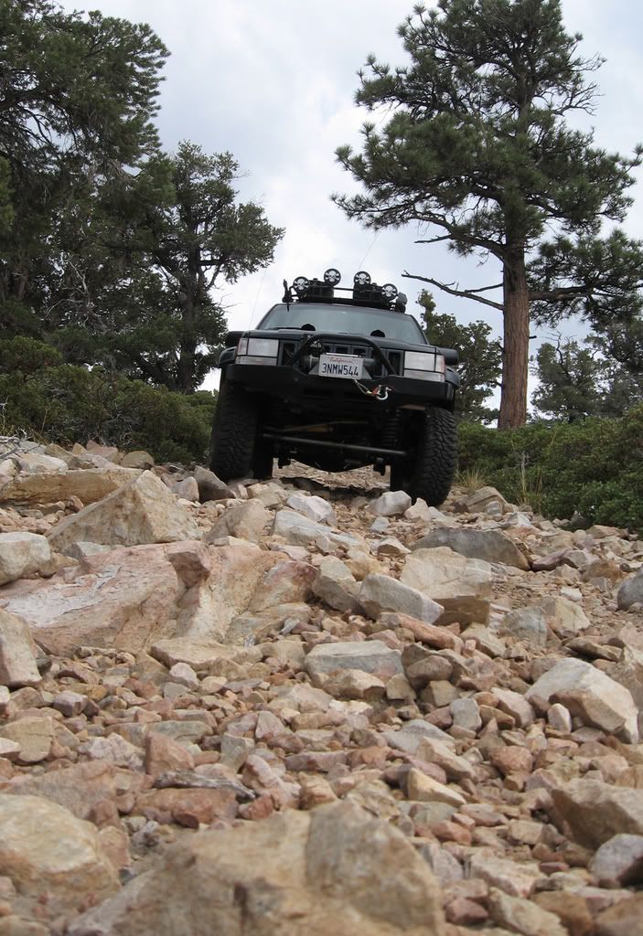
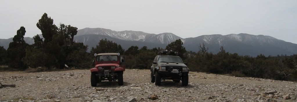
    Once at Onyx Summit on Hwy 38 we headed offroad on 1N01. We found the gate open at 1N01A and we headed up to Onyx Peak. Great views of Lucerne Valley and the Santa Ana River Valley.


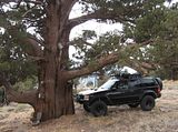
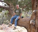
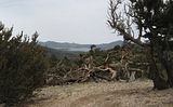
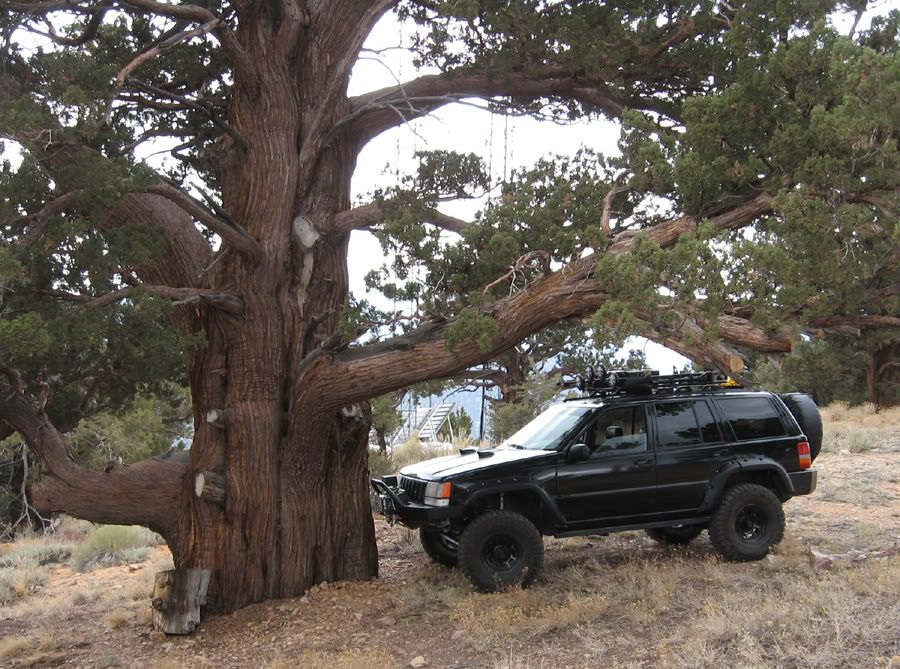
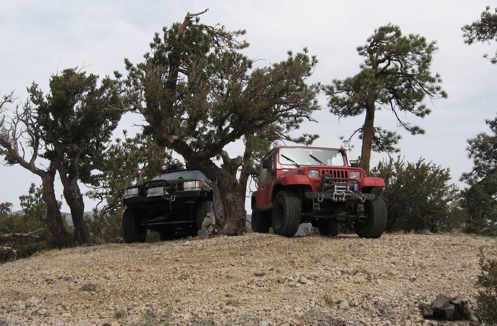
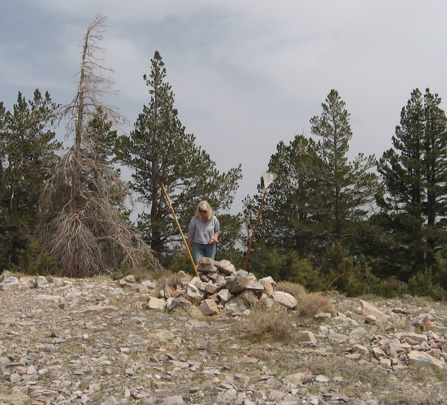
    There were some gnarly trees on top of Onyx Peak.


    Back down 1N01 to 2N68Y


    Down 2N68Y to 2N01. 2N01 to 2N04 Broom Flat/Arrastre Creek and back to Hwy 38 ending our Saturday.

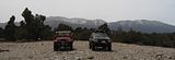
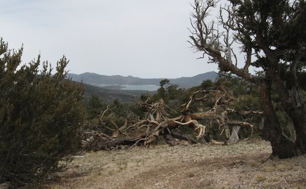
    Sunday we met Jim Hoeltgen at AM PM and we headed for 2N27 Sand Canyon. After winding our way around we took 2N60 up to an unnamed peak at 8220 elevation with fabulous views of Snow Summit, Big Bear Lake, Baldwin Lake, Sugarloaf Mountain and Lucerne Valley.


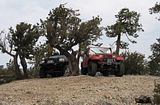
    Leaving the unnamed peak we took 2N93 Wildhorse to 2N93D and lunch at Yellow Post 54 (a great campsite!)

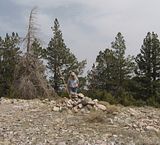
    Leaving YP54 we took an unnamed road to the top of Lightning Gulch peak at 9385 Elevation. Once more fabulous views of the surrounding areas.


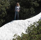
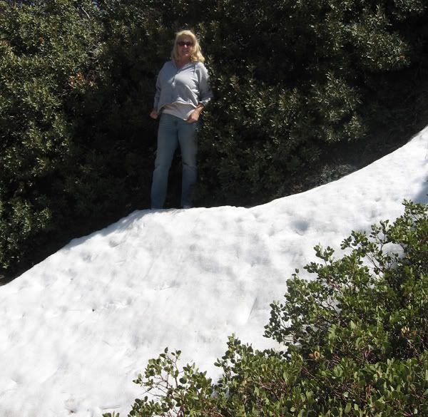
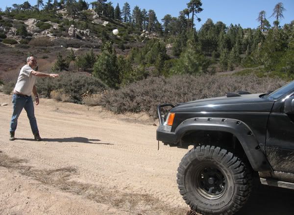
    Back down to 2N93 and over to Hwy 38. Down Hwy 38 to 2N06 Radford Truck Trail. Up 2N06 to 2N10 Skyline Dr. West on 2N10 to 1N54 Clark's Grade. We played in the snow a bit on the top of Clark's Grade.


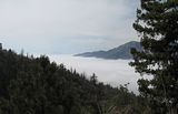
    Down 1N54 to more cool fog/cloud pics of the Santa Ana River valley.


    to 1N09 to Seven Oaks Rd to 1N07 Middle Control Rd to Angeles Oaks.

    Temps in Big Bear were in the low 70's both days with lots of sunshine.

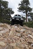
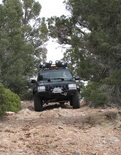
    The trails were all green easy with a couple of sections of blue square. The rangers at Mill Creek had wrong info about the winter trail closures. They are all open!
    Last edited by FishPOET; 04-08-07, 09:12 PM.
    Over 2500 hours donated to the San Bernardino National Forest. Life member of CA4WD, CORVA & BRC. Tread Lightly Trainer. Reforestation Supervisor. CASSP

  • #2
    Awesome report! And sweet clouds
    :gun:'99 TJ Sport:gun:

    Comment


    • #3
      Great report and great pics! Thanks for sharing!! Looks like an awesome way to spend Easter weekend. :thumbs_up
      -Bob
      '98 Black TJ [COLOR=Blue]Sport[/COLOR] 4.0L/Auto Trans

      My rig : http://i9.photobucket.com/albums/a95...n/DSC06310.jpg

      Comment


      • #4
        Thanks for sharing your pics all the time Doug! I love seeing your travels and only hope that some day I'll be able to go out as often, and to as many neat places you go!
        If we aren't supposed to eat animals, then why are they made out of meat?

        http://jeep.matandtiff.com/

        Truth is treason in the empire of lies. -Ron Paul

        Comment


        • #5
          Great report and pics! I'm glad to hear that 1N01 is back open. I want to go explore the whole thing one of these upcoming weekends.
          [COLOR=#ff8c00]MYJEEP(crawls)ROCKS(again).com

          I have finally stopped drinking for good.
          Now I drink for evil..... :devil:
          [/COLOR]

          Comment


          • #6
            Nice post, i think we will do this route (or similar) this weekend. Did you camp somewhere Saturday night? Was curious if spots are available w/o reservation. Also, I could not find 2N27 but I did find "Sand Canyon" just East of Bear Mtn on the SBNF trail map. And I could not find 2N60 on the map, so we could try to find the "unnamed peak". Thanks for your help.
            I have not done any driving around these parts, so I was going to follow someones else's itinerary, for the first few trips.
            2000 XJ, 108k miles
            33's, RE 4.5", 4.56

            Comment


            • #7
              Originally posted by jeep-noob View Post
              Did you camp somewhere Saturday night?
              It was Tracy's birthday so we camped at Best Western.

              Originally posted by jeep-noob View Post
              Was curious if spots are available w/o reservation
              This time of year camping spots are normally not a problem. http://www.fs.fed.us/r5/sanbernardin...ng/index.shtml

              Originally posted by jeep-noob View Post
              Also, I could not find 2N27 but I did find "Sand Canyon" just East of Bear Mtn on the SBNF trail map. And I could not find 2N60 on the map, so we could try to find the "unnamed peak". Thanks for your help. I have not done any driving around these parts, so I was going to follow someones else's itinerary, for the first few trips.


              The only route I have not taken the whole way is the unnamed route (the only white route on the map). We stopped at the top. Jim told me that there are some gnarly rocks to traverse between Lightning Gulch Peak and Hwy 38. There are actually 3 different burned in trails leading to the unnamed peak that are considered 2N60.
              Over 2500 hours donated to the San Bernardino National Forest. Life member of CA4WD, CORVA & BRC. Tread Lightly Trainer. Reforestation Supervisor. CASSP

              Comment


              • #8
                Originally posted by Malachi View Post
                Great report and pics! I'm glad to hear that 1N01 is back open. I want to go explore the whole thing one of these upcoming weekends.
                1N01 is open 7 miles down to the old campground/forest boundry. The road no longer exists all the way down to Pioneertown.

                1N01A (Onyx Peak) is normally locked, but it was open last weekend.

                I'll be up there again May 4 & 5 with NAXJA and I may try to run 1N01 down 7 miles to the gate. I also hope to run 3N03A to Horsethief Flat. Jim said last time he ran the trail it was pretty washed out with some scary off camber cliff driving!
                Over 2500 hours donated to the San Bernardino National Forest. Life member of CA4WD, CORVA & BRC. Tread Lightly Trainer. Reforestation Supervisor. CASSP

                Comment


                • #9
                  Originally posted by FishPOET View Post
                  1N01 is open 7 miles down to the old campground/forest boundry. The road no longer exists all the way down to Pioneertown.

                  1N01A (Onyx Peak) is normally locked, but it was open last weekend.

                  I'll be up there again May 4 & 5 with NAXJA and I may try to run 1N01 down 7 miles to the gate. I also hope to run 3N03A to Horsethief Flat. Jim said last time he ran the trail it was pretty washed out with some scary off camber cliff driving!
                  I'd love to go to the gate and back on 1N01. If you don't mind a Wrangler joining in, I'd like to join you.

                  As for 3N03A, off-camber makes me nervous now that I have seen the underneath of my Jeep while still standing up. But if you go first, I'll try it!
                  [COLOR=#ff8c00]MYJEEP(crawls)ROCKS(again).com

                  I have finally stopped drinking for good.
                  Now I drink for evil..... :devil:
                  [/COLOR]

                  Comment


                  • #10
                    thank you sir
                    yeah I would only want to traverse blue square or less... I am bring the gal and she freaks out easily lol.
                    Last edited by jeep-noob; 04-12-07, 08:03 AM.
                    2000 XJ, 108k miles
                    33's, RE 4.5", 4.56

                    Comment

                    Working...
                    X