Announcement

Collapse
No announcement yet.

Borrego Pynion run Dec 17

Collapse

Forum Thread First Post

Collapse
X
 
  • Filter
  • Time
  • Show
Clear All
new posts

  • #16
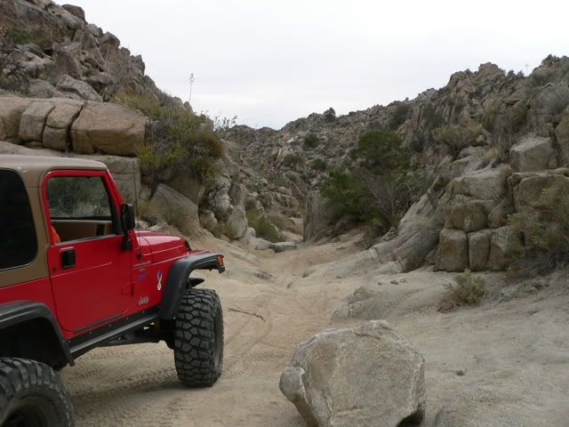
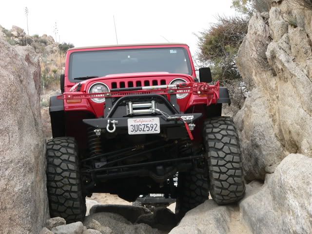
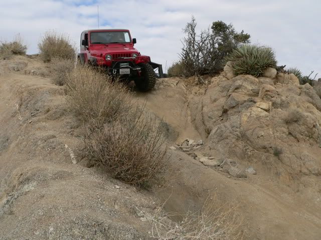
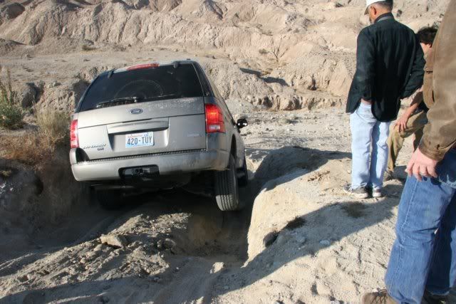
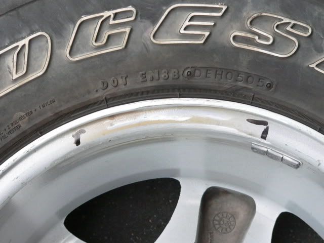
    It was a good run. No roll overs or damage.

    Skates04,
    Tell your boss to drop the aging F16's and get the newer F22's


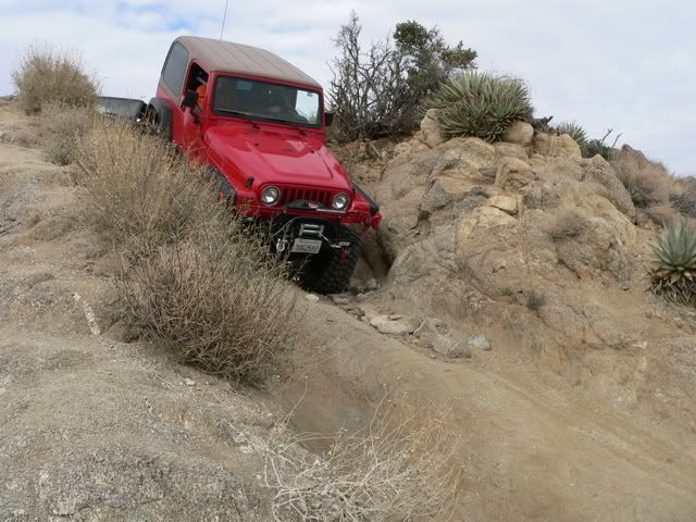
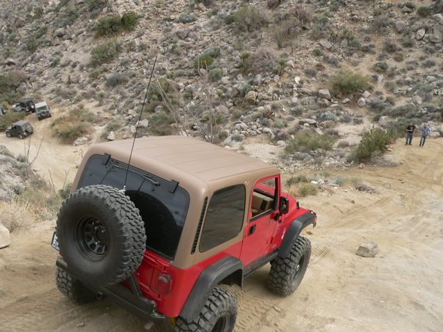
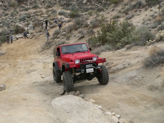
    Here's some pictures of the run...
    http://britain.connectnet.com/Photog...705/index.html
    97 TJ Buffed Out

    LETS ROCK!
    WEB site

    Comment


    • #17
      Pics look great!
      :gun:'99 TJ Sport:gun:

      Comment


      • #18
        Vern looks like fun, Anyways, Thats F-18's which will soon, but not soon enough, will be replaced by the Joint Strike Fighter F-35
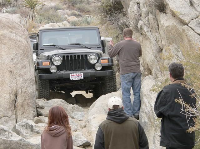
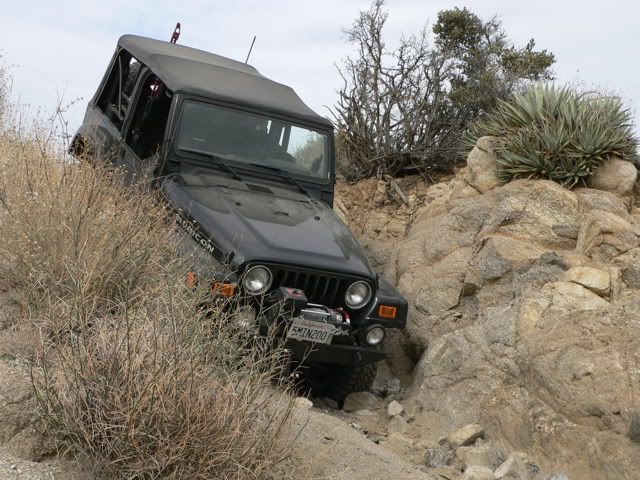
        Locked up fourbanger (Poor Mans Rubicon)
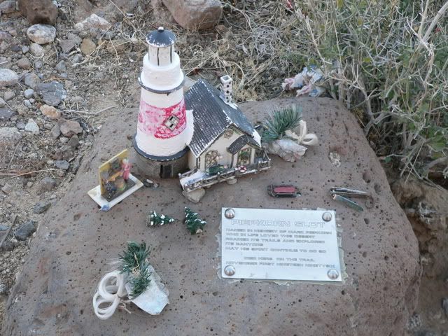
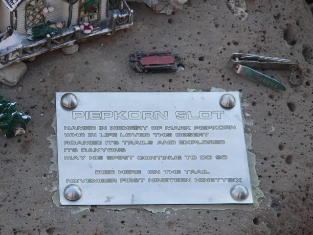
        Comment


        • #19
          Originally posted by skates04
          Vern looks like fun, Anyways, Thats F-18's which will soon, but not soon enough, will be replaced by the Joint Strike Fighter F-35
          F18?

          Well you will know!! Get them to upgrade to F35! so that you can do some trailing! Looking forward in trailing soon!!
          97 TJ Buffed Out

          LETS ROCK!
          WEB site

          Comment


          • #20
            Trail Report

            The Pinion trail runs east-west. It starts at the western boundary of Anza-Borrego Desert State Park, about 90 miles east of San Diego, about 150 miles southeast of Los Angeles. Four MJR members participated in this run: Vern (Britain) led the run. Jason, one of Vern’s co-workers rode shotgun with him. The other participants were Rick (Sam 15), Dave (dhsundance) and myself. Here’s a picture of the line up at the trailhead, Britain (red 97 TJ), dhsundance (black 04 Rubicon), Russ Chung (khaki 05 TJ), and Sam 15 (white 01 TJ). Left to right Dave (blue sweatshirt), Jason, Vern (leather jacket) and Rick.


            Vern runs this trail regularly in both directions; he uses it as a shortcut between his home in El Centro and his son’s home in eastern San Diego county. Neither Rick nor I had run this trail before; Dave had run the western end of the trail (to the top of the Pinion Dropoff) a few weeks ago. After we aired down, Vern led us east across the Pinion Valley. It was a cloudy, dry December day in the desert. The temperature was in the 60s. The trail was easy, sandy desert wash. I started off in 4 wheel drive, but soon changed to two wheel drive so I could keep up.


            Seven miles east of the trailhead, we reached “The Squeeze”. A TJ can fit through with several inches to spare, provided you keep the vehicle level:


            Here is Vern going through the Squeeze:


            Here is Dave in the Squeeze:


            Rick took this picture of me in the Squeeze:


            And I took these pictures of Rick in the Squeeze:


            While we were working our way through the Squeeze, another group pulled up behind us. In that group was a brand new Rubicon. The owner had picked it up the day before; it had fewer than 60 miles on its odometer. We couldn’t resist; we had to wait to watch it go through the Squeeze.


            It cleared the Squeeze easily.
            If you don't like the way I drive, stay out of the bushes!
            KI6MLU

            Comment


            • #21
              After the Squeeze, we continued on the trail. Vern calls this rock on the left the “Window Breaker”:


              Just past the Window Breaker, Rick had an “oops” moment. He put his left tire on this rock, but it slipped off, so he landed on his pumpkin with both front wheels spinning (no damage):


              After Rick got off the rock, we continued on the trail. The trail became more challenging, definitely time for four wheel drive:


              If you don't like the way I drive, stay out of the bushes!
              KI6MLU

              Comment


              • #22
                It is less than a mile from the Squeeze to the Pinyon dropoff, also known as “Heart Attack Hill”. This is a picture of a Jeep in the group ahead of us going down Heart Attack Hill:


                We're doing a recon of Heart Attack Hill. The left side (where Vern is standing) is easier, but as a result it is more heavily used and has more ruts. We discussed some tips to get down the hill safely: use engine braking and avoid locking the brakes (pump the brakes if necessary) because you have no control once the wheels are locked. Try to avoid the ruts because you lose 25% of your braking power when a wheel is in the air (unavoidable near the top because the ruts at the top were HUGE).


                Vern starts down Heart Attack Hill:


                Here is Rick going down Heart Attack Hill:


                While Dave is descending the left side of Heart Attack Hill, Vern turns around and climbs up the right side of the hill


                Vern took this shot of me going down Heart Attack Hill:


                Vern also took this shot of Rick going down Heart Attack Hill:

                If you don't like the way I drive, stay out of the bushes!
                KI6MLU

                Comment


                • #23
                  We stopped for lunch at Split Rock:


                  Vern said that the Native Americans used the rocks in this area to grind their grain. The depressions on the top of this rock were caused by the grinding.


                  After lunch, Vern led us to Sandstone Canyon. The trail is dry sandy wash. I drove most of it in two wheel drive:


                  The clouds cleared and the sun came out, but the late December sun could not penetrate to the bottom of Sandstone Canyon


                  Some sections of Sandstone Canyon are claustrophobic:


                  After touring Sandstone Canyon, Vern led us south through Fish Creek Wash to Arroyo Diablo.

                  Last edited by Russ Chung; 12-19-05, 01:34 AM.
                  If you don't like the way I drive, stay out of the bushes!
                  KI6MLU

                  Comment


                  • #24
                    As we climbed out of Fish Creek Wash enroute to Arroyo Diable, we met a stranded tourist at a place known as Diablo dropoff. He had a rented SUV, went part of the way down the Diablo dropoff, and could not get back up because of the soft sand. He decided to continue to the bottom and exit via Fish Canyon. Jason took this picture of him as we spotted him down the trail. We hope he made it out OK.


                    This is a picture of the Anza-Borrego desert to the east from the top of the Diablo dropoff.

                    Last edited by Russ Chung; 12-19-05, 01:36 AM.
                    If you don't like the way I drive, stay out of the bushes!
                    KI6MLU

                    Comment


                    • #25
                      We continued south through Arroyo Diablo, Vallecito Wash, and Canyon Sin Nombre for about ten miles until we got to Highway S2. It was getting late, so Dave decided to air up and return home, while Vern offered to lead Rick and myself to see a desert lighthouse. The lighthouse turned out to be a geocache


                      We returned to the highway, where we proceeded to air up as the sun set in the west….


                      As we were airing up, I mentioned to Vern that I had run with a lower tire pressure (10 psi) than I usually run because I wanted to be able to maintain traction in the soft sand, and it seemed to work. He warned me that I risked damage to my wheel rims if I ran with pressure that low. Shortly after our conversation, I noticed that my left front tire would not hold pressure; the inside of the left rim was bent. Rick took this shot of me changing my tire as the sun set. The end of a perfect day:


                      Last edited by Russ Chung; 12-19-05, 01:38 AM.
                      If you don't like the way I drive, stay out of the bushes!
                      KI6MLU

                      Comment


                      • #26
                        Another impressive trip report, Russ - thanks for sharing.
                        :gun:'99 TJ Sport:gun:

                        Comment


                        • #27
                          nice pics and description
                          Last edited by jeep-noob; 12-19-05, 05:26 PM.
                          2000 XJ, 108k miles
                          33's, RE 4.5", 4.56

                          Comment


                          • #28
                            Russ,
                            Good write up! You certainly kept all four on the ground!
                            97 TJ Buffed Out

                            LETS ROCK!
                            WEB site

                            Comment


                            • #29
                              Wheel fixed!!

                              I took the bent wheel to TruWheel in North Hollywood, CA. They specialize in repairing damaged alloy wheels. They told me it would take a week, but I got a call two days later to pick it up. It cost $100 to fix the dent and to true the wheel so that the runout is within the original factory specs. When I left with my wheel, the receptionist smiled at me and said "now you can go out and beat it up again!"
                              http://www.fixarim.com/

                              If you don't like the way I drive, stay out of the bushes!
                              KI6MLU

                              Comment


                              • #30
                                Great write up Russ.
                                Are you doing Cleghorn on the 15th?
                                71' Jeepster - Stock Jeep
                                70' Jeepster - Trail Jeep
                                73' Commando - Wrecked Heap

                                Comment

                                Working...
                                X