 Tweet
Tweet
I last ran the Rowher and Lookout Trails in March, 2012, and I had forgotten how much fun I have had on these two trails. I like this area for two reasons: 1. I can drive from my home to the Rowher trailhead in 45 minutes, compared to an hour and half to Lockwood-Miller or over two hours to Big Bear. 2. I don't worry about rock damage to my Jeep compared to Big Bear, Johnson Valley, or the Sierras. Although there are optional rock obstacles throughout the area, there are bypasses for most obstacles; the reason these are black diamond trails is due to the challenge of choosing the proper line on the steep, rutted trails. If you choose the wrong line, you won�t have enough traction to get up the hill, or worse, you might flop in a rut or off camber part of the trail. My first trip on this trail was when my Jeep was bone stock with open diffs on 30" tires. I now have a lift, lockers and 33s, but I still enjoy the challenge of finding the best line on these two trails.
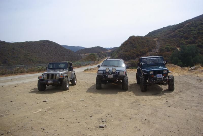
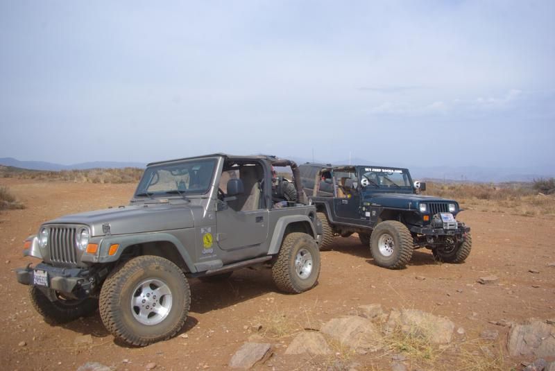
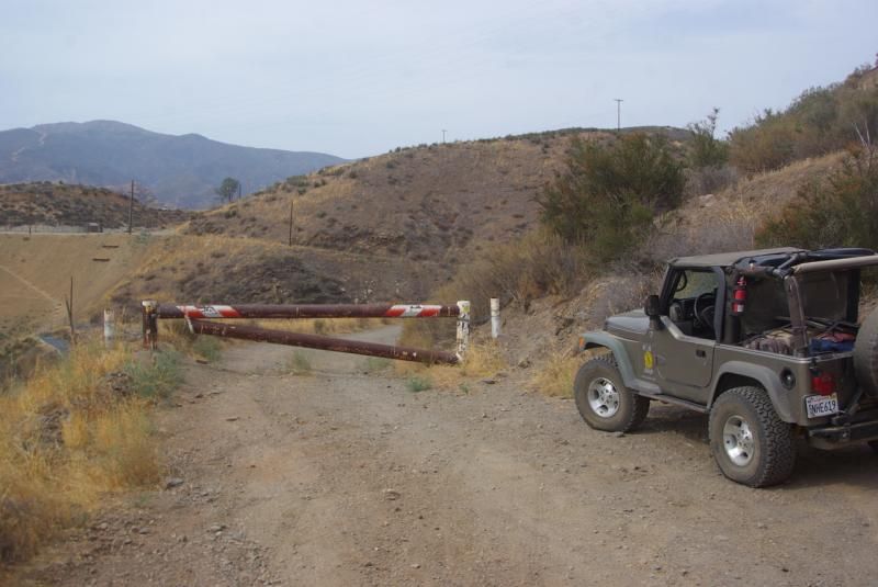
Stever, Jason and I met at the Rowher trailhead on Bouquet Canyon Road. This was a shakedown run for each of us for different reasons. Jason had just replaced the linkage on his Atlas transfer case, Steve had just replaced his Power Distribution Center, and I was preparing to leave for the Fordyce and Rubicon Trails. From left to right, my TJ, Steve's ZJ and Jason's YJ:
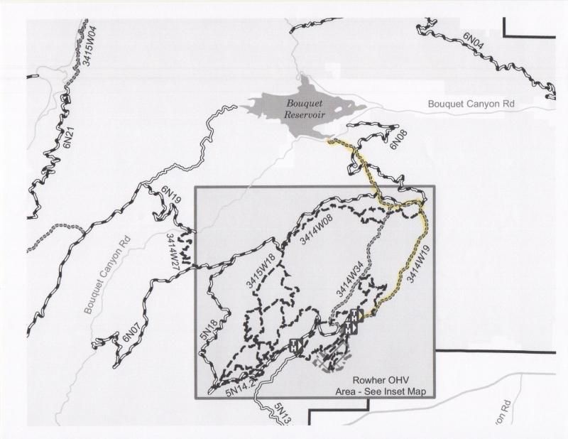
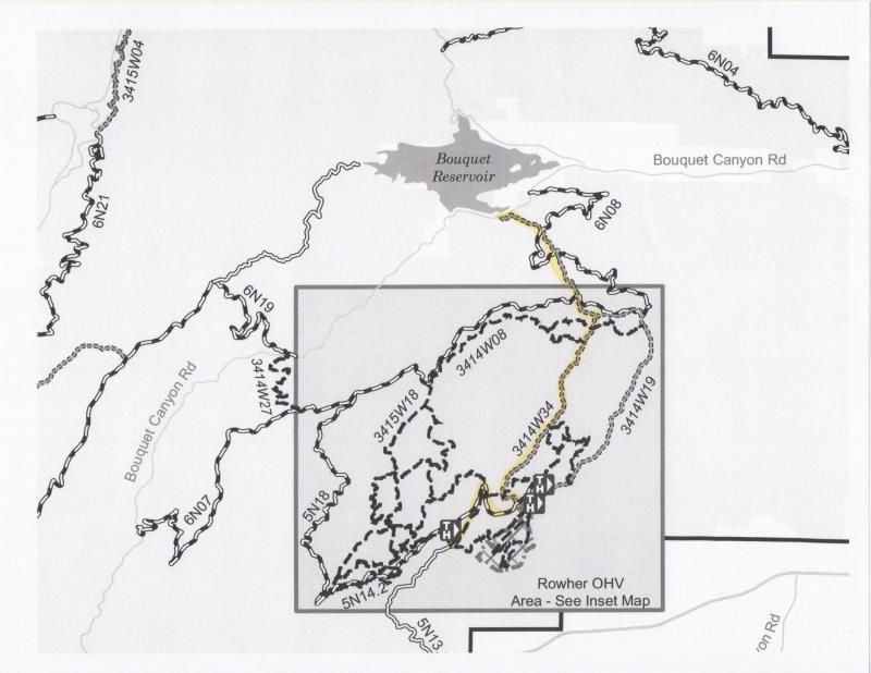
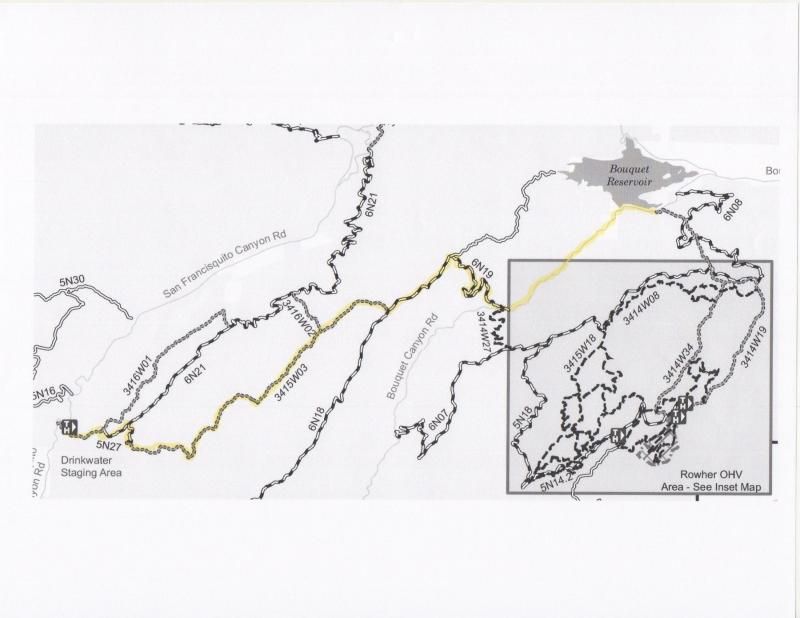
Our plan was to take the Rowher Trail (3414W19) to the Rowher OHV area, eat lunch, check out the obstacle course, take the Lookout Trail back to Bouquet Canyon Road, then take the Drinkwater Trail to San Francisquito Road. The yellow line on this diagram shows our planned route from Bouquet Canyon to the Rowher OHV area:
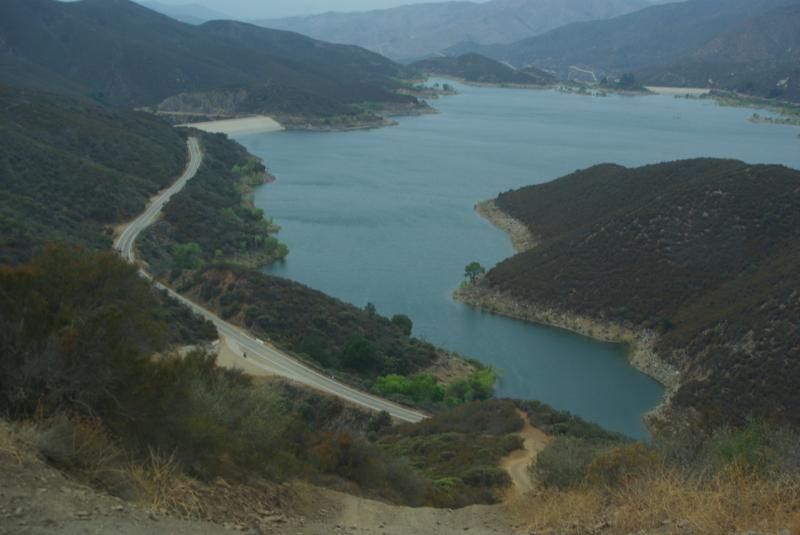
Following the 2008 Buckweed fire, the Forest Service bulldozed the trail and filled in the ruts. Over the years, erosion has gradually returned the trail to its earlier condition. This is Jason's YJ followed by Steve's ZJ ascending the trail with Bouquet Reservoir in the background:
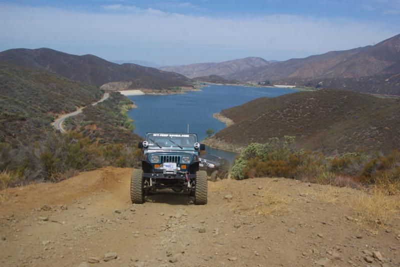
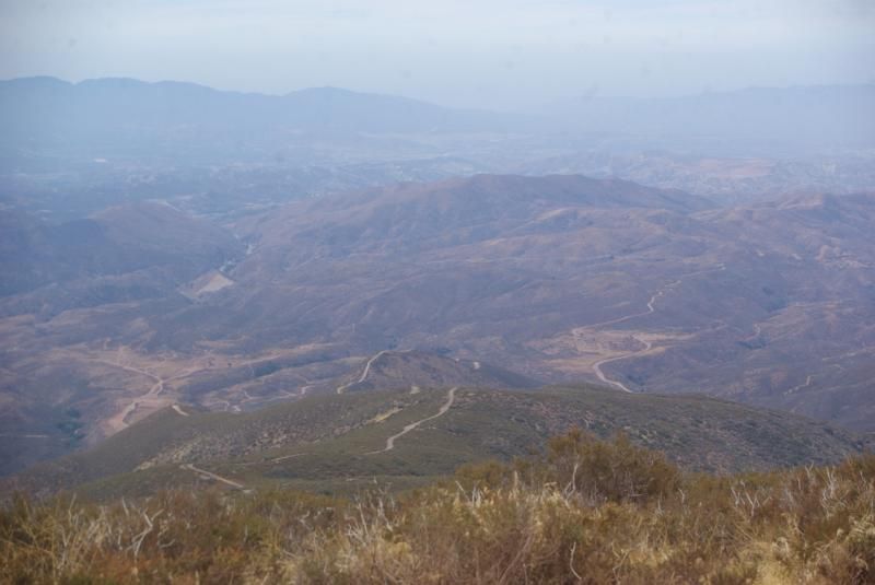
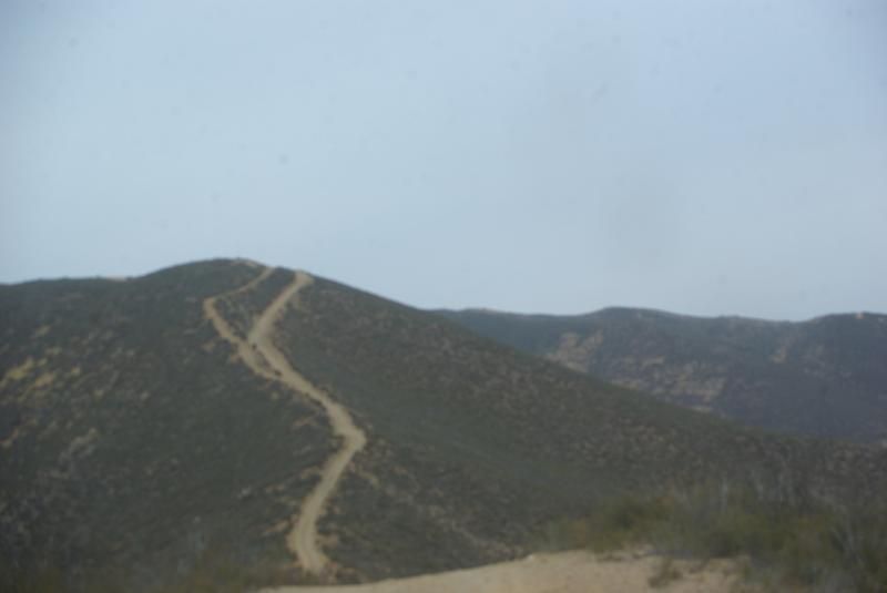
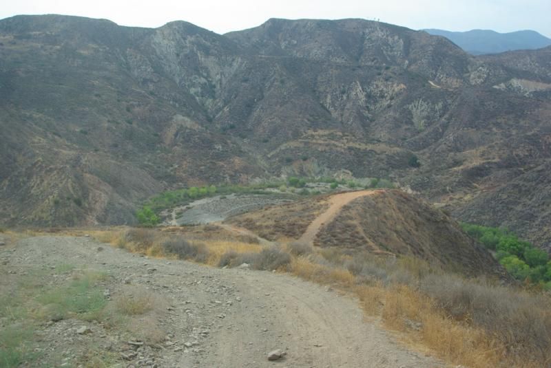
On the way up the trail, Steve discovered that his engine temp was running high, and that his lockers weren�t engaging. Shutting off his air conditioner solved the first problem. When we got to the top of Sierra Pelona ridge, we checked on Steve�s locker problem and discovered that the mechanic who replaced his PDC failed to wire up his air compressor. He decided that he could continue the run without lockers. This is the view of the Rowher OHV area from the ridge. The weather was warm and humid, so the visibility wasn�t great.
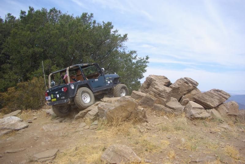
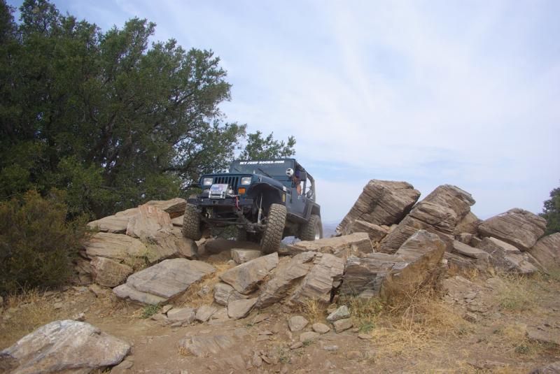
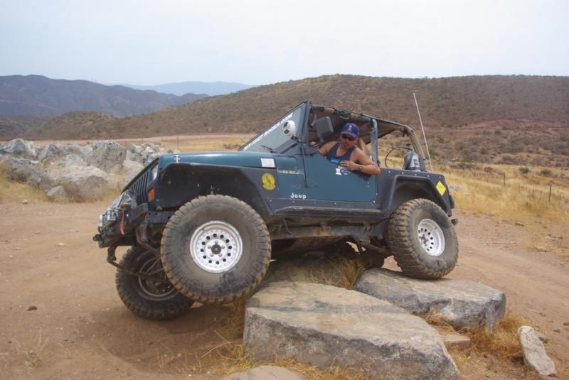
Jason decided to checkout the rock pile:
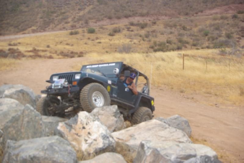
We continued down the Rowher Trail to the Rowher OHV area, where we stopped for lunch. After lunch, we made a brief visit to the Obstacle Course. I apologize for the fuzzy picture:
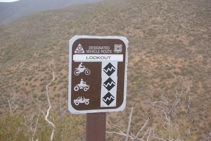
We took the Lookout Trail (3414W34) to Sierra Pelona Ridge and descended on the Rowher Trail to our starting point on Bouquet Canyon Road. The yellow line shows our route from the Obstacle Course back to Bouquet Canyon Road:
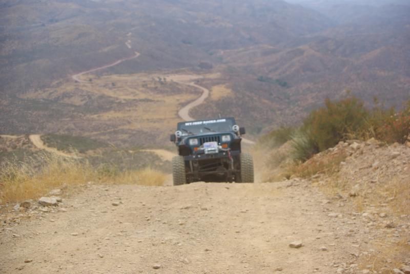
Recently, it became time to replace my worn out BFG KM2 tires. Since I am doing less rock-crawling and more overlanding style trips, I decided to replace them with BFG KO/AT tires. I believe the change in tires made a difference on the third long uphill portion of the Lookout Trail. I decided to take the more difficult left fork. In the past, I could crawl up this section of the trail with very little wheel spin on my KM2s. This time, I could not get up this section and had to back down and take the main trail. I don�t think that the trail has become more difficult; I think that the less aggressive tire tread made the difference.
We crossed the ridge and returned to our start point at Bouquet Canyon Road:
When we reached Bouquet Canyon Road, we continued 3-1/2 miles on pavement to 6N19, which would take us to the Drinkwater area. I had never been to this area, so I didn�t know what to expect.
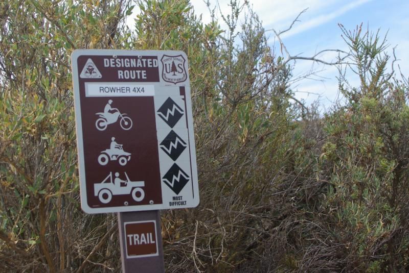
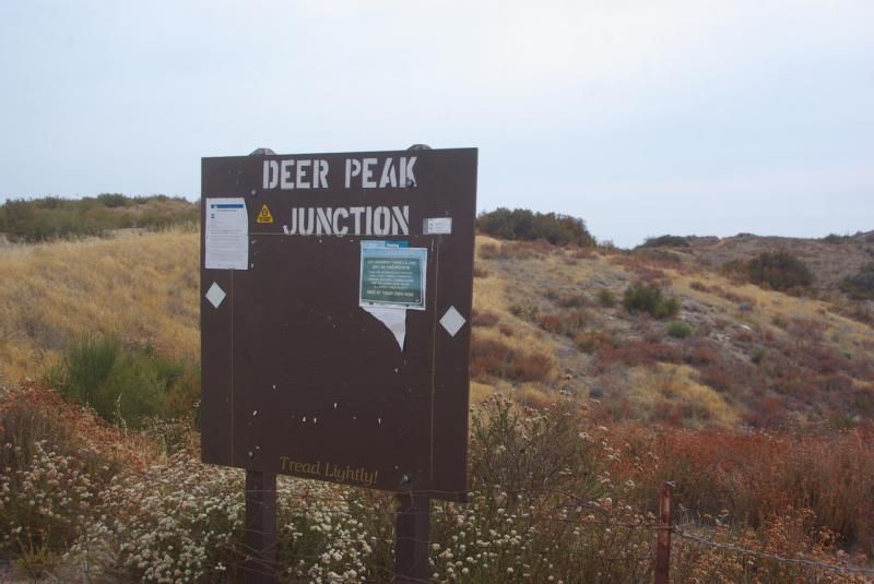
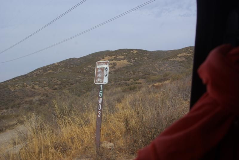
6N19 is a smooth, graded dirt road and we turned on 6N18, which is also a smooth, graded dirt road. When we reached Deer Peak Junction, we turned onto 3415W03, which is a black diamond 4x4 road. The first half of this route follows the ridge and is easy. The western half of this route has steep rutted hills, much like the Rowher and Lookout Trails.
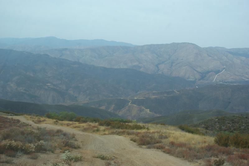
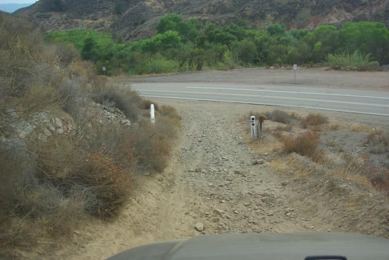
3415W03 ends at 6N21 at Drinkwater Flat. To get to pavement at San Francisquito Canyon Road, we take 6N21 to 5N27 to 3416W01. However, I missed the turnoff to 3416W01 and came to this:
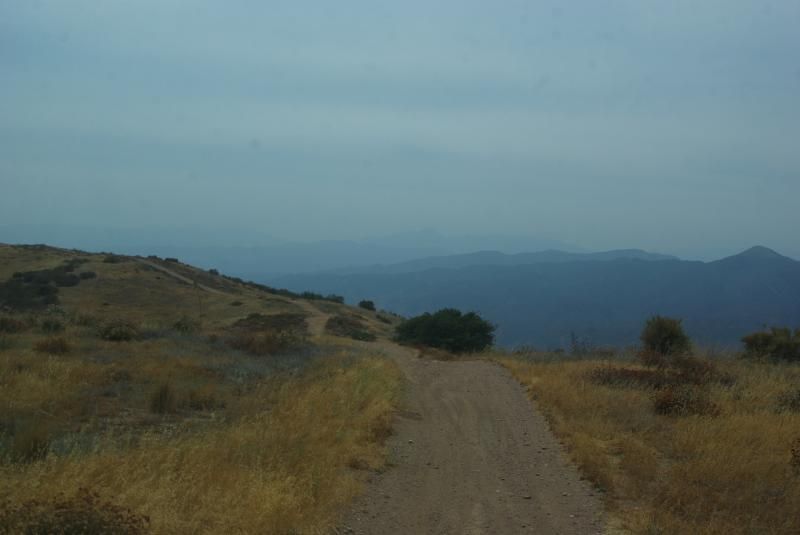
I did not have a detailed map of the area, but fortunately Steve�s GPS showed the way to 3416W01 and to San Francisquito Canyon Road.
The weather was warm and humid, but we didn't get any rain. I learned the difference in traction between KM2 and KO/AT tires (at least that's my excuse and I'm sticking to it!). It was a great day to be on the trails.
Stever, Jason and I met at the Rowher trailhead on Bouquet Canyon Road. This was a shakedown run for each of us for different reasons. Jason had just replaced the linkage on his Atlas transfer case, Steve had just replaced his Power Distribution Center, and I was preparing to leave for the Fordyce and Rubicon Trails. From left to right, my TJ, Steve's ZJ and Jason's YJ:

Our plan was to take the Rowher Trail (3414W19) to the Rowher OHV area, eat lunch, check out the obstacle course, take the Lookout Trail back to Bouquet Canyon Road, then take the Drinkwater Trail to San Francisquito Road. The yellow line on this diagram shows our planned route from Bouquet Canyon to the Rowher OHV area:


Following the 2008 Buckweed fire, the Forest Service bulldozed the trail and filled in the ruts. Over the years, erosion has gradually returned the trail to its earlier condition. This is Jason's YJ followed by Steve's ZJ ascending the trail with Bouquet Reservoir in the background:

On the way up the trail, Steve discovered that his engine temp was running high, and that his lockers weren�t engaging. Shutting off his air conditioner solved the first problem. When we got to the top of Sierra Pelona ridge, we checked on Steve�s locker problem and discovered that the mechanic who replaced his PDC failed to wire up his air compressor. He decided that he could continue the run without lockers. This is the view of the Rowher OHV area from the ridge. The weather was warm and humid, so the visibility wasn�t great.

Jason decided to checkout the rock pile:


We continued down the Rowher Trail to the Rowher OHV area, where we stopped for lunch. After lunch, we made a brief visit to the Obstacle Course. I apologize for the fuzzy picture:


We took the Lookout Trail (3414W34) to Sierra Pelona Ridge and descended on the Rowher Trail to our starting point on Bouquet Canyon Road. The yellow line shows our route from the Obstacle Course back to Bouquet Canyon Road:


Recently, it became time to replace my worn out BFG KM2 tires. Since I am doing less rock-crawling and more overlanding style trips, I decided to replace them with BFG KO/AT tires. I believe the change in tires made a difference on the third long uphill portion of the Lookout Trail. I decided to take the more difficult left fork. In the past, I could crawl up this section of the trail with very little wheel spin on my KM2s. This time, I could not get up this section and had to back down and take the main trail. I don�t think that the trail has become more difficult; I think that the less aggressive tire tread made the difference.

We crossed the ridge and returned to our start point at Bouquet Canyon Road:

When we reached Bouquet Canyon Road, we continued 3-1/2 miles on pavement to 6N19, which would take us to the Drinkwater area. I had never been to this area, so I didn�t know what to expect.

6N19 is a smooth, graded dirt road and we turned on 6N18, which is also a smooth, graded dirt road. When we reached Deer Peak Junction, we turned onto 3415W03, which is a black diamond 4x4 road. The first half of this route follows the ridge and is easy. The western half of this route has steep rutted hills, much like the Rowher and Lookout Trails.


3415W03 ends at 6N21 at Drinkwater Flat. To get to pavement at San Francisquito Canyon Road, we take 6N21 to 5N27 to 3416W01. However, I missed the turnoff to 3416W01 and came to this:

I did not have a detailed map of the area, but fortunately Steve�s GPS showed the way to 3416W01 and to San Francisquito Canyon Road.


The weather was warm and humid, but we didn't get any rain. I learned the difference in traction between KM2 and KO/AT tires (at least that's my excuse and I'm sticking to it!). It was a great day to be on the trails.

Comment