 Tweet
Tweet
The Jeep Expeditions Group began planning a trip to Baja in 2008, but the perceived danger of travel in Mexico caused the trip to be postponed each year, until five intrepid club members finally decided that the desire to have a good time in Baja outweighed the perceived risks. We planned to spend two weeks in Baja--one week to get from the border to Cabo San Lucas and one week for the return. Since we were a Jeep club, we wanted to follow some of the Baja 1000 trans-peninsular race route if possible. We thought that we would avoid the heat and humidity of summer by scheduling the trip for the last week of September through the first week of October (but we were wrong because it remained hot and humid throughout our trip).
Mike (trip leader) '99 TJ (lifted)
Sam '09 JK Unlimited (lifted)
Kevin '08 JK Unlimited (stock) with his daughter, Ally
Woody '96 ZJ (lifted)
myself '05 TJ (lifted) with Ziggy
Our general plan was to cross the border at Calexico, head south along the Sea of Cortez to the tip of the peninsula and return via the Pacific Coast, crossing the border at Tecate. We planned to meet up in Calexico on Sunday afternoon September 23, cross the border, get our Mexican Tourist Cards and stay at a hotel in Mexicali on Sunday night, but significant events began to change our plans two days before. On Friday afternoon, Mike, the trip leader told us that his vacation dates had been cut short from two weeks to one week by his employer because of the sudden resignation of one of the managers. He briefly considered going part of the way with the group then returning home by himself, but he decided that it would not be a good idea to travel that far alone in unfamiliar territory so he dropped out of the trip. I became the trip leader. On Saturday afternoon, I got a phone call from Woody. He was in the middle of the Nevada, heading to the meeting point in Calexico, but was having trouble with his '96 Jeep Grand Cherokee. His engine was misfiring and would not develop full power. After discussing it on the phone for a few minutes, he decided to limp back to Fallon, NV to do some further troubleshooting; he did not want to risk breaking down in the Nevada desert outside of cell phone range. Later in the afternoon, after replacing a fuel filter and cleaning his throttle body, the engine ran better, so he resumed his journey to a planned overnight stop in Las Vegas, NV. After about two hours, his engine again began to misfire, and he barely made it to Las Vegas. We were uncertain if he would be able to start the trip with the rest of the group on Sunday afternoon.
Sunday, September 23, 2012
On Sunday morning, the two JKs left the Phoenix area and I left Los Angeles for the meeting point in Calexico. Woody, the driver of the '96 Jeep Grand Cherokee decided to remain in Las Vegas in order to get his Jeep repaired on Monday morning; he would try to catch up to the rest of the group once his Jeep was fixed.
The temperature was over 108 degrees F. when I arrived at the meeting point (the Jack-in-the-Box) in Calexico. We crossed the border, got our Mexican FMM cards, and checked in to the Hotel Colonial in Mexicali. After checking in to the hotel, we walked around the corner to the Los Arcos Restaurant for our first meal in Mexico.
Monday, September 24, 2012
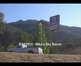
Many of our club members have ham radio licenses, so our schedule on Monday morning allowed time for us to go to the SCT office in Mexicali to get our Mexican ham radio operators permits. After we finished with the ham radio permit process, we stopped at the WalMart to shop for snacks and soft drinks enroute back to the hotel. Meanwhile, Woody called us and told us that the mechanic installed a pressure gauge to his fuel rail and took his Jeep for a test drive. They determined that his fuel pump was unable to maintain pressure under load. He had a replacement fuel pump, and would be on his way to join us later that afternoon. In order to give him time to catch up with us, and to get away from the 100 plus temperatures, we decided to spend Monday night at Mike�s Sky Ranch in the Sierra San Pedro Martir range just west of San Felipe. Woody would meet up with us on Tuesday in San Felipe for lunch.
We returned to the hotel, loaded up our Jeeps and prepared to check out, when I noticed a puddle of fluid under my Jeep. I had not driven the Jeep since our arrival the previous night and it appeared that the fluid was coolant seeping past my water pump seal. Fortunately, there was an AutoZone about a block away so after checking out of the hotel, we stopped there so I could purchase a water pump to take along in case the seep got worse. I almost panicked when I saw the price was $699.00 until I realized that the price was in pesos, about US$56.
We departed Mexicali on MEX-5 and filled up our gas tanks at the Pemex station at the edge of town. We paid 10.5 pesos per liter, which worked out to about US$3.12 per gallon. We encountered our first dirt road when we had to take a detour for about 20 miles around a (much needed) repaving of MEX-5. We encountered our first military checkpoint at the junction of MEX-5 and MEX-3. We headed up MEX-3 and aired down at the turnoff to Mike�s Sky Ranch. We arrived at Mike�s Sky Ranch in late afternoon. We were the only guests, and when we asked what time they served dinner, the cook asked us when we wanted to have dinner served. We went for a swim before enjoying a delicious steak dinner.
Tuesday, September 25, 2012
After a restful night in the cool mountain air and a full hot breakfast at Mike�s Sky Ranch, we headed back down into the heat of the coastal plain. Woody had spent the night in Yuma, AZ and we planned to meet him for lunch in San Felipe. When we reached MEX-3 we had cell phone service so we contacted Woody while we aired up the Jeeps. Woody was in Mexicali and he confirmed that he would meet us in San Felipe for lunch. We passed through the military checkpoint at the junction with MEX-5 and found a nice restaurant on the San Felipe Malecon and we found parking spaces right in front of the restaurant. Woody arrived shortly afterward. After lunch, we withdrew some cash from an ATM, filled our gas tanks at a Pemex station and headed toward Gonzaga Bay.
MEX-5 is now paved to within 20 km of Gonzaga Bay. When cruising down the new highway at the 110 kph speed limit it is hard to imagine crawling along the rocky coastal road on my last trip a few years ago. We cleared the military checkpoint at the north end of Gonzaga Bay just before sunset. We were in a hurry to set up camp before dark, so while waiting for the others to clear the military checkpoint, I asked the Pemex attendant what time they would open tomorrow. He replied �Mana�a no open�. Since they would be closed the next day, we refueled before setting up camp at Campo Beluga. We were the only guests at the campground. After setting up camp, we headed over to Alfonsina�s restaurant at the other end of the beach. We arrived at 7:50 pm, only to learn that the restaurant closed at 7:30 pm. We went to the mini-market at Rancho Grande and bought some food and snacks for dinner. We were beginning to realize that we were in the �off season� for Baja visitors.
Wednesday, September 26, 2012
After breakfast in camp, we loaded up the Jeeps and followed the 2010 Baja 1000 course to Coco�s Corner. We bought some sodas and chatted with Coco for awhile. Coco told us that the recent late summer rain had caused a lot of road damage. He said that the trip from Coco�s Corner to Laguna Chapala normally takes about half an hour, but his last trip took him an hour and a half.
After we left Coco�s Corner, we followed the Baja 1000 course through the Calamajue Canyon. Reports on other web forums indicated that the trail was in good condition, but those reports were posted before the rainstorms that occurred earlier in the month. The trail crosses the stream numerous times and the trail was washed out in places.
After Calamajue Canyon, we passed through a forest of Cirio trees and Cardon cactus. We arrived in Bahia de Los Angeles and set up camp at Daggett�s Campground, then went into town for dinner. Again, we were the only guests at the campground.
Thursday, September 27, 2012 � Tropical Storm Miriam and Punta San Francisquito
We were keeping an eye on the weather because Tropical Storm Miriam was brewing in the Pacific just off the southern tip of Baja. We left Bahia de Los Angeles and followed the Baja 1000 course toward Punta San Francisquito. The summer monsoon rains had washed out the road in several places and slowed down our travel. The last time I drove that route was in 2008, and it took about four hours to travel from Bahia de Los Angeles to Punta San Francisquito. After three hours, we were only at the Bahia Las Animas junction. Dark storm clouds began building up. Tropical Storm Miriam was still hundreds of miles away, but I suppose that this thunder storm was caused by the moisture circulating around Miriam. We were soon engulfed by the storm. Although the bikini top on my Jeep kept Ziggy and myself dry, the rain that fell in the back soon flooded my tub. I pulled the drain plugs and the water quickly drained out, but it took several days for my carpet to dry.
We arrived in San Francisquito in time to see a beautiful double rainbow. We camped on the beach at the fishing camp at Punta San Francisquito. Once again we were the only guests at the camp.
Friday, September 28, 2012 � Punta San Francisquito to Muleg�
On Friday morning we loaded our Jeeps in brilliant sunshine and bid farewell to Punta San Francisquito. We rejoined the Baja 1000 course and followed it up La Cuesta De La Ley grade and through a very green desert to the town of El Arco. We had hoped to eat lunch in El Arco, but despite the fact that it is one of the larger villages in the area, we could not find anything that was open. We left El Arco on a narrow sandy two-track trail that is as straight as an arrow for nearly twenty miles. We later learned from a Baja racer that this stretch of the course is nicknamed the �sand highway� and racers reach speeds of over 120 mph on it.
We reached pavement on MEX-1 just outside of Vizcaino. We aired up and headed into town to replenish our pesos at the ATM (the first one we had seen since leaving San Felipe on Tuesday) and to refuel our Jeeps. Unfortunately, we discovered that we had arrived on payday, and the line for the ATM stretched across the bank�s parking lot. We also discovered that the Pemex could not accept our credit cards because their credit card reader was not working (we heard this at nearly every Pemex station in Baja). By pooling our pesos, we were able to come up with enough cash to refill our Jeeps. We decided to leave the Baja 1000 course at San Ignacio, and we continued south on MEX-1 to Santa Rosalia where we planned to replenish our pesos and eat dinner. We discovered that since it was Friday evening, the center of town was jammed with people, the narrow streets were jammed with cars and although there were several banks in the center of town, each had long lines at the ATM. It took awhile to find parking, then we stood in line at the ATM. After replenishing our supply of pesos, we regrouped and stopped at a caf� for dinner. After dinner, we continued another 40 miles to Muleg� where stayed at Villa Maria Isabel campground. For the fifth night in a row we were the only guests.
Saturday, September 29, 2012 � Muleg� to Puerto San Carlos
We were just beginning to dry out from Tropical Storm Miriam when we encountered more rain. When I checked my e-mail on Saturday morning, I had an emergency message from the U.S. Consulate in Tijuana warning of Tropical Storm Norman. The storm was located about 85 miles east of Cabo San Lucas and heading northwest. We hoped to avoid some of the rain and get away from the warm, muggy weather of the Sea of Cortez by crossing to the Pacific side of the Baja peninsula. Our destination was Puerto San Carlos on Magdalena Bay, approximately 200 highway miles from Muleg�. We stopped for lunch in Loreto. In places, one or both lanes of MEX-1 were flooded. Puerto San Carlos is a fishing community on Magdalena Bay. Its main industry is a fish processing plant. In winter, tourists come to Puerto San Carlos to view the migrating gray whales. We chose to stay at the Hotel Brennan and for the first time since leaving Mexicali, we were not alone; there was one other guest at the hotel. We had come to Puerto San Carlos in search of drier, cooler weather but we were disappointed because in the aftermath of Tropical Storm Miriam we found it was just as warm and humid along Magdalena Bay as it was on the Sea of Cortez.
Sunday, September 30, 2012 � Puerto San Carlos to San Jose Del Cabo
One week had elapsed since we crossed the US-Mexico border, and the tip of the Baja Peninsula was 300 miles away. We left Puerto San Carlos and rejoined MEX-1 at Cuidad Constitution. We traveled down Hwy 1 to La Paz, where we stopped for lunch on the Malecon. We continued down Hwy 1 and visited the small town of El Triunfo. In the 19th century, gold and silver were discovered in the area and the town once had a population of 10,000. The mines have closed and now only a few hundred people reside in El Triunfo. Because of our flexible travel plans, we did not have room reservations in the Cabo area, but after a brief search, we were able to find a three-bedroom condo at the Alegranza Resort in San Jose Del Cabo, which would accept pets. After nearly a week of camping, we welcomed the plush accommodations and especially the air conditioning at the Alegranza.
Monday, October 1, 2012 � Land�s End
We had nothing planned for Monday morning. Some of us slept late, others used the condo�s washer and dryer, swimming pools, and/or internet access. I watched some surfers catch a few waves. About mid-afternoon we headed to Cabo San Lucas. Our goal was to see the Arch and Land�s End thus signifying the end of our trip down the Baja Peninsula. We took a water taxi to get close to the Arch and Land�s End. After returning to shore, we shopped for souvenirs of our trip and searched for a Margarita to celebrate reaching the tip of the peninsula. I bought a t-shirt at Cabo Wabo, but I was disappointed that Ziggy could not go inside for a Margarita (even though he is over 21 in dog years). Instead, we went to an open-air restaurant next to the marina for our celebration.
(continued)
Mike (trip leader) '99 TJ (lifted)
Sam '09 JK Unlimited (lifted)
Kevin '08 JK Unlimited (stock) with his daughter, Ally
Woody '96 ZJ (lifted)
myself '05 TJ (lifted) with Ziggy
Our general plan was to cross the border at Calexico, head south along the Sea of Cortez to the tip of the peninsula and return via the Pacific Coast, crossing the border at Tecate. We planned to meet up in Calexico on Sunday afternoon September 23, cross the border, get our Mexican Tourist Cards and stay at a hotel in Mexicali on Sunday night, but significant events began to change our plans two days before. On Friday afternoon, Mike, the trip leader told us that his vacation dates had been cut short from two weeks to one week by his employer because of the sudden resignation of one of the managers. He briefly considered going part of the way with the group then returning home by himself, but he decided that it would not be a good idea to travel that far alone in unfamiliar territory so he dropped out of the trip. I became the trip leader. On Saturday afternoon, I got a phone call from Woody. He was in the middle of the Nevada, heading to the meeting point in Calexico, but was having trouble with his '96 Jeep Grand Cherokee. His engine was misfiring and would not develop full power. After discussing it on the phone for a few minutes, he decided to limp back to Fallon, NV to do some further troubleshooting; he did not want to risk breaking down in the Nevada desert outside of cell phone range. Later in the afternoon, after replacing a fuel filter and cleaning his throttle body, the engine ran better, so he resumed his journey to a planned overnight stop in Las Vegas, NV. After about two hours, his engine again began to misfire, and he barely made it to Las Vegas. We were uncertain if he would be able to start the trip with the rest of the group on Sunday afternoon.
Sunday, September 23, 2012
On Sunday morning, the two JKs left the Phoenix area and I left Los Angeles for the meeting point in Calexico. Woody, the driver of the '96 Jeep Grand Cherokee decided to remain in Las Vegas in order to get his Jeep repaired on Monday morning; he would try to catch up to the rest of the group once his Jeep was fixed.
The temperature was over 108 degrees F. when I arrived at the meeting point (the Jack-in-the-Box) in Calexico. We crossed the border, got our Mexican FMM cards, and checked in to the Hotel Colonial in Mexicali. After checking in to the hotel, we walked around the corner to the Los Arcos Restaurant for our first meal in Mexico.
Monday, September 24, 2012
Many of our club members have ham radio licenses, so our schedule on Monday morning allowed time for us to go to the SCT office in Mexicali to get our Mexican ham radio operators permits. After we finished with the ham radio permit process, we stopped at the WalMart to shop for snacks and soft drinks enroute back to the hotel. Meanwhile, Woody called us and told us that the mechanic installed a pressure gauge to his fuel rail and took his Jeep for a test drive. They determined that his fuel pump was unable to maintain pressure under load. He had a replacement fuel pump, and would be on his way to join us later that afternoon. In order to give him time to catch up with us, and to get away from the 100 plus temperatures, we decided to spend Monday night at Mike�s Sky Ranch in the Sierra San Pedro Martir range just west of San Felipe. Woody would meet up with us on Tuesday in San Felipe for lunch.
We returned to the hotel, loaded up our Jeeps and prepared to check out, when I noticed a puddle of fluid under my Jeep. I had not driven the Jeep since our arrival the previous night and it appeared that the fluid was coolant seeping past my water pump seal. Fortunately, there was an AutoZone about a block away so after checking out of the hotel, we stopped there so I could purchase a water pump to take along in case the seep got worse. I almost panicked when I saw the price was $699.00 until I realized that the price was in pesos, about US$56.
We departed Mexicali on MEX-5 and filled up our gas tanks at the Pemex station at the edge of town. We paid 10.5 pesos per liter, which worked out to about US$3.12 per gallon. We encountered our first dirt road when we had to take a detour for about 20 miles around a (much needed) repaving of MEX-5. We encountered our first military checkpoint at the junction of MEX-5 and MEX-3. We headed up MEX-3 and aired down at the turnoff to Mike�s Sky Ranch. We arrived at Mike�s Sky Ranch in late afternoon. We were the only guests, and when we asked what time they served dinner, the cook asked us when we wanted to have dinner served. We went for a swim before enjoying a delicious steak dinner.
Tuesday, September 25, 2012
After a restful night in the cool mountain air and a full hot breakfast at Mike�s Sky Ranch, we headed back down into the heat of the coastal plain. Woody had spent the night in Yuma, AZ and we planned to meet him for lunch in San Felipe. When we reached MEX-3 we had cell phone service so we contacted Woody while we aired up the Jeeps. Woody was in Mexicali and he confirmed that he would meet us in San Felipe for lunch. We passed through the military checkpoint at the junction with MEX-5 and found a nice restaurant on the San Felipe Malecon and we found parking spaces right in front of the restaurant. Woody arrived shortly afterward. After lunch, we withdrew some cash from an ATM, filled our gas tanks at a Pemex station and headed toward Gonzaga Bay.
MEX-5 is now paved to within 20 km of Gonzaga Bay. When cruising down the new highway at the 110 kph speed limit it is hard to imagine crawling along the rocky coastal road on my last trip a few years ago. We cleared the military checkpoint at the north end of Gonzaga Bay just before sunset. We were in a hurry to set up camp before dark, so while waiting for the others to clear the military checkpoint, I asked the Pemex attendant what time they would open tomorrow. He replied �Mana�a no open�. Since they would be closed the next day, we refueled before setting up camp at Campo Beluga. We were the only guests at the campground. After setting up camp, we headed over to Alfonsina�s restaurant at the other end of the beach. We arrived at 7:50 pm, only to learn that the restaurant closed at 7:30 pm. We went to the mini-market at Rancho Grande and bought some food and snacks for dinner. We were beginning to realize that we were in the �off season� for Baja visitors.
Wednesday, September 26, 2012
After breakfast in camp, we loaded up the Jeeps and followed the 2010 Baja 1000 course to Coco�s Corner. We bought some sodas and chatted with Coco for awhile. Coco told us that the recent late summer rain had caused a lot of road damage. He said that the trip from Coco�s Corner to Laguna Chapala normally takes about half an hour, but his last trip took him an hour and a half.
After we left Coco�s Corner, we followed the Baja 1000 course through the Calamajue Canyon. Reports on other web forums indicated that the trail was in good condition, but those reports were posted before the rainstorms that occurred earlier in the month. The trail crosses the stream numerous times and the trail was washed out in places.
After Calamajue Canyon, we passed through a forest of Cirio trees and Cardon cactus. We arrived in Bahia de Los Angeles and set up camp at Daggett�s Campground, then went into town for dinner. Again, we were the only guests at the campground.
Thursday, September 27, 2012 � Tropical Storm Miriam and Punta San Francisquito
We were keeping an eye on the weather because Tropical Storm Miriam was brewing in the Pacific just off the southern tip of Baja. We left Bahia de Los Angeles and followed the Baja 1000 course toward Punta San Francisquito. The summer monsoon rains had washed out the road in several places and slowed down our travel. The last time I drove that route was in 2008, and it took about four hours to travel from Bahia de Los Angeles to Punta San Francisquito. After three hours, we were only at the Bahia Las Animas junction. Dark storm clouds began building up. Tropical Storm Miriam was still hundreds of miles away, but I suppose that this thunder storm was caused by the moisture circulating around Miriam. We were soon engulfed by the storm. Although the bikini top on my Jeep kept Ziggy and myself dry, the rain that fell in the back soon flooded my tub. I pulled the drain plugs and the water quickly drained out, but it took several days for my carpet to dry.
We arrived in San Francisquito in time to see a beautiful double rainbow. We camped on the beach at the fishing camp at Punta San Francisquito. Once again we were the only guests at the camp.
Friday, September 28, 2012 � Punta San Francisquito to Muleg�
On Friday morning we loaded our Jeeps in brilliant sunshine and bid farewell to Punta San Francisquito. We rejoined the Baja 1000 course and followed it up La Cuesta De La Ley grade and through a very green desert to the town of El Arco. We had hoped to eat lunch in El Arco, but despite the fact that it is one of the larger villages in the area, we could not find anything that was open. We left El Arco on a narrow sandy two-track trail that is as straight as an arrow for nearly twenty miles. We later learned from a Baja racer that this stretch of the course is nicknamed the �sand highway� and racers reach speeds of over 120 mph on it.
We reached pavement on MEX-1 just outside of Vizcaino. We aired up and headed into town to replenish our pesos at the ATM (the first one we had seen since leaving San Felipe on Tuesday) and to refuel our Jeeps. Unfortunately, we discovered that we had arrived on payday, and the line for the ATM stretched across the bank�s parking lot. We also discovered that the Pemex could not accept our credit cards because their credit card reader was not working (we heard this at nearly every Pemex station in Baja). By pooling our pesos, we were able to come up with enough cash to refill our Jeeps. We decided to leave the Baja 1000 course at San Ignacio, and we continued south on MEX-1 to Santa Rosalia where we planned to replenish our pesos and eat dinner. We discovered that since it was Friday evening, the center of town was jammed with people, the narrow streets were jammed with cars and although there were several banks in the center of town, each had long lines at the ATM. It took awhile to find parking, then we stood in line at the ATM. After replenishing our supply of pesos, we regrouped and stopped at a caf� for dinner. After dinner, we continued another 40 miles to Muleg� where stayed at Villa Maria Isabel campground. For the fifth night in a row we were the only guests.
Saturday, September 29, 2012 � Muleg� to Puerto San Carlos
We were just beginning to dry out from Tropical Storm Miriam when we encountered more rain. When I checked my e-mail on Saturday morning, I had an emergency message from the U.S. Consulate in Tijuana warning of Tropical Storm Norman. The storm was located about 85 miles east of Cabo San Lucas and heading northwest. We hoped to avoid some of the rain and get away from the warm, muggy weather of the Sea of Cortez by crossing to the Pacific side of the Baja peninsula. Our destination was Puerto San Carlos on Magdalena Bay, approximately 200 highway miles from Muleg�. We stopped for lunch in Loreto. In places, one or both lanes of MEX-1 were flooded. Puerto San Carlos is a fishing community on Magdalena Bay. Its main industry is a fish processing plant. In winter, tourists come to Puerto San Carlos to view the migrating gray whales. We chose to stay at the Hotel Brennan and for the first time since leaving Mexicali, we were not alone; there was one other guest at the hotel. We had come to Puerto San Carlos in search of drier, cooler weather but we were disappointed because in the aftermath of Tropical Storm Miriam we found it was just as warm and humid along Magdalena Bay as it was on the Sea of Cortez.
Sunday, September 30, 2012 � Puerto San Carlos to San Jose Del Cabo
One week had elapsed since we crossed the US-Mexico border, and the tip of the Baja Peninsula was 300 miles away. We left Puerto San Carlos and rejoined MEX-1 at Cuidad Constitution. We traveled down Hwy 1 to La Paz, where we stopped for lunch on the Malecon. We continued down Hwy 1 and visited the small town of El Triunfo. In the 19th century, gold and silver were discovered in the area and the town once had a population of 10,000. The mines have closed and now only a few hundred people reside in El Triunfo. Because of our flexible travel plans, we did not have room reservations in the Cabo area, but after a brief search, we were able to find a three-bedroom condo at the Alegranza Resort in San Jose Del Cabo, which would accept pets. After nearly a week of camping, we welcomed the plush accommodations and especially the air conditioning at the Alegranza.
Monday, October 1, 2012 � Land�s End
We had nothing planned for Monday morning. Some of us slept late, others used the condo�s washer and dryer, swimming pools, and/or internet access. I watched some surfers catch a few waves. About mid-afternoon we headed to Cabo San Lucas. Our goal was to see the Arch and Land�s End thus signifying the end of our trip down the Baja Peninsula. We took a water taxi to get close to the Arch and Land�s End. After returning to shore, we shopped for souvenirs of our trip and searched for a Margarita to celebrate reaching the tip of the peninsula. I bought a t-shirt at Cabo Wabo, but I was disappointed that Ziggy could not go inside for a Margarita (even though he is over 21 in dog years). Instead, we went to an open-air restaurant next to the marina for our celebration.
(continued)
Comment