Announcement

Collapse
No announcement yet.

San Savaine Revisited

Collapse

Forum Thread First Post

Collapse
X
 
  • Filter
  • Time
  • Show
Clear All
new posts

  • Trail Report: San Savaine Revisited

    Since we didn't make it to the end of the trail last week, we tried again today. We had a good turn out. Kurt, Russ, Jonah, Jason, and Rick were all able to join us for the run.

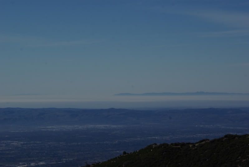
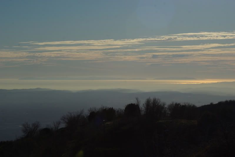
    It was a beautiful day with an amazing visibility distance:


    We headed straight to the campground and unlike last week, we didn't see any snow until the shelf road where we turned back last Monday:


    We pushed on and finally got to a point where the only tracks were from an ATV:


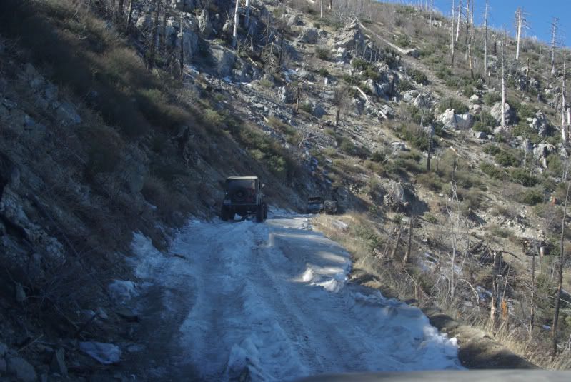
    We cut new tracks without too much effort until we got to this point:


    I was leading and hit the snow bank way too slow. Several tries and lockers required, I finally pushed through. After I got through, the rest of the crew made it through without any issue:


    We soon after made it to the campground:


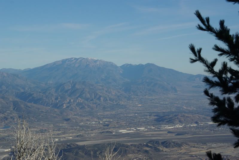
    When I was last there in 2008, the road was barricaded. It was nice to see the barricade gone and the campground set up with several campsites. It wasn't long before we made it to the gate where there is a killer view:


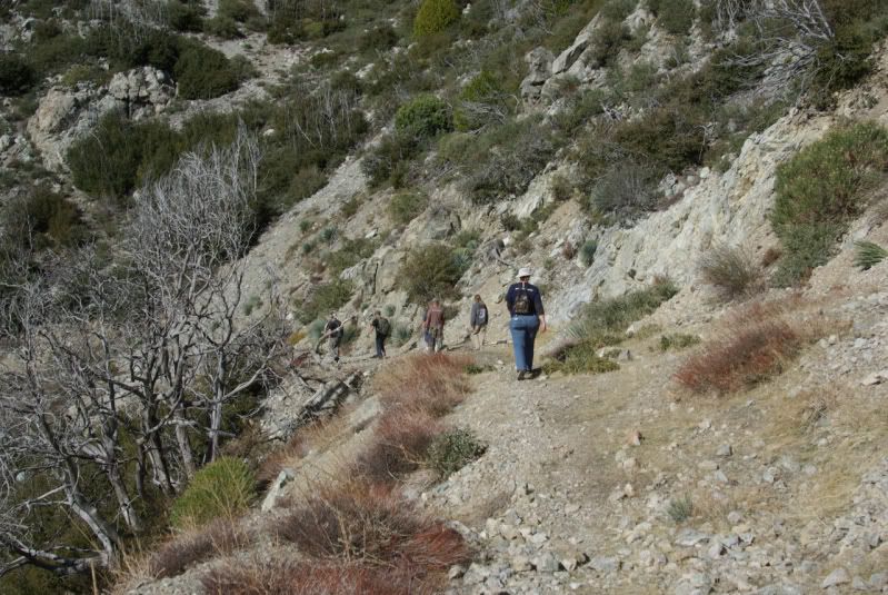
    From there, we hiked the road to find the wash outs that have been reported:


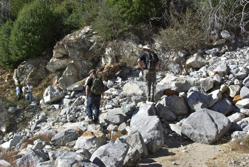
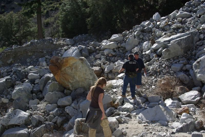
    The first major wash out was quite impressive. The forces required to move the boulders must have been amazing to see:


    The second major wash out was even more impressive:


    Plus it had a stream flowing through it:


    Quick Video:


    We hiked back up to the Jeeps at the gate after enjoying the surroundings for a while. I forgot to mention, there are nasty patches of thorny bushes filling many parts of the trail. I recommend wearing appropriate clothes:


    But the views make up for the pain (sort of):


    Heading back out was not too tough and the pretty views were a nice distraction:


    We made it back to the radio tower and posed for some shots:


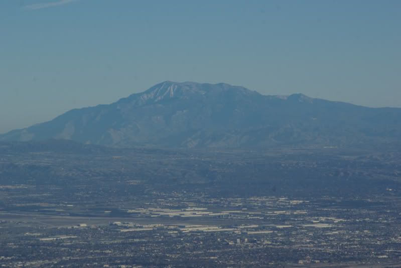
    And some great views:


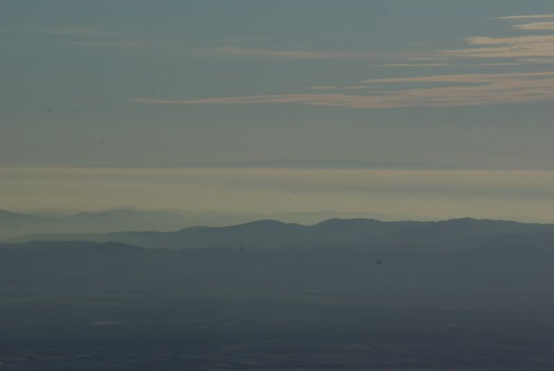
    The visibility was so clear that we could see the ocean:


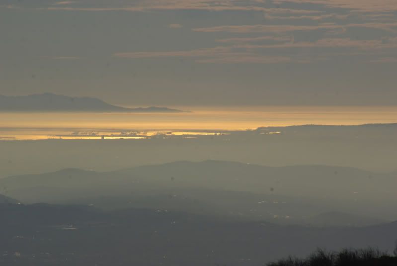
    The views didn't stop after we got back though, the sunset was beautiful on the way home:


    It was yet another great trip with some great people. It was excellent fun and I am looking forward to another run somewhere soon. Thanks everyone for a great day!
    [COLOR=#ff8c00]MYJEEP(crawls)ROCKS(again).com

    I have finally stopped drinking for good.
    Now I drink for evil..... :devil:
    [/COLOR]

  • #2
    Ryan and Nick will have that road whipped back in shape in no time. Nice pics, looks like a fun hiking trip.
    The wife and me and one of our dogs did some wandering around east of MT Baldy village today, was nice to do some walking in the mountains

    Comment


    • #3
      Originally posted by aw12345 View Post
      Ryan and Nick will have that road whipped back in shape in no time. Nice pics, looks like a fun hiking trip.
      The wife and me and one of our dogs did some wandering around east of MT Baldy village today, was nice to do some walking in the mountains
      Sounds like you had a good time today too. I think that we should adopt the trail. I'm sure that we can have it passable in a year!
      [COLOR=#ff8c00]MYJEEP(crawls)ROCKS(again).com

      I have finally stopped drinking for good.
      Now I drink for evil..... :devil:
      [/COLOR]

      Comment


      • #4
        Originally posted by Mike View Post
        Sounds like you had a good time today too. I think that we should adopt the trail. I'm sure that we can have it passable in a year!
        I second that. I went up this road last year and it was beautiful. Being that the trail is so close to home, getting to the trail to work on it will be quick.

        I See Detroit's in My Future:gun:

        Comment


        • #5
          Mike,

          Nice report and pictures. What kind of zoom do you have that reaches to the ocean? Wow.

          Mitch

          Comment


          • #6
            Rae and I had an awesome day exploring with an awesome group of fellow jeepers. Thanks Mike for the post and all I the pics, the views were amazing. Can't believe how good the pictures came out of the ocean. Looking forward to more exploring.

            Comment


            • #7
              I think that lens could see into the future!
              God forgives, rocks don't
              -sons of thunder

              Comment


              • #8
                Originally posted by Mitch View Post
                Mike,

                Nice report and pictures. What kind of zoom do you have that reaches to the ocean? Wow.

                Mitch
                You are going to hate me, but it is a Canon point-and-shoot. PowerShot SX130. 12x optical zoom. $195.
                (It is the same camera that took the Cerro Gordo mine bucket pic.

                In this case, I have to say that I had no idea what I had captured until I got home and looked at the pics on the PC. Trying to get a good view through the viewer on the back of the camera with the sun in my face was a pure crap shoot.

                The right place at the right time. I got lucky.
                Last edited by Mike; 01-03-12, 12:37 AM.
                [COLOR=#ff8c00]MYJEEP(crawls)ROCKS(again).com

                I have finally stopped drinking for good.
                Now I drink for evil..... :devil:
                [/COLOR]

                Comment


                • #9
                  Too funny Mike. I remember some fantastic shots with my Sony point and shoot. And they can really reach out on the zoom stuff. Very nice, thanks for sharing.

                  So I could have saved the $4k that in my camera bag? Well no......

                  Comment


                  • #10
                    The Chamber of Commerce would like everyone to believe that it was a typical January day in Southern California. Yeah right!

                    Here is a view of the Pacific Ocean as we ascended the trail. On the horizon on the right is Santa Catalina Island (about 75 miles away), on the left is San Clemente Island (about 105 miles away).


                    Most of the trail is on the sunny south side of the mountain. It was getting pretty warm and I was ready to turn on the A/C when the trail went around to the shady side of the mountain. Snow on the trail just before Joe Elliott Campground:


                    We parked at the gate, ate lunch, and started the hike:


                    About a half mile from the gate, we reached the first washout. It is about 40 yards wide:


                    Another quarter of a mile, we reached another, bigger washout. This one is more than a hundred yards wide:


                    On the way back down the mountain, we stopped at the radio towers to enjoy the view. This is Mt. San Gorgonio:


                    Mount San Jacinto:


                    Santiago Peak:


                    The Los Angeles/Long Beach harbor:


                    Santa Catalina Island:


                    San Clemente Island:


                    Thanks to Mike and Sharon for leading this run.
                    If you don't like the way I drive, stay out of the bushes!
                    KI6MLU

                    Comment


                    • #11
                      Those Are some great pictures guys. I need to get up there and check it out.
                      IN A LAND OF FREEDOM WE ARE HELD HOSTAGE BY THE TYRANNY OF POLITICAL CORRECTNESS!!

                      Better To Burn Out Than To Rust Out!

                      Comment


                      • #12
                        Thanks for a great day! That was a super fun run. Here are a few pics:


                        Comment


                        • #13
                          Thanks Mike & Sharon for setting this run up .very nice day good group of people IM being reminded why not to wear shorts when standing near water ( scratch-scratch-itch-itch ) Had a blast .Mike hope to do that other trail we talked about.

                          Comment


                          • #14
                            Too bad the gate is locked on the other side it was a fairly long trail IIRC. I think it took us about 3 hours to do with the awd honda crv. I remember great views and some harder bypasses we didnt take. Btw we followed some jeeps to. I believe it was 2001 when we did it, not sure when they finally closed it. Thinking it might of been right after the grand prix fire went through the area. I wish it would open again who do we have to call to get this done.

                            Comment

                            Working...
                            X