 Tweet
Tweet
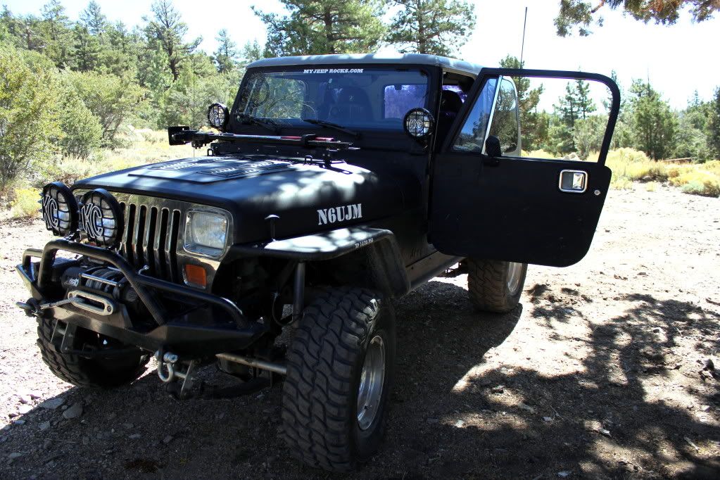
I talked to my buddy Mitch the other day complaining how I haven't been wheeling much lately and I needed to get out and play. So he came over yesterday morning and since the weather was perfect, he agreed that a run in the mountains was the order of the day.
I have not been on 1N01 (Pipes Road) since the mid 1980's and right after the Illegal gate was installed by the Conservarory group. But that's another discussion.
It is rated as a Blue (moderate) trail. So with Mitch riding shotgun we headed out. He was the official photographer for the run and I know he'll be posting on this thread some fantastic photos!
When we got to the trailhead and were airing down, I did look across the highway and saw that the trail to Lightening Ridge has been closed. Bummer.
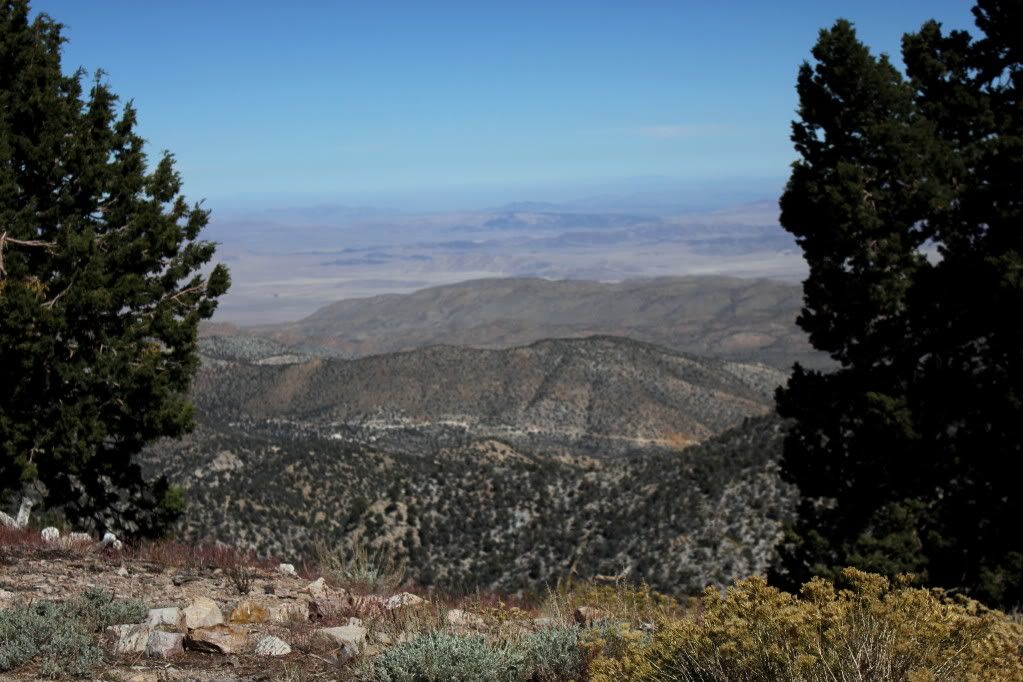
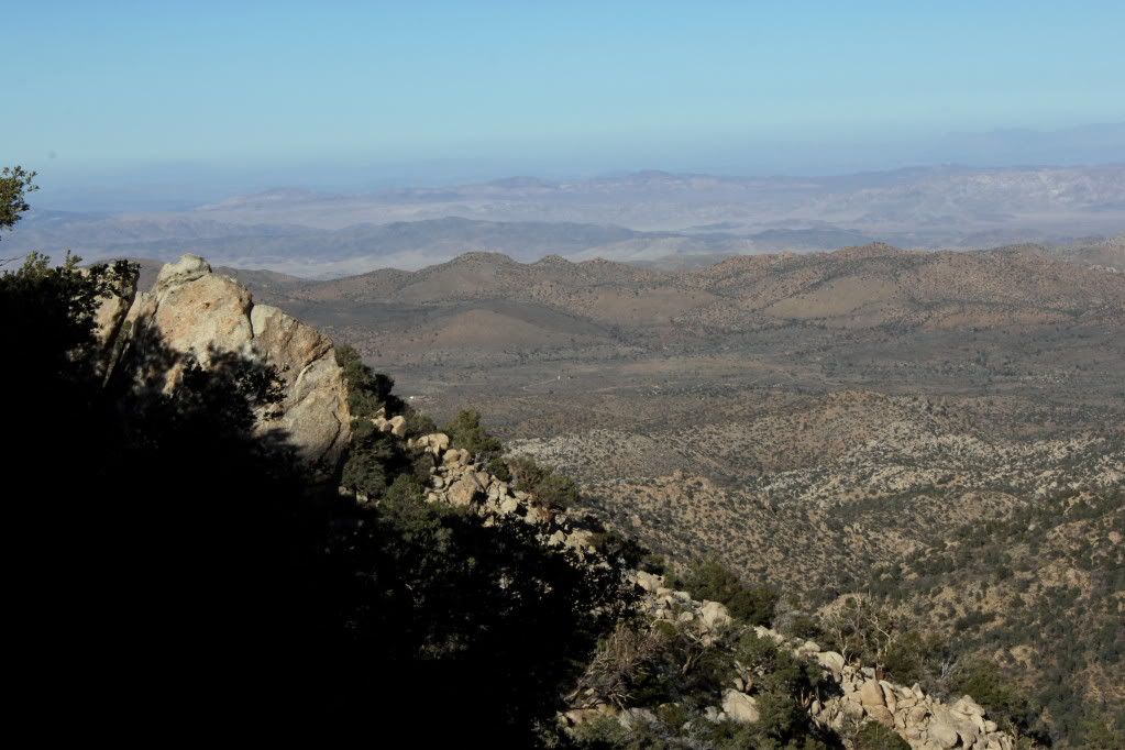
The first two miles of the trail are green to the top of Onyx Peak. This is a site with many radio towers. I saw an interesting looking site that was a GPS transponder that is used to monitor earthquake activity. During the Big Bear/Landers twin quake back in 1992 Onyx peak moved and changed elevation by quite a bit. I just can't remember Just how much though. Now scientists will know any movement immediately. The views out over the desert are incredable! You can see as far as Nevada and the Sierra Nevada Range.
The rest of the trail is moderate and a stock Jeep could make it through, but with a tiny bit of bumping a bottom scraping. It does not appear anyone is maintaining the trail and there are a few dicey off-camber sections where the cut in the hillside has eroded onto the trail.
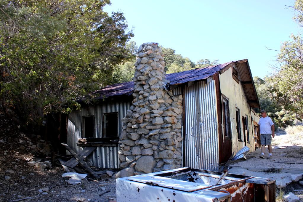
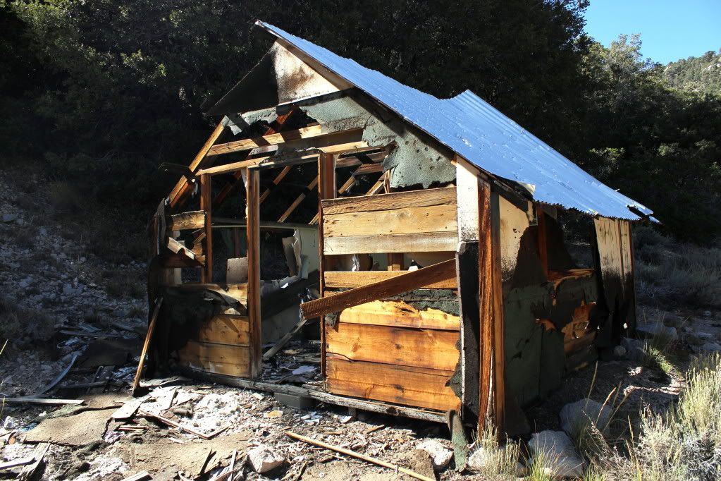
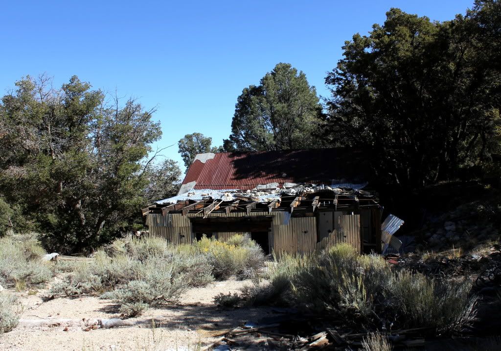
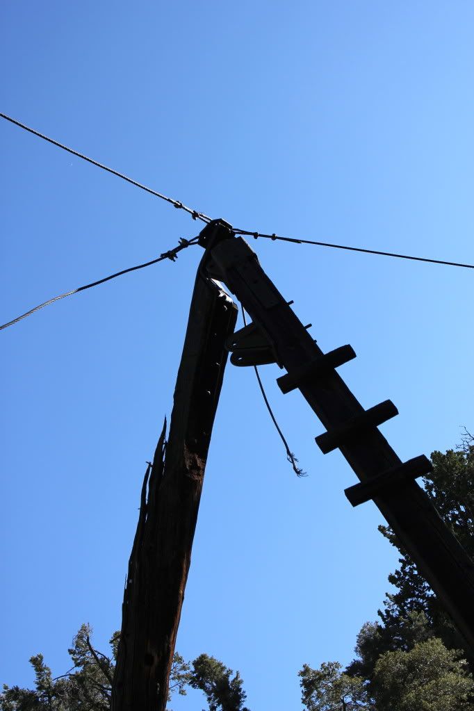
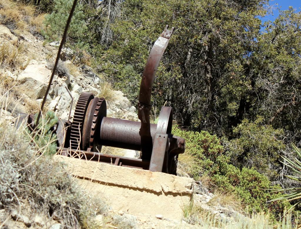
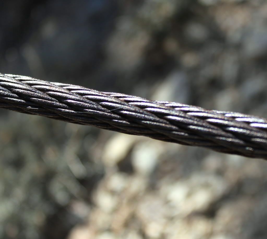
Down near the bottom is the Onyx Mine site. The buildings are still there but are pretty much trashed. The winch gears and cable are still ther running up to the top of the ridge where they mined for onyx.
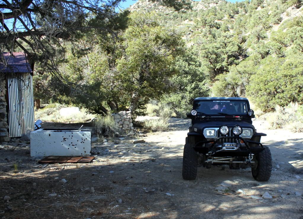
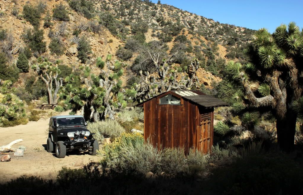
After exploring this site we headed down to the Pipes Campground. This is a USFS campground but unfortunatly it appears that they have been neglecting it. It is in pretty rough shape. It's in a very nice setting though and it would be worth putting an overnight Jeep run together and camp there. There's no water and no camp fires are not allowed. Sucks having a campground with no fires. I think it is probably the most secluded campground in the SBNF.
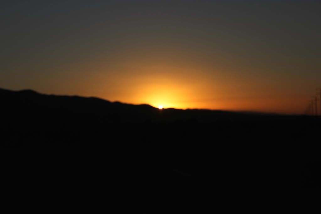
Well, as it was getting late so we headed back and enjoyed three sunsets as we drove to my house.
Thank you Mitch for making yesterday a perfect day! I needed that!
BTW we sent Curtis a text message telling him where we were going.
I have not been on 1N01 (Pipes Road) since the mid 1980's and right after the Illegal gate was installed by the Conservarory group. But that's another discussion.
It is rated as a Blue (moderate) trail. So with Mitch riding shotgun we headed out. He was the official photographer for the run and I know he'll be posting on this thread some fantastic photos!
When we got to the trailhead and were airing down, I did look across the highway and saw that the trail to Lightening Ridge has been closed. Bummer.
The first two miles of the trail are green to the top of Onyx Peak. This is a site with many radio towers. I saw an interesting looking site that was a GPS transponder that is used to monitor earthquake activity. During the Big Bear/Landers twin quake back in 1992 Onyx peak moved and changed elevation by quite a bit. I just can't remember Just how much though. Now scientists will know any movement immediately. The views out over the desert are incredable! You can see as far as Nevada and the Sierra Nevada Range.
The rest of the trail is moderate and a stock Jeep could make it through, but with a tiny bit of bumping a bottom scraping. It does not appear anyone is maintaining the trail and there are a few dicey off-camber sections where the cut in the hillside has eroded onto the trail.
Down near the bottom is the Onyx Mine site. The buildings are still there but are pretty much trashed. The winch gears and cable are still ther running up to the top of the ridge where they mined for onyx.
After exploring this site we headed down to the Pipes Campground. This is a USFS campground but unfortunatly it appears that they have been neglecting it. It is in pretty rough shape. It's in a very nice setting though and it would be worth putting an overnight Jeep run together and camp there. There's no water and no camp fires are not allowed. Sucks having a campground with no fires. I think it is probably the most secluded campground in the SBNF.
Well, as it was getting late so we headed back and enjoyed three sunsets as we drove to my house.
Thank you Mitch for making yesterday a perfect day! I needed that!
BTW we sent Curtis a text message telling him where we were going.

Comment