One of the items on my bucket list has been to drive to Alaska via the Alaska Highway. I have passed through Alaska on MAC flights to/from Vietnam and Korea, but I never left the airport terminal, so this would be my first true visit to Alaska. It is about 4,000 miles from Southern California to Prudhoe Bay, AK and I figured it would take a minimum of three weeks to make the round trip. Last year, The Jeep Expeditions Group™ announced an Alaska trip to take place in July 2011. About two dozen members of the Group expressed interest in the “Arctic Expedition” and we started the trip planning process.
Trip Planning
With so many participants and such a long trip, it was difficult to find a consensus on the itinerary as some participants wanted to get to Alaska as quickly as possible, while others wanted to stop along the way to visit attractions such as Yellowstone Park, Glacier Park, the Canadian Rockies, and Canada’s Northwest Territories. I figured I would be tired of driving by the time I reached Alaska, and I wanted to take the Alaska ferry to return home via the Inside Passage, but some of the participants preferred to drive both ways. In order to accommodate everyone’s desires, we decided that the official “group expedition” would start at Milepost Zero of the Alaska Highway in Dawson Creek, British Columbia, Canada. Members could make their own plans and travel individually or in small groups to the starting point. The group would travel together on the Alaska Highway to Delta Junction, continue to Fairbanks, and travel the Dalton Highway to Prudhoe Bay (the road featured on the "Ice Road Truckers" show). The official “group expedition” would end at Denali National Park. Then we would travel individually or in small groups to return home by land or by sea. A small group would explore Canada’s Yukon and Northwest Territories by taking the Dempster Highway to Inuvik.
My plan was to leave home in late June, 2011, travel to Glacier National Park, continue to Banff where I would meet two other members, spend the 4th of July weekend in the Canadian Rockies, and meet the main group in Dawson Creek on July 6. After the end of the group run on July 15 at Denali National Park, I would visit the Kenai Peninsula, then head to Haines, AK to catch the southbound ferry on July 21. I would take the ferry to Juneau, transfer to another ferry to Prince Rupert, BC, and take another ferry to Port Hardy, BC. Finally, I would drive to Victoria, BC and take another ferry to Anacortes, WA then drive home on I-5. This route would be about 7,000 miles by highway and about 800 miles by ferry.
Fifty years ago, the Alaska Highway, then known as the Alcan Highway, was mostly dirt and gravel. Today, it is paved its entire length of 1,422 miles. However, there are stretches of the roadway that are potholed, uneven, or under repair. The group considered, but then discarded any plans to run any 4WD trails. There would be about 800 miles of gravel roads on the way to and from Prudhoe Bay but a 2WD vehicle would be capable of negotiating those roads. I decided it would not be necessary to drive my 2005 Jeep Wrangler on this trip; instead, I decided to borrow my daughter’s 2WD 2007 Jeep Grand Cherokee Laredo. The 2007 WK would get better gas mileage and would be more comfortable for the long trip. To prepare for the trip, I installed tow hooks and a roof rack, and I purchased a second spare tire and a receiver mounted cargo rack. I purchased magnetic mount antennas for my hand held CB and ham radios. I also purchased a small (25 qt) 12v refrigerator so I wouldn’t have to mess with replenishing ice for an ice chest.
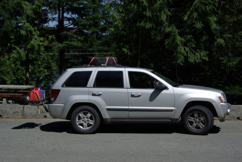
The first carnage on the trip happened in my daughter’s driveway in Scottsdale, AZ. While loading the extra spare tire onto the Grand Cherokee’s roof rack, I dropped the tire and snapped off the door handle on the front passenger door I could still open the door from inside, but it would be inconvenient. So instead of beginning the trip early the next morning, I went to the local Chrysler Jeep dealer in search of a replacement door handle. No dealer in Arizona had a door handle in stock in any color, but their parts department gave me a list of the dealers who had one in the right color. I contacted the dealer in San Antonio, TX and had them send it to me via UPS overnight to the motel I planned to stay at in Kalispell, MT. I then began the journey north to Alaska.
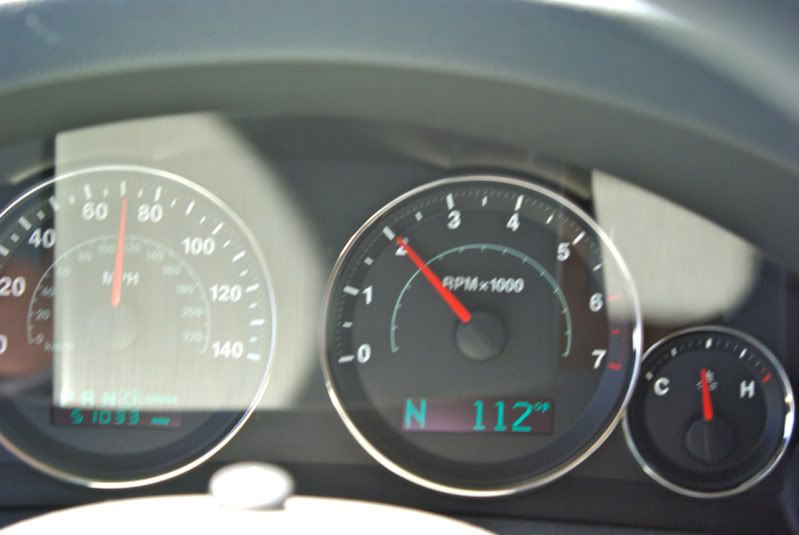
I soon appreciated the decision to drive a Grand Cherokee instead of my Wrangler. In the Arizona heat, the bikini top on my Wrangler let in so much heat that I would run the air conditioning at max power and still it was warm. In the Grand Cherokee, I set the air conditioning on low power and still felt comfortable in the 112º heat.
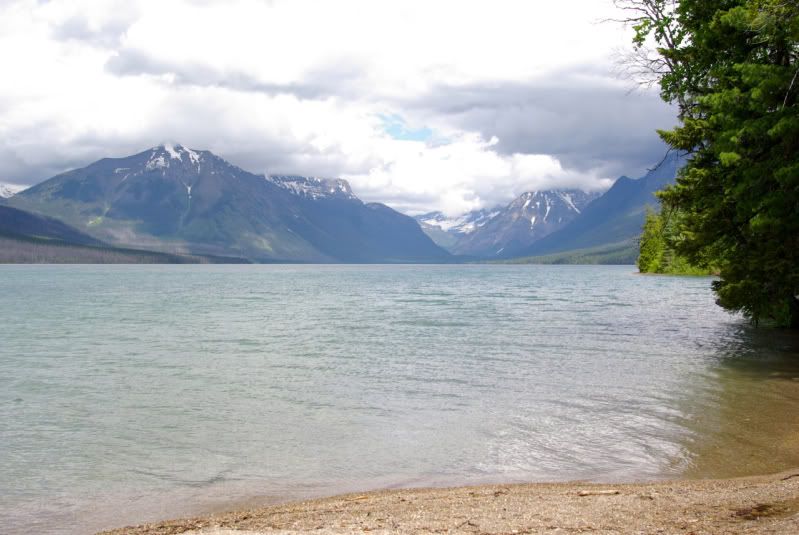
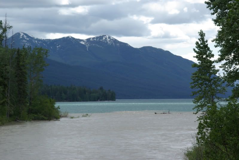
It is about 1,300 miles from my daughter’s house in Scottsdale, AZ to the motel in Kalispell, MT. Due to time lost in finding and ordering the door handle, I only drove to Beaver, UT the first night. The next day, I had 800 miles to go to get to Kalispell, MT where I hoped the replacement door handle would be waiting for me. Again I appreciated the comfort of the Grand Cherokee, and I was happy to be averaging about 19 mpg compared to the 15 or 16 mpg that I would expect from my Wrangler. I arrived in Kalispell after midnight, and the door handle was there. The next morning, I replaced the door handle, and headed to Glacier National Park. This is Lake McDonald on the west side of Glacier National Park:
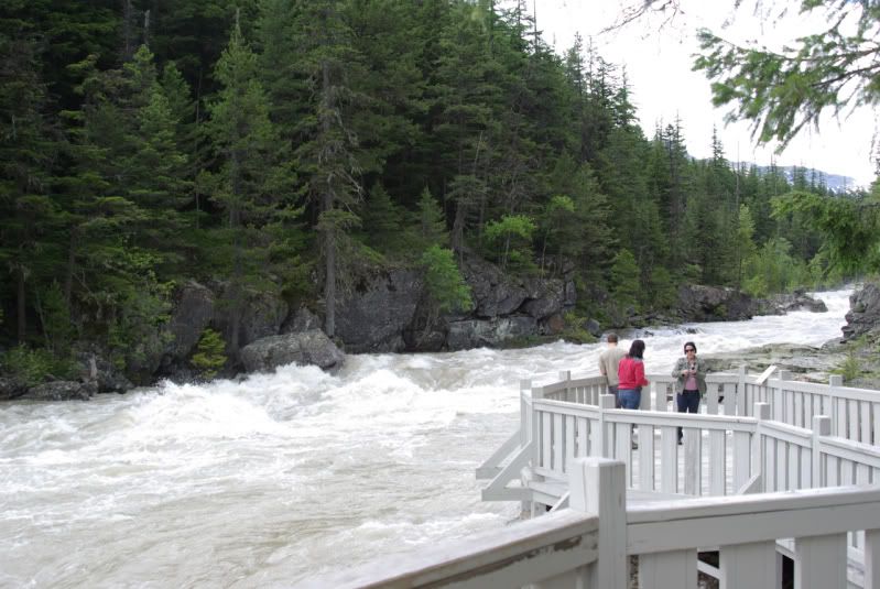
McDonald Creek was fed by melting snow and ice and left a distinct band of color where it entered the lake:
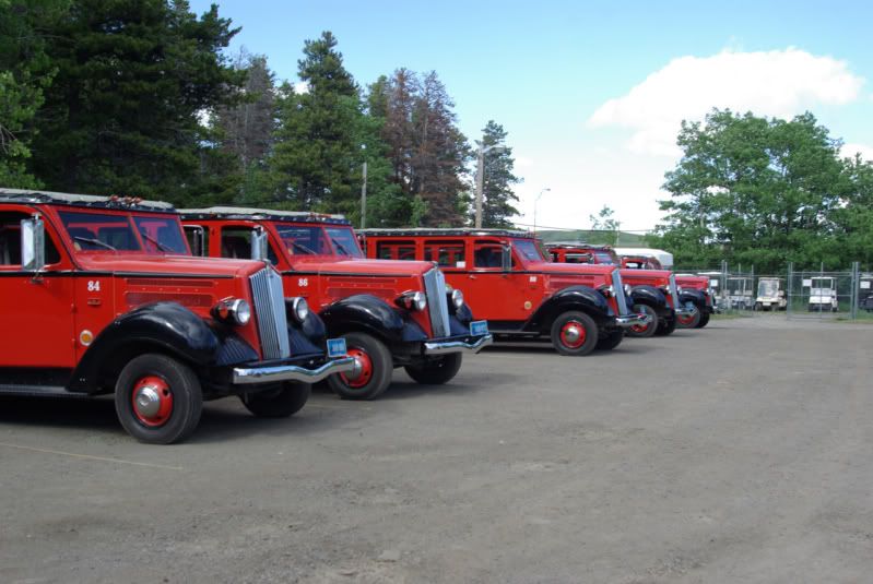
I had planned to take the Going to the Sun Highway to cross from the west side of Glacier National Park to the east side of the park, but the highway was not yet open for the season as the road crews were still repairing the winter damage. I had to detour around the south end of the park. Here are some of the historic restored red busses at East Glacier, MT:
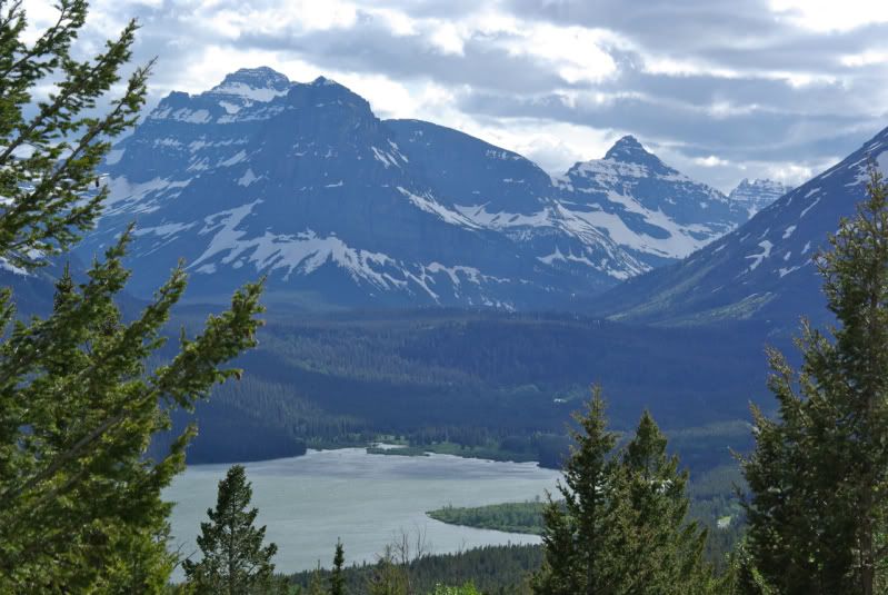
Two Medicine Lake, Glacier National Park:
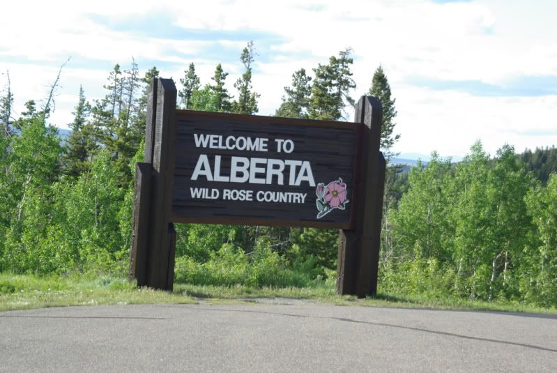
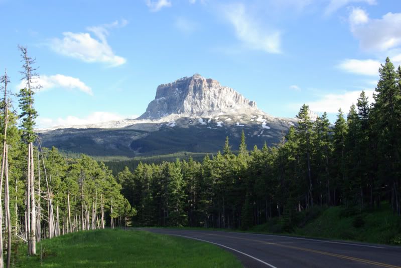
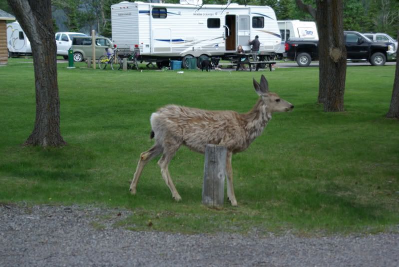
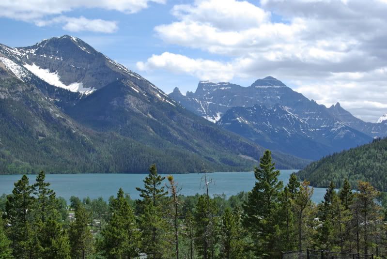
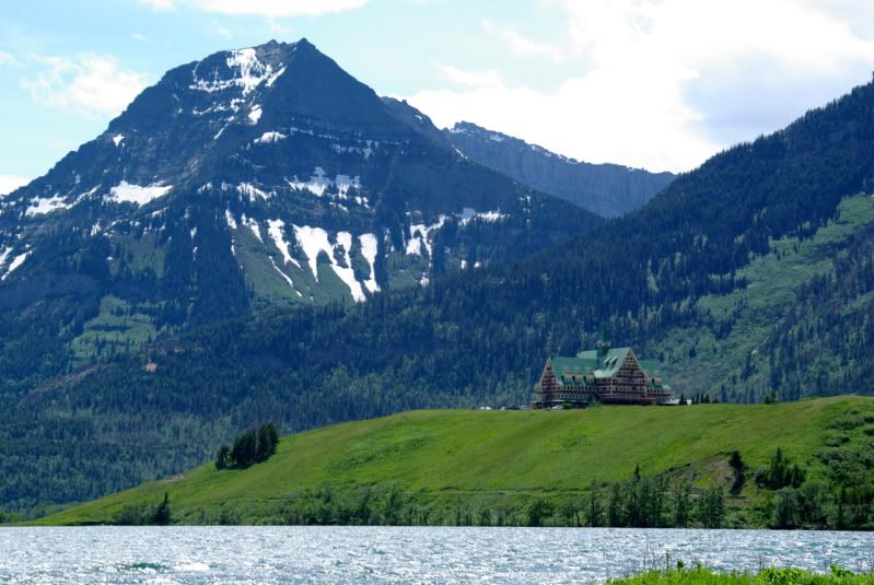
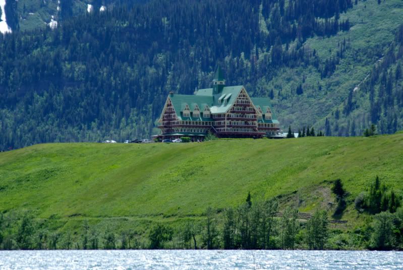
I crossed the border into Canada at the Chief Mountain border crossing and camped at Waterton Lakes National Park:
(continued)
Trip Planning
With so many participants and such a long trip, it was difficult to find a consensus on the itinerary as some participants wanted to get to Alaska as quickly as possible, while others wanted to stop along the way to visit attractions such as Yellowstone Park, Glacier Park, the Canadian Rockies, and Canada’s Northwest Territories. I figured I would be tired of driving by the time I reached Alaska, and I wanted to take the Alaska ferry to return home via the Inside Passage, but some of the participants preferred to drive both ways. In order to accommodate everyone’s desires, we decided that the official “group expedition” would start at Milepost Zero of the Alaska Highway in Dawson Creek, British Columbia, Canada. Members could make their own plans and travel individually or in small groups to the starting point. The group would travel together on the Alaska Highway to Delta Junction, continue to Fairbanks, and travel the Dalton Highway to Prudhoe Bay (the road featured on the "Ice Road Truckers" show). The official “group expedition” would end at Denali National Park. Then we would travel individually or in small groups to return home by land or by sea. A small group would explore Canada’s Yukon and Northwest Territories by taking the Dempster Highway to Inuvik.
My plan was to leave home in late June, 2011, travel to Glacier National Park, continue to Banff where I would meet two other members, spend the 4th of July weekend in the Canadian Rockies, and meet the main group in Dawson Creek on July 6. After the end of the group run on July 15 at Denali National Park, I would visit the Kenai Peninsula, then head to Haines, AK to catch the southbound ferry on July 21. I would take the ferry to Juneau, transfer to another ferry to Prince Rupert, BC, and take another ferry to Port Hardy, BC. Finally, I would drive to Victoria, BC and take another ferry to Anacortes, WA then drive home on I-5. This route would be about 7,000 miles by highway and about 800 miles by ferry.
Fifty years ago, the Alaska Highway, then known as the Alcan Highway, was mostly dirt and gravel. Today, it is paved its entire length of 1,422 miles. However, there are stretches of the roadway that are potholed, uneven, or under repair. The group considered, but then discarded any plans to run any 4WD trails. There would be about 800 miles of gravel roads on the way to and from Prudhoe Bay but a 2WD vehicle would be capable of negotiating those roads. I decided it would not be necessary to drive my 2005 Jeep Wrangler on this trip; instead, I decided to borrow my daughter’s 2WD 2007 Jeep Grand Cherokee Laredo. The 2007 WK would get better gas mileage and would be more comfortable for the long trip. To prepare for the trip, I installed tow hooks and a roof rack, and I purchased a second spare tire and a receiver mounted cargo rack. I purchased magnetic mount antennas for my hand held CB and ham radios. I also purchased a small (25 qt) 12v refrigerator so I wouldn’t have to mess with replenishing ice for an ice chest.

The first carnage on the trip happened in my daughter’s driveway in Scottsdale, AZ. While loading the extra spare tire onto the Grand Cherokee’s roof rack, I dropped the tire and snapped off the door handle on the front passenger door
 I could still open the door from inside, but it would be inconvenient. So instead of beginning the trip early the next morning, I went to the local Chrysler Jeep dealer in search of a replacement door handle. No dealer in Arizona had a door handle in stock in any color, but their parts department gave me a list of the dealers who had one in the right color. I contacted the dealer in San Antonio, TX and had them send it to me via UPS overnight to the motel I planned to stay at in Kalispell, MT. I then began the journey north to Alaska.
 I soon appreciated the decision to drive a Grand Cherokee instead of my Wrangler. In the Arizona heat, the bikini top on my Wrangler let in so much heat that I would run the air conditioning at max power and still it was warm. In the Grand Cherokee, I set the air conditioning on low power and still felt comfortable in the 112º heat.

It is about 1,300 miles from my daughter’s house in Scottsdale, AZ to the motel in Kalispell, MT. Due to time lost in finding and ordering the door handle, I only drove to Beaver, UT the first night. The next day, I had 800 miles to go to get to Kalispell, MT where I hoped the replacement door handle would be waiting for me. Again I appreciated the comfort of the Grand Cherokee, and I was happy to be averaging about 19 mpg compared to the 15 or 16 mpg that I would expect from my Wrangler. I arrived in Kalispell after midnight, and the door handle was there. The next morning, I replaced the door handle, and headed to Glacier National Park. This is Lake McDonald on the west side of Glacier National Park:

McDonald Creek was fed by melting snow and ice and left a distinct band of color where it entered the lake:


I had planned to take the Going to the Sun Highway to cross from the west side of Glacier National Park to the east side of the park, but the highway was not yet open for the season as the road crews were still repairing the winter damage. I had to detour around the south end of the park. Here are some of the historic restored red busses at East Glacier, MT:

Two Medicine Lake, Glacier National Park:

I crossed the border into Canada at the Chief Mountain border crossing and camped at Waterton Lakes National Park:


(continued)

Comment