Announcement

Collapse
No announcement yet.

Nightmare Gulch - Last Run of the Season

Collapse

Forum Thread First Post

Collapse
X
 
  • Filter
  • Time
  • Show
Clear All
new posts

  • Trail Report: Nightmare Gulch - Last Run of the Season

    A few hardy souls headed up to the El Paso Mtn's today to run Nightmare Gulch and then do some exploring. On the way, we drove through a little rain squall between Mojave and Jawbone, was treated to a spectacular rainbow where you could see both ends. Really cool, but I don't have a picture of that....

    Weather was nice, but windy and really cold in a couple of spots, toward Mormon Gulch on the east end, and on one of the peaks above Burro Schmidt Tunnel at around 4300 elevation. Otherwise it was terrific. When we got to Jawbone Station the lady said, "be careful, there's lots of reports of rock slides making the trails harder" Woohoo!

    In reality, not too bad. Trail changes a bit each time its run, this time was no different, but no harder and still quite passable. We ran all the way through to Opal Canyon instead of taking Exit Hill. That second half of the trail is rumored to be closed, but the only signs in existence say it's open, so we enjoyed it.

    Took a new-to-me short cut from near Camp Cudahy due east towards Burro Schmidt. Ended up climbing way up some of those higher peaks to get there, and then dropped down right at the tunnel entrance, only to find the trail blocked off at that end. Doh! Would make sense to block both sides, wouldn't? I think its an illegal block. There's no reason for it other than to create more of a parking area at the tunnel entrance.

    Anyway, after exploring the tunnel with all the newb's, we continued eastward towards Goler Gulch and then out to Randsburg and home via 395. It was a 13 hour round trip, and a really nice day.

    Thanks Guys!

    Full Gallery (26 images):
    http://nwoods.smugmug.com/Jeep-Adven...011-Nightmare/


    Off road adventure photography:

    TreadLightly Trainer
    Wilderness First Aid (WFA)
    HAM - KI6PFO

    2005 Rubicon Unlimited + trailer

  • #2
    First off nice pic's. Red Rock is a beautiful area and Nightmare is no exception.

    Our club did Nightmare on Jan. 22nd. It was sad to see all of the bonus lines that idiots are creating off of the main trail. Some people (the idiots) seem to think that this is an open OHV area with no rules or restrictions. This trail is located in a sensitive area within the boundaries of the state park and vehicle travel is suppose to be limited to existing trails. There should only be a single trail through this canyon. Anything more is unacceptable. These idiots are the ones that are going to get this trail closed for the rest of us. If the state park had the necessary funding the trail would already be closed forever. Unfortunately it's just a matter of time and when that happens we can thank the idiots for their contributions.
    Last edited by GrimJeeper91; 01-31-11, 08:20 AM.
    '91 YJ 4.O, Auto, 4.5" Deaver, 1" BL, Rubi Flares, 35x12.50 MT/R's, D60 w/ Detroit, D30 w/ TrueTrac, Warn 9000XDI, York OBA, AA SYE, Belly Up Skid, LED's...

    Comment


    • #3
      Originally posted by GrimJeeper91 View Post
      It was sad to see all of the bonus lines that idiots are creating off of the main trail. Some people (the idiots) seem to think that this is an open OHV area with no rules or restrictions. This trail is located in a sensitive area within the boundaries of the state park and vehicle travel is suppose to be limited to existing trails. There should only be a single trail through this canyon. Anything more is unacceptable. These idiots are the ones that are going to get this trail closed for the rest of us. If the state park had the necessary funding the trail would already be closed forever. Unfortunately it's just a matter of time and when that happens we can thank the idiots for their contributions.
      Well, I'm not sure I saw the same things you are concerned about. It's a wash, with significant water flow through there every year. Mother Nature changes the trail more than any vehicles from what I have seen, with the exception of the Exit Hill, which is really a poorly located route. Here is a current photo of Exit Hill, all tore up due to its difficulty


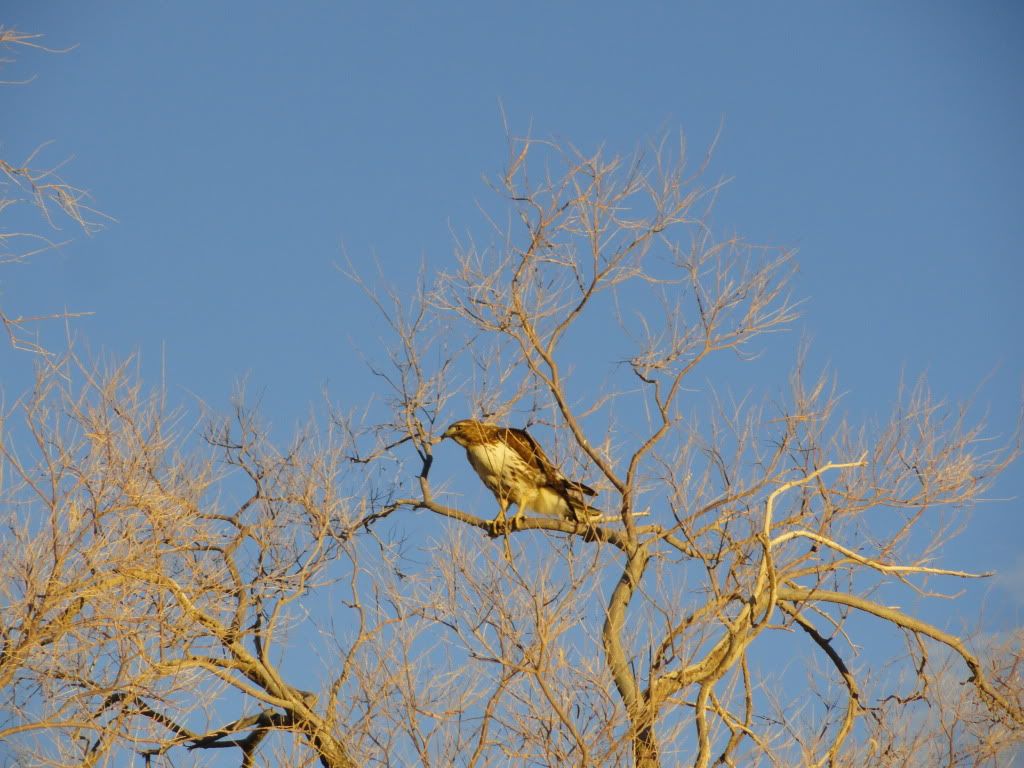
      As for the protected bird species, I have read in the past, and find it interesting (I searched but did not find it just now) that the "birds of prey" quantities have been steadily diminishing following a sizable drop in population right after the seasonal closures went into effect in 1986. I think the presence of people in the canyon areas helps make the little critters move about, and the birds swoop in and eat them.

      The bottom line is that this canyon route was establish well over 100 years ago, and is no worse for wear now than it ever was. Look at Last Chance for example. That used to be paved! Nature wins, humans are doing no damage to the area worthy of closure.
      Off road adventure photography:

      TreadLightly Trainer
      Wilderness First Aid (WFA)
      HAM - KI6PFO

      2005 Rubicon Unlimited + trailer

      Comment


      • #4
        Originally posted by GrimJeeper91 View Post
        First off nice pic's. Red Rock is a beautiful area and Nightmare is no exception.

        Our club did Nightmare on Jan. 22nd. It was sad to see all of the bonus lines that idiots are creating off of the main trail. Some people (the idiots) seem to think that this is an open OHV area with no rules or restrictions. This trail is located in a sensitive area within the boundaries of the state park and vehicle travel is suppose to be limited to existing trails. There should only be a single trail through this canyon. Anything more is unacceptable. These idiots are the ones that are going to get this trail closed for the rest of us. If the state park had the necessary funding the trail would already be closed forever. Unfortunately it's just a matter of time and when that happens we can thank the idiots for their contributions.
        LOL . . . I recall you bitching about this two or three years ago too and complaining about how apparently everyone but you and your club have no respect for the area blah, blah, blah . . . nice to see that some things never change. I've been thru these trails several times and don't see what you are so up in arms about . . . it's a wash for goodness sake . . . as soon as the rain comes, the water flows, removes the tracks, moves around the rocks, etc. I can understand being concerned about new trails being cut thru forested areas, vegetation, etc, but getting your panties in a wad about a bonus line thru a wash that is going to be washed out and where a new path will be set by Mother Nature after the next rain just seems to be ridiculous.
        That which does not kill me postpones the inevitable.

        Comment


        • #5
          To bad i had to work, i really would of liked to have gone.

          Comment


          • #6
            Correct, tracks in the bottom of the wash are erased with each storm. I'm not concerned about travel that is limited to the wash bottom. The problem is the bonus lines are not limited to the wash. People are leaving the wash (sometimes 20-30 feet from the bottom) and crawling on features 5-10-15 feet above the wash. This type of damage is not removed each time it rains. It also encourages others to follow thereby increasing the damage. This damage is becoming more apparent over the years.

            As for exit hill, this is an established trail. This use to be just a drive up a rock shelf. However, around 20 years ago the cliff above let loose and deposited a tremendous amount of rocks and debris onto the trial. The resulting trail over and through this debris field is what it is and can be challenging at times. But this is the trail.

            I do believe that most that visit this canyon do wheel responsibly. However, those that do not need to be held accountable. What's so wrong with that?
            '91 YJ 4.O, Auto, 4.5" Deaver, 1" BL, Rubi Flares, 35x12.50 MT/R's, D60 w/ Detroit, D30 w/ TrueTrac, Warn 9000XDI, York OBA, AA SYE, Belly Up Skid, LED's...

            Comment


            • #7
              Nathan,

              Beautiful pictures as always. I really wish I could have made it. Next time.

              I love closing an area because "Birds of Prey" mate and nest. Too funny. I'm glad that the "Birds of Prey" just hang out in trees and have fun watching the Jeeps go by in JV.

              Comment


              • #8
                Nathan,

                Pleasure meeting you, Trevor, "Cocoa", Al, Dave, and Frank yesterday. Thanks again for organizing the run, providing the driving tips to see us all through the obstacles, and tidbits of information about the history of the area.

                I'm looking forward to the next outing.

                Josh

                Comment


                • #9
                  Here's a link to Franks images. They are REALLY nice scenery shots:
                  http://yellowrhino.smugmug.com/4x4Ad...lch-1-30-2011/

                  A few examples:


                  Last edited by nwoods; 02-02-11, 01:19 PM.
                  Off road adventure photography:

                  TreadLightly Trainer
                  Wilderness First Aid (WFA)
                  HAM - KI6PFO

                  2005 Rubicon Unlimited + trailer

                  Comment


                  • #10
                    Nathan - looks like a great weekend trip. Do you have tracks or waypoints to share?
                    Cliff

                    Comment


                    • #11
                      Nathan,
                      Thanks so much for leading our group. We always have a great time when your in the front. It was nice to meet Trevor, Josh and Frank too. Great pictures from everyone.....

                      P.S. I do have the track and a few waypoints from our trip. I will post them later..

                      Thanks,

                      Al

                      Comment


                      • #12
                        Track and way points

                        Here is our track. The waypoints are unlabeled.
                        Attached Files

                        Comment

                        Working...
                        X