Announcement

Collapse
No announcement yet.

Carveacre Road / Pancake Rock

Collapse

Forum Thread First Post

Collapse
X
 
  • Filter
  • Time
  • Show
Clear All
new posts

  • Trail Report: Carveacre Road / Pancake Rock

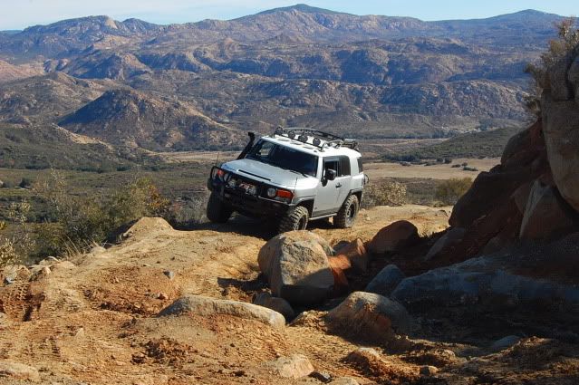
    A few friends who had the day off thursday invited me along for some wheelin' up to Pancake Rock. The recent rains we got here sure made things interesting, besides keeping the dust down. After taking in the views at the top we parked our rigs just down the trail in a clearing and hiked up Lawson Peak.

    The fun begins as you plunge ahead through low brush and boulders east and north of the summit block. Just below the summit on the west side is a near-vertical fissure with abundant hand-and-foot-holds. At the top of this is a narrow rock cave. By groping 15 feet or so into the darkness in the back of the cave, you'll find an opening above. By mantling up onto a ledge, you'll reach a broad shelf with a view to the east. Nearby is an easy route to the topmost boulders on the peak.

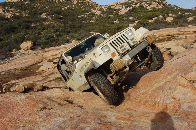
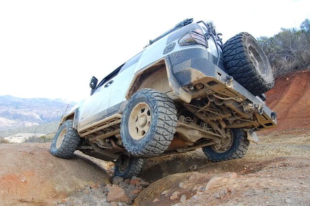
    Afterwards, we cruised on down to the end at the locked gate and then down into the "little moab" rock area. At one point I thought I cracked my front diff but it turned out to be just a disconnected breather tube. Time to change the diff fluid!
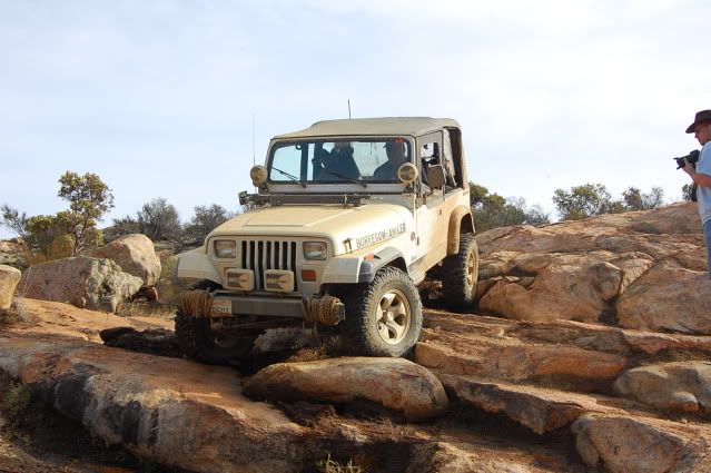


  • #2
    Originally posted by Borregowrangler View Post


    Like the splash. Thanks for the trail report.
    Those left standing
    Will make millions
    Writing books on ways
    It should have been
    -Incubus "Warning"

    Comment


    • #3
      Great Report. Where are these spots at? I'm not familiar with the trails in this report.
      [COLOR=#ff8c00]MYJEEP(crawls)ROCKS(again).com

      I have finally stopped drinking for good.
      Now I drink for evil..... :devil:
      [/COLOR]

      Comment


      • #4
        John,

        Excellent pictures! Looks like an interesting area to wheel around. Thanks for the report.

        Mitch

        Comment


        • #5
          Mike,

          East of San Diego, North of Tecate Mexico, and south of the 8 Fwy.

          Comment


          • #6
            It is basically an un-maintained county road that has gotten pretty rough over the years. It is an up and back type of trail, one way in one way out.

            From El Cajon (I8 & 67)

            Go east on Interstate 8 about 21 miles. (About 40 miles east of San Diego.) At Japatul Valley Rd. (Exit 40) go south approximately 4.5 miles to Lyons Valley Rd. Continue south on Lyons Valley Rd. approximately 4.5 Miles to the entrance to Barret Correction Facility. Air down at the open area near the entrance. Continue on Lyons Valley Rd. south approximately 1 mile. The trailhead will be a very sharp right as you round a curve.

            When turning off of Lyons Valley Rd, the trail immediately becomes very rough. Vehicles need to immediately go into 4 WD as you turn off Lyons Valley Road. There is only enough room at the trailhead for 2 or 3 vehicles and the trailhead is in a dangerous curve. Vehicles should be spaced out to avoid problems at the trailhead.

            Comment


            • #7
              It only looks slightly un-maintained! LMAO Nice!

              Comment


              • #8
                Cool pics, John. Looks like a beautiful day--makes me miss San Diego County.
                holes = cowbell

                Comment


                • #9
                  Looks like a really scenic area!

                  Thanks for sharing that.

                  Christian
                  "People demand freedom of speech to make up for the freedom of thought which they avoid." - Soren Aabye Kierkegaard (1813-1855)

                  Comment

                  Working...
                  X