Announcement

Collapse
No announcement yet.

Santa Rosa Mtn: Sawmill Springs Trail

Collapse

Forum Thread First Post

Collapse
X
 
  • Filter
  • Time
  • Show
Clear All
new posts

  • Trail Run: Santa Rosa Mtn: Sawmill Springs Trail

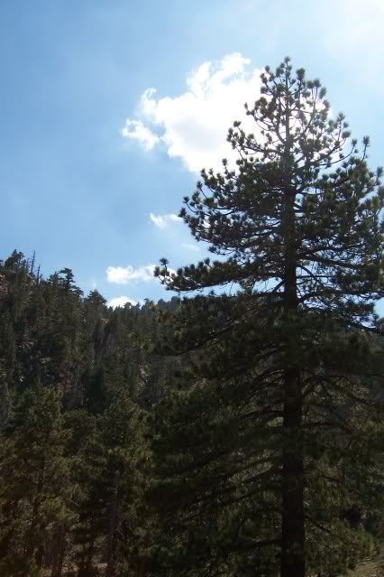
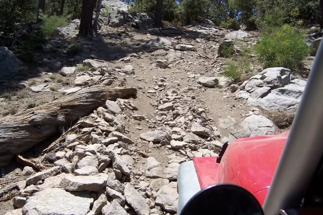
    Wanna do a run up Santa Rosa Mountain this Saturday. The route in question should be a fun run with beautiful scenery. We will climb over 4000'. The trail itself is not technical, but is quite steep at times; sometimes rocky and steep, sometimes soft and steep. There will be a few tight spots, but nothing crazy. Make no mistake, this will not be a cruise through the park--you will be wheeling.

    Once at the "top," there is a large, shady, picnic area with a table or two and a fire ring (actually there are several such areas on the mountain, but one I have in mind).

    Santa Rosa Mountain is just south of Highway 74 Palms to Pines Highway, between Palm desert and Idyllwild.

    You: a reasonably competent, safety-conscious wheeler who doesn't like to tear stuff up.

    Your Rig: parking brake works well; engine runs well; recommend 31s or larger.
    Last edited by inVERt'D; 07-31-09, 09:26 AM.
    holes = cowbell

  • #2
    Next time!

    Comment


    • #3
      Originally posted by DavidWymore View Post
      Next time!
      Soon hopefully...

      Ran the Sawmill Trail solo again. Fun climbing, beautiful place, beautiful day.


      holes = cowbell

      Comment


      • #4
        I would like to do this run, or others in the area, in the near future. My folks live down that way, and I have always wanted to explore the area. I am hoping that you are the person to help me out with a little advice and guidance as to where to go and what to see!!!????
        Quando Omni Flunkus Moritati

        Comment


        • #5
          [COLOR="Blue"]Do you have any other pictures you can post? Looks like a neat area.
          mk[/COLOR]

          Comment


          • #6
            Here's a trip report/pics


            http://iv4x4.forumotion.net/run-pics...trail-t125.htm


            is forum crossposting OK here?
            Last edited by DavidWymore; 08-02-09, 10:50 AM.

            Comment


            • #7
              I saw the "Jeeps for Christ". I thought that group was no more? Guess not. Thanks for link.

              Comment


              • #8
                Originally posted by Jeep4cern View Post
                I saw the "Jeeps for Christ". I thought that group was no more? Guess not. Thanks for link.
                Naw, there's 2 or three of us out here in the boondocks. Then there's 4x4him and ew4c, etc.

                Comment


                • #9
                  Originally posted by DavidWymore View Post
                  Naw, there's 2 or three of us out here in the boondocks. Then there's 4x4him and ew4c, etc.
                  Right-on! Keep on wheeling! Do you guys have a site or just the two of you? I thought I read you guys had a web site, etc.

                  Comment


                  • #10
                    We had a section off the EC site that was an offshoot of the Yuma site, but it is defunct. Now the IV site is us and some other people from the area, great bunch. Had a total blast wheeling at the colorado river in Yuma yesterday. Rick is the white CJ and Cole the black TJ. I currently wheel a big ole Dodge so I'm not exatly a jeeper, but I might be again, I started out with a Jeep.

                    Comment


                    • #11
                      Originally posted by ECV Jeep View Post
                      I would like to do this run, or others in the area, in the near future. My folks live down that way, and I have always wanted to explore the area. I am hoping that you are the person to help me out with a little advice and guidance as to where to go and what to see!!!????
                      Would be my pleasure!
                      holes = cowbell

                      Comment


                      • #12
                        Originally posted by mkjeepers View Post
                        [COLOR="Blue"]Do you have any other pictures you can post? Looks like a neat area.
                        mk[/COLOR]
                        Yeah, but my internet connection is barely working; will post more when I can.
                        holes = cowbell

                        Comment


                        • #13
                          Is this a side trail off of Santa Rosa Mtn that leads to Toro Peak? If not can you post the GPS lat/lon?
                          "JJ" The PhotoJeeper
                          Ham Callsign: KG6HRA

                          Comment


                          • #14
                            Per Roger Mullins

                            There is a Sawmill Trail (hiking trail) which is closed to 4 Wheeling. However there is a dirt road that joins Sawmill Road (trail) that is open, according to the Forest Service. There are no signs forbidding motorized travel, in fact, there are signs that say "Street Legal Vehicles Only".
                            The Sawmill Trail (road) begins about 3 miles east of the Santa Rosa Truck Trail sign on Hwy. 74 (east of Anza). The road turning off the highway to the south is about 100 ft. west of the fire station. It is easy to miss. Follow the dirt road as it begins to climb the mountain. As it gets higher, it becomes more challenging with some tight switchbacks and some narrow sections. After climbing 1000 ft or more you reach the Pine forest and the trail becomes more interesting with lots of fallen trees, loose and rocky steep sections and tight turns. After about 6 miles the trail joins the Santa Rosa Truck Trail that leads to Toro Peak.
                            For a GPS file See: http://www.justruns.com/files/Sawmill.gdb
                            For a .jpg Map See: http://www.justruns.com/files/Maps/SawmillMap.jpg
                            The confusion is that there is a portion that is closed but not the good 4WD part. The closed portion is the lowest section of the hiking trail that begins near the Dump. There is a large sign saying “Sawmill Trailhead” or something like that. A bit further east on the highway, just west of the fire station, is a dirt road that leads up the mountain. It heads south and joins the old Sawmill Road part way up the mountain. It is not closed, there are no signs and according to the National Forest people it is open. The trail is heavily eroded and a fun challenge in a few places but not what I’d call difficult. I’d rate it as at least a 2+ Difficulty Rating. Some places are steep and loose so open diffs would probably have some trouble. I’d recommend at least limited slip and 31” or 32” tires. There is a lot of fallen trees that have been pulled off the road but some places are tight to squeeze between them. The trail tops out at the road to Toro Peak, at Stump Campground, not too far from the top.
                            We need to go in on Pigeon Springs, not Pinon Flats.

                            Comment


                            • #15
                              Okay, I do not remember seeing that spur. Need to check it out. I remember taking a spur trail for about .25 mile then coming to a locked gate with no sign. Thanks, fogot the Roger had that on the JustRuns site.
                              "JJ" The PhotoJeeper
                              Ham Callsign: KG6HRA

                              Comment

                              Working...
                              X