 Tweet
Tweet
Bee Canyon to Indian Mtn Trail
I spent Saturday with some friends in Hemet. Since there are trails in the San Jacinto range of the SBNF that I haven�t explored yet, we took Mr. Green and headed out to explore on Sunday.
I had heard that there is a Black Diamond road in the range so I wanted to find it. Indian Mountain (4S21) is off of the San Jacinto Truck Trail (5S09), which is reached by Bee Canyon Road (5S07).
(I know that I posted this as an Easy Trail Report, and for the vast majority, it is. But you need to take the Indian Mtn trail seriously. It is a difficult trail similar to a shorter 2N17X)
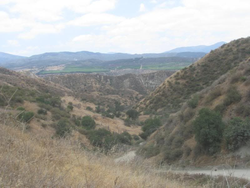
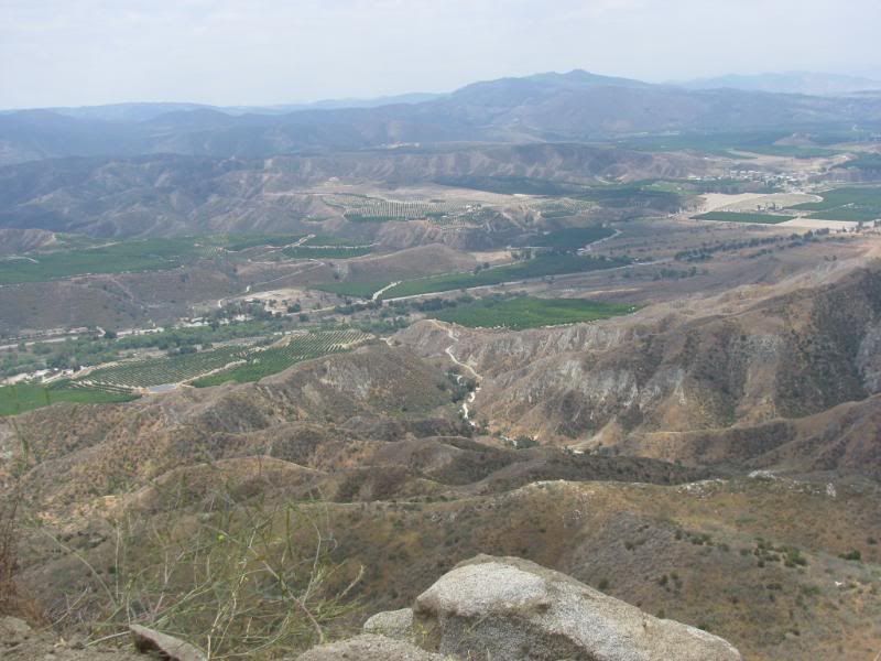
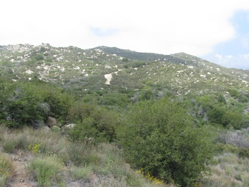
We turned onto Bee Cyn from Hwy 74 just a few miles outside of Hemet. The road is easy for the most part and has a great view as we climbed constantly uphill:
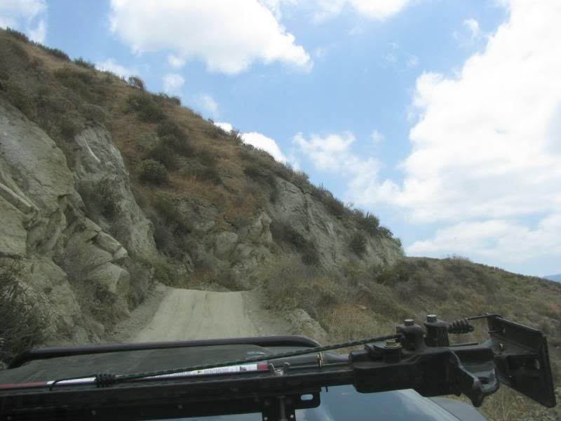
We encountered an area of the trail that had a steep climb with a sharp drop from the shelf road. The road is rutted by motorcycles and the dirt was soft and powdery. I engaged the 4WD through this short part just to ensure that I made it back to write this report:
Higher up the nice view expanded:
The road pretty much became the San Jacinto Truck Trail (5S09) without really looking for it:
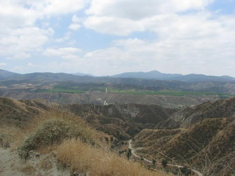
We got one last view down Bee Cyn before turning into the range of mountains:
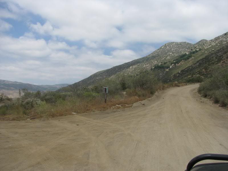
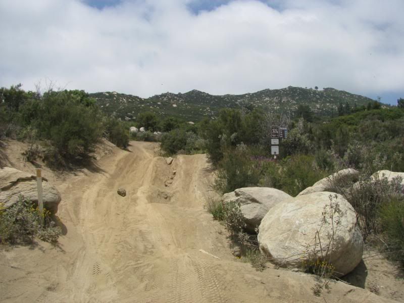
It wasn�t long before we made it to the entrance of the Indian Mtn Trail:
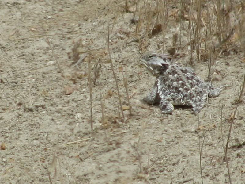
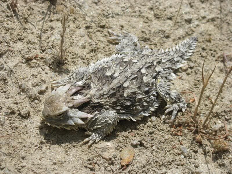
We by-passed the entrance because further down the road was an area the FishPOET told me was �nice�. Since I have noticed that he is a master of understatement, I wanted to check it out. On the way, we encountered this little guy:
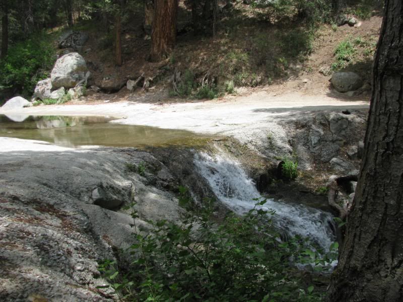
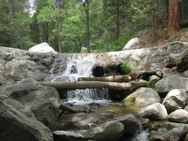
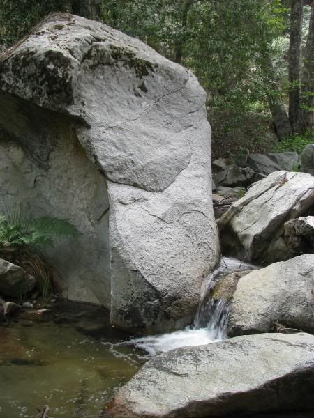
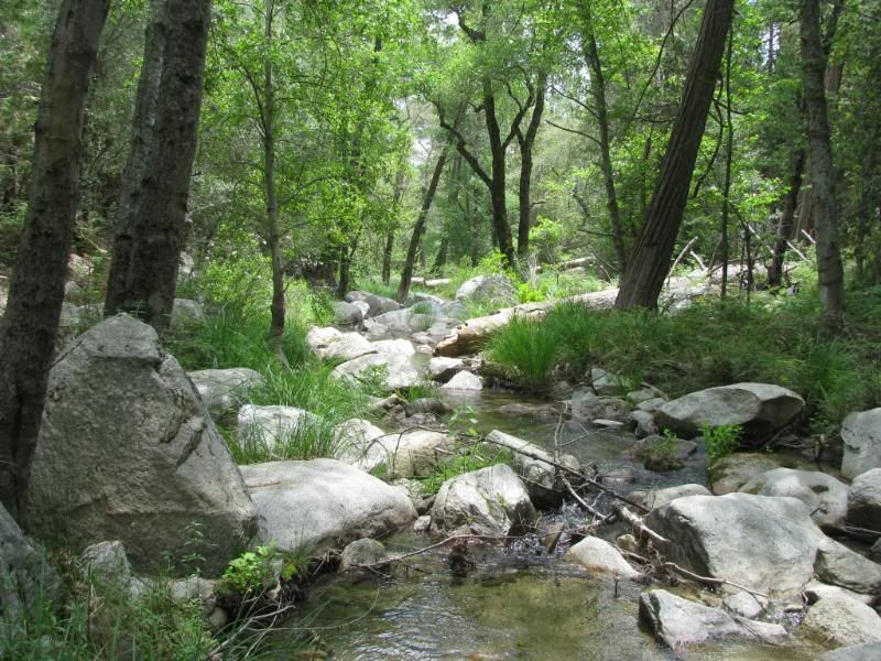
As I expected, the area that FishPOET told me about was fantastic! The North Fork of the San Jacinto River crosses the trail at a � aww, just see for yourself:
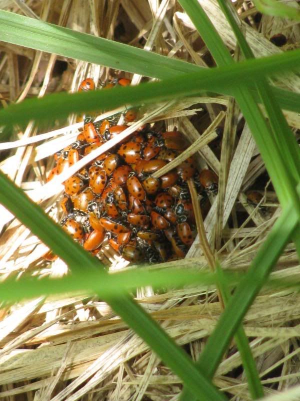
While exploring the area, we came across a couple of , umm, for lack of a better explanation, Lady Bug Orgies:

We headed back to the entrance to Indian Mtn:
The trail climbs steeply up the mountain:
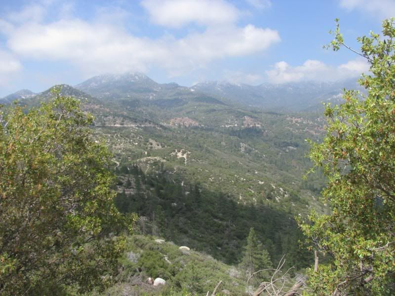
The tough part is fairly short but it is a real test of articulation on a narrow path up the side of the mountain. There are some wonderful views along the climb if you can peel your eyes away from the trail for a moment:
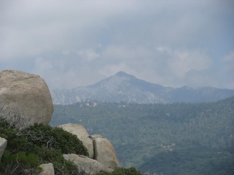
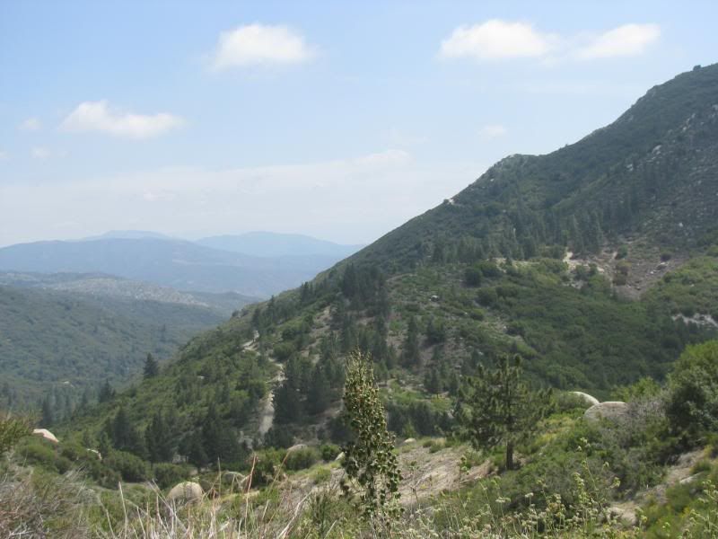
Once past the difficult part, there were some very nice views of the mountain range above us:
The rest of the trail over to Hwy 243 was easy with lots of vistas. Several types of flowers were in bloom at the higher elevations:
One last look back the way that we came�:
�Before heading out onto Hwy 243:

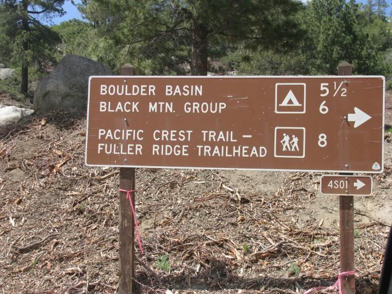
From here we headed west to the entrance to the Black Mountain Scenic Trail.
Black Mountain Road (4S01)
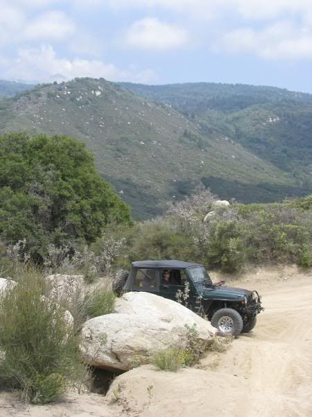
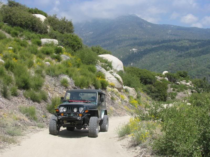
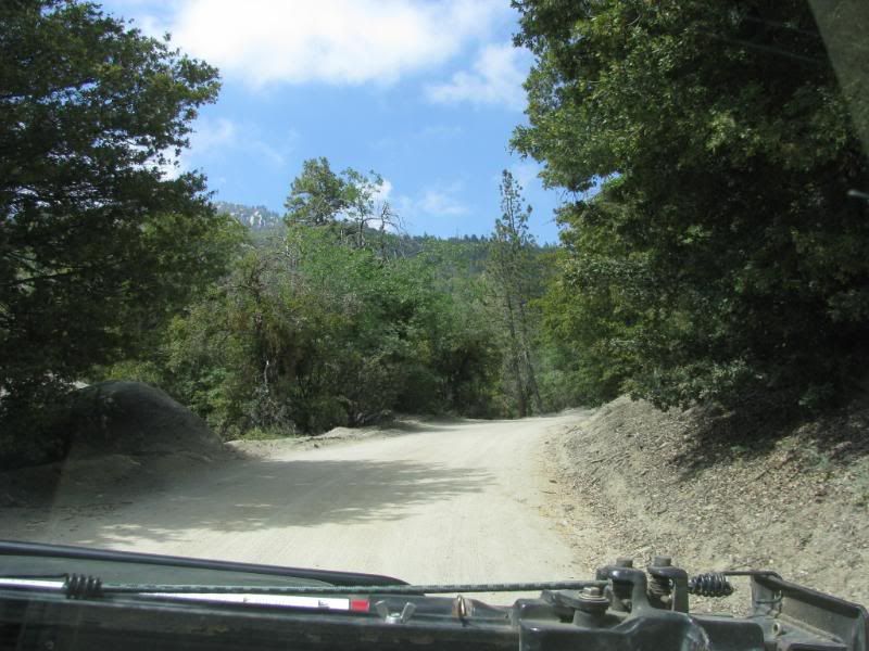
Black Mtn Road is a very popular drive. We encountered many vehicles going both up and down the trail. It is an easy drive that starts directly off of Hwy 243:
The graded road is easy but heavily wash-boarded in spots:
It is immediately obvious why it is designated as a Scenic road:

At the top, we by-passed the turn to the overlook and Boulder Basin campground, just to take a look around. There are several yellow post sites in the area. The temperature dropped dramatically at the top, so this could be a very nice summer escape.
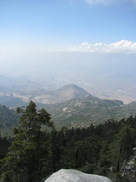
We caught a glimpse of Casino Morongo far down below in the desert:

It was an absolutely gorgeous day in the high elevations:

But the cloudy/hazy conditions down below were not far from view:
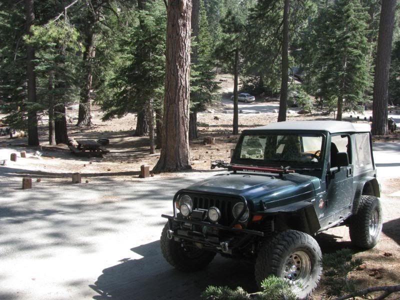
We returned to the Boulder Basin Campground before heading back down the mountain. This is a very nice campground!:
I really enjoyed our outing into the San Jac range. It was my first time but I am planning on not allowing it to be my last! Drop dead gorgeous views and beautiful places, nice trails and cool temps make this an area that I look forward to wandering around in again!
The rest of our pics can be seen at this link:
http://s139.photobucket.com/albums/q...h%20SB%20Mtns/
I spent Saturday with some friends in Hemet. Since there are trails in the San Jacinto range of the SBNF that I haven�t explored yet, we took Mr. Green and headed out to explore on Sunday.
I had heard that there is a Black Diamond road in the range so I wanted to find it. Indian Mountain (4S21) is off of the San Jacinto Truck Trail (5S09), which is reached by Bee Canyon Road (5S07).
(I know that I posted this as an Easy Trail Report, and for the vast majority, it is. But you need to take the Indian Mtn trail seriously. It is a difficult trail similar to a shorter 2N17X)
We turned onto Bee Cyn from Hwy 74 just a few miles outside of Hemet. The road is easy for the most part and has a great view as we climbed constantly uphill:
We encountered an area of the trail that had a steep climb with a sharp drop from the shelf road. The road is rutted by motorcycles and the dirt was soft and powdery. I engaged the 4WD through this short part just to ensure that I made it back to write this report:
Higher up the nice view expanded:
The road pretty much became the San Jacinto Truck Trail (5S09) without really looking for it:
We got one last view down Bee Cyn before turning into the range of mountains:
It wasn�t long before we made it to the entrance of the Indian Mtn Trail:
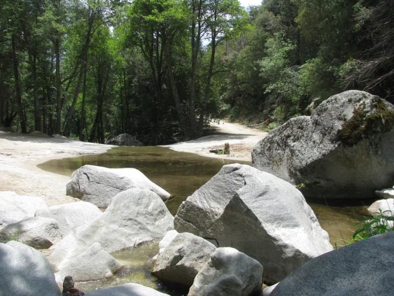
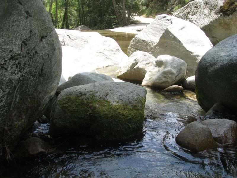
We by-passed the entrance because further down the road was an area the FishPOET told me was �nice�. Since I have noticed that he is a master of understatement, I wanted to check it out. On the way, we encountered this little guy:
As I expected, the area that FishPOET told me about was fantastic! The North Fork of the San Jacinto River crosses the trail at a � aww, just see for yourself:
While exploring the area, we came across a couple of , umm, for lack of a better explanation, Lady Bug Orgies:
We headed back to the entrance to Indian Mtn:
The trail climbs steeply up the mountain:
The tough part is fairly short but it is a real test of articulation on a narrow path up the side of the mountain. There are some wonderful views along the climb if you can peel your eyes away from the trail for a moment:
Once past the difficult part, there were some very nice views of the mountain range above us:
The rest of the trail over to Hwy 243 was easy with lots of vistas. Several types of flowers were in bloom at the higher elevations:
One last look back the way that we came�:
�Before heading out onto Hwy 243:
From here we headed west to the entrance to the Black Mountain Scenic Trail.
Black Mountain Road (4S01)
Black Mtn Road is a very popular drive. We encountered many vehicles going both up and down the trail. It is an easy drive that starts directly off of Hwy 243:
The graded road is easy but heavily wash-boarded in spots:
It is immediately obvious why it is designated as a Scenic road:
At the top, we by-passed the turn to the overlook and Boulder Basin campground, just to take a look around. There are several yellow post sites in the area. The temperature dropped dramatically at the top, so this could be a very nice summer escape.
We caught a glimpse of Casino Morongo far down below in the desert:
It was an absolutely gorgeous day in the high elevations:
But the cloudy/hazy conditions down below were not far from view:
We returned to the Boulder Basin Campground before heading back down the mountain. This is a very nice campground!:
I really enjoyed our outing into the San Jac range. It was my first time but I am planning on not allowing it to be my last! Drop dead gorgeous views and beautiful places, nice trails and cool temps make this an area that I look forward to wandering around in again!
The rest of our pics can be seen at this link:
http://s139.photobucket.com/albums/q...h%20SB%20Mtns/


Comment