Originally posted by jpflat2a
View Post
Announcement
Collapse
No announcement yet.
Horsethief Flats
Collapse
Forum Thread First Post
Collapse
X
-
I remember someone telling me back when I got started in this hobby that injuries from flying "equipment" were the #2 injury in a roll (putting your arm out to stop the roll was #1). Never confirmed it (no handy Internet in the 70's), but don't doubt it.Jeff
OHV76V
KG6TY
You're just upset because the voices in my head only talk to ME!
-
I remember a local Jeeper from years way back who was elk hunting in Montana..CJ5 with a full cage.
He rolled about 250 ft down the side of a hill.
He walked back up to the top of the hill where the road was; the Jeep was totaled, the cage did it's job, he needed a ton of stitches caused by a loose axe in the Jeep; mostly to his head and arms.
yes, it does happen.
Comment
-
WOW, Im glad everyone is OK, that Cherokee seems to have held up pretty well. Its a good reminder to always wear a seatbelt and strap down all your gear.95 YJ
2.5L Low Output, 4.5" RE, 35" KM2's, D30 Aussie, 8.8, TeraLow 4:1, Outdoor Logic custom fab - Cage, Tube fenders, Sliders, and more.
Comment
-
I can remember my dad and uncle pulling loose items from my first rig (CJ-5) and throwing them at me. (At my feet if I was lucky - head if I wasn't). Then they'd tell me it was going to hurt a lot less then than if I rolled. I learned (and my 22 yr old son was taught the same way) Jeff
Jeff
OHV76V
KG6TY
You're just upset because the voices in my head only talk to ME!
Comment
-
That's the little draw at the bottom of Suicide Slide. So did the roll start on Suicide Slide or in that draw?Originally posted by Old Fart View PostWas this on 3N03A (Horsethief) or Suicide Slide? (BLM area to the northeast of 3N03A). The pictures look like the bottom of Suicide Slide.
Something to note: Depending on which maps you use, "Suicide Slide" is/may be part of the Bighorn Wilderness. Motorized vehicle use in the Wilderness is a pretty hefty fine ($5000/6 months in jail), and the latest policy on Law Enforcement allows NO "officer discretion" as to whether the fine is imposed.
Yeah it'd be nice to at least find a legal description of the WA. It seems the BLM has a description of the BLM portion of the Bighorn WA, but I can't find anything for the USFS portion.
Comment
-
really
[QUOTE
Something to note: Depending on which maps you use, "Suicide Slide" is/may be part of the Bighorn Wilderness. Motorized vehicle use in the Wilderness is a pretty hefty fine ($5000/6 months in jail), and the latest policy on Law Enforcement allows NO "officer discretion" as to whether the fine is imposed.
Carlos, glad to see you were unhurt. But I'd like to ask everyone to help pass the word - Suicide Slide is NOT part of the SBNF trail system.[/QUOTE]
really the guy just wrecked his jeep and probably messed with his head, and you are going to say that. yeah stay on the trail but you could have at least said this in later post. thanks for putting more ammo out there.
glad you are ok carlos now you have an excuse to make it into a buggy of some sort.
Comment
-
I guess you missed that part.Originally posted by ghostrider View Postreally the guy just wrecked his jeep and probably messed with his head, and you are going to say that. yeah stay on the trail but you could have at least said this in later post. thanks for putting more ammo out there.Originally posted by Old FartSomething to note: Depending on which maps you use, "Suicide Slide" is/may be part of the Bighorn Wilderness. Motorized vehicle use in the Wilderness is a pretty hefty fine ($5000/6 months in jail), and the latest policy on Law Enforcement allows NO "officer discretion" as to whether the fine is imposed.
Carlos, glad to see you were unhurt. But I'd like to ask everyone to help pass the word - Suicide Slide is NOT part of the SBNF trail system.
I believe the point that Old Fart is making is the the portion of the trail on which the rollover occured is NOT on USFS land, but rather BLM land. Two different agencies, two different jurisdictions, two different management perspectives.
IF I AM WRONG HE CAN CORRECT ME.Last edited by karstic; 05-19-09, 12:13 PM.
Comment
-
I wanted to make two points, I apologize if I came across harsh or insensitive (old age is kicking in)(shut up Kurt!)
Karstic is correct - the portion of the "trail" that Carlos rolled on is NOT part of the SBNF trail system, and never has been. Whether it is actually in the SBNF is immaterial, travel is restricted in the SBNF to Designated Vehicle Routes only (DVR), and even if Suicide Slide is on USFS land (I don't believe it is, but I could be wrong) - you can't legally get to it from the San Bernardino National Forest legally. The popular rumor of a "road" out to Lucerne Valley hasn't been a reality for several decades, if not longer.
Having been a participant (sometimes willingly, sometimes not) of my share of rollovers, I feel for Carlos. But the last thing we ("we" being USFS in this instance) need is a bunch of folks seeing this post, thinking "hell - I could have made that!" and then trekking along 3N03A looking (illegally) for a challenge. (and if you think that never happens, think again)
Second point is very basic and simple - Suicide Slide is not only dangerous - it's illegal to be on.Jeff
OHV76V
KG6TY
You're just upset because the voices in my head only talk to ME!
Comment
-

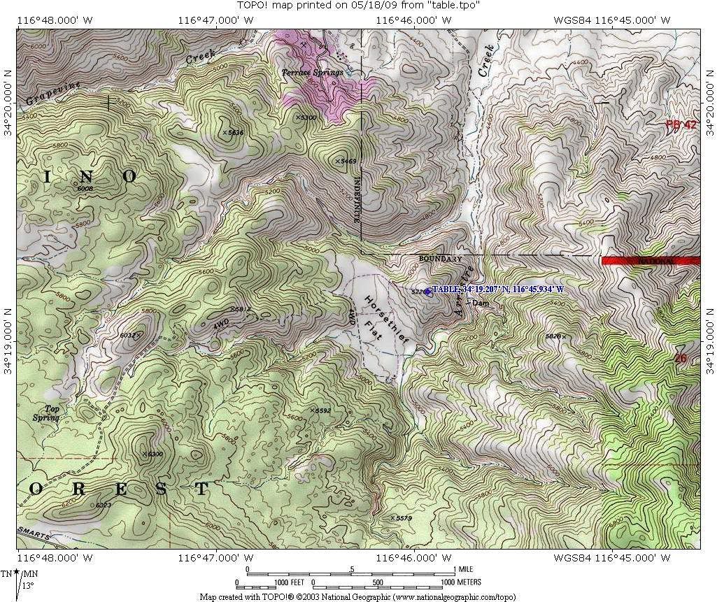
I have never been on Suicide Slide and I'm not sure of the exact location on this map. I know it is North of the existing route in Horsethief Flat. It looks like approx 1/8th of a mile between the existing route and the BLM boundry to the North. The boundry to the South and East is the Bighorn Wilderness area.
I was down in Horsethief Flat a few months ago. There were not any boundry signs nor were there any DVRs. Might be a problem the AAT club or the OHV Volunteers want to correct.Over 2500 hours donated to the San Bernardino National Forest. Life member of CA4WD, CORVA & BRC. Tread Lightly Trainer. Reforestation Supervisor. CASSP
Comment
-
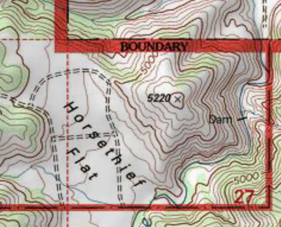
Doug, here's the "easternmost" side of 3N03A

I have considered asking Greg for boundary signs, but we're holding off (for now) as the climb up to the high point (marked "table") may be reclassified into wilderness - I can't really put a DVR there - as there's no legitimate BLM road that "connects" with a USFS road to differentiate. I'm working with IE4W as far as ideas on the AAT side, we'll increase patrols (or more correctly start patrols) in that area to discourage illegal use.Jeff
OHV76V
KG6TY
You're just upset because the voices in my head only talk to ME!
Comment
Comment