 Tweet
Tweet
My first "trail report", more of a hiking report, so bear with me...Approx. 9 mi. east of the 247, on the old "SV 183" is an old wagon road that takes you to the mouth of Sweet water spring canyon. Someone has tried to block this road with large rocks, so its more fun to do! Great 88 and I, and some friends were at the mouth by about 9:30, and started our 1 mi. hike to the spring. Great, remote area, LOTS of history, flowing water at the spring, and we found another spring,(well?) 50 yds. from Sweet water. Maybe Mitch will post pictures of this area. GREAT place to visit!:cactus::cactus:
-
:cactus::cactus:+:beer:=:poop:...:hide: -
Sounds like a cool trail. Pics definitely would be good to see if any are available.[COLOR=#ff8c00]MYJEEP(crawls)ROCKS(again).com
I have finally stopped drinking for good.
Now I drink for evil..... :devil:[/COLOR] -
Hey Dave,
Thanks for a great trip to the "Springs". I'm glad we hiked the mile plus to the top this time. Several mines to explore and lots of things to ponder! Check out my photo's on my photobucket
site. Look at "Sweet Water Springs"
http://234.photobucket.com/albums/ee259/great88jeep
MitchComment
-
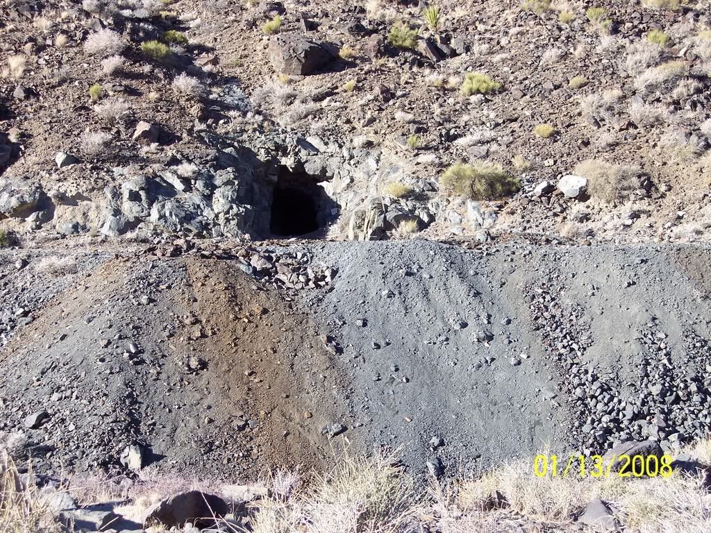
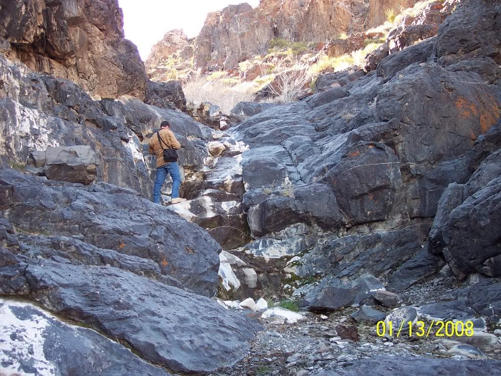
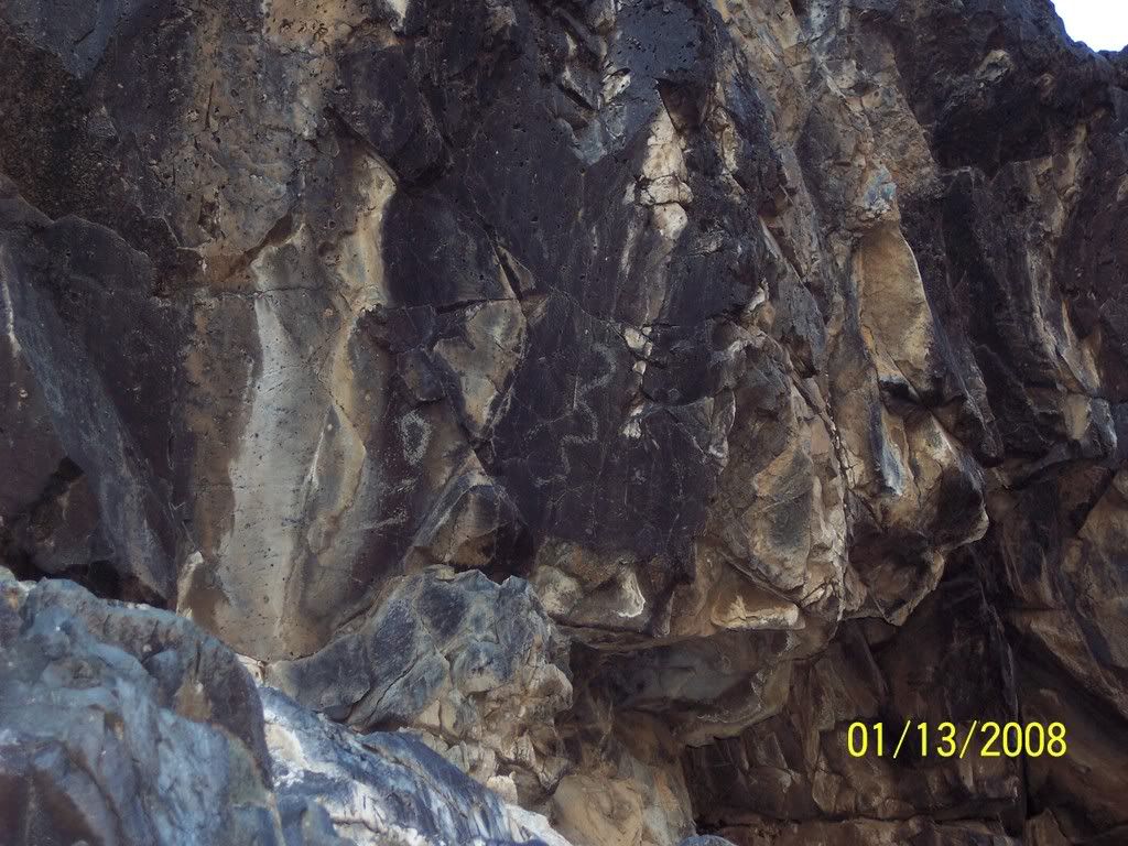
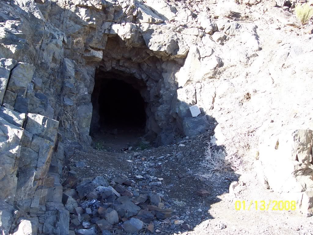
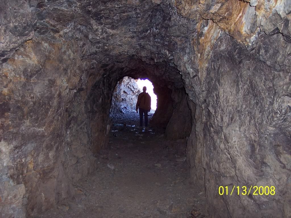
A fun day checking out some old mines and a year round spring located up a canyon. We hiked about 1 mile to the springs and scattered petroglyphs
One of several mines in the area of Sweetwater Springs
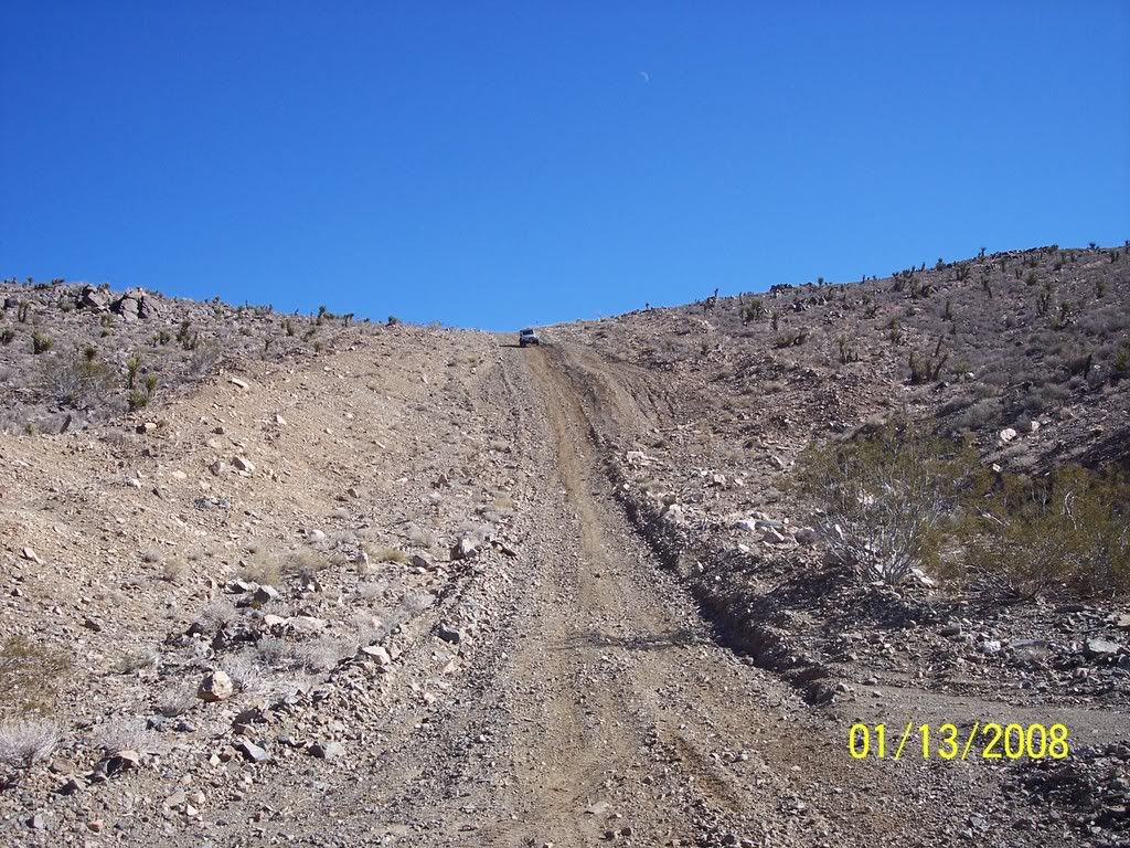
Hiking to the springs
Some scattered petroglyphs at the springs
Another nice mine we checked out
Caveman Dave
Dave crusing down the "Wall"
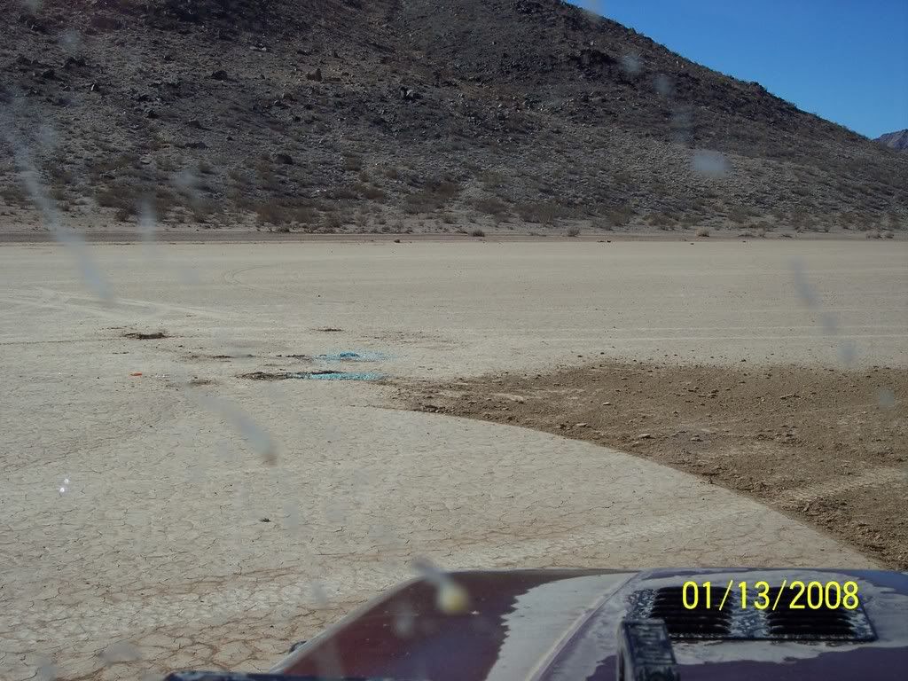
Hey look! A puddle
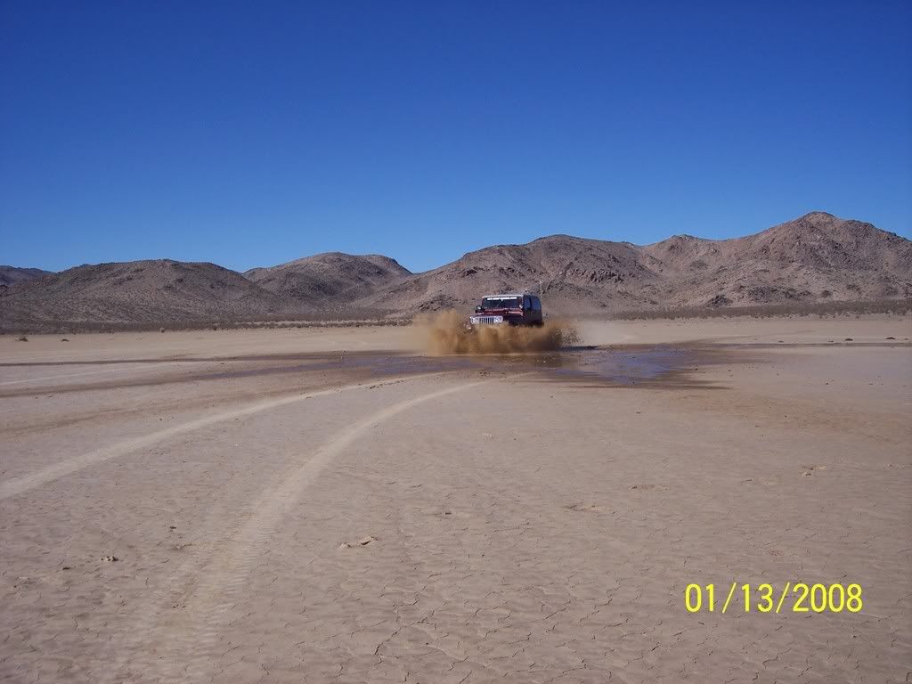
Check out the "highside rollover" remains. This was on Erickson Dry Lake. Not one of us!
Comment
-
FYI
from your pics, I assume you drove around a locked gate on the road coming in from the gas line road.
I was informed previously 2 years ago the area is patent, private land.
That's approx the time when the locked gate went up if I recall correctly.
I would advise verifying this information so as to avoid any trouble.
Cattleman Dave Fisher(sp) (since deceased) at one time had a grazing lease on the property. Unknown if that is still in effect as BLM has been trying to rid all cattle from that area.
BLM has done lots of restoration work in the area.
Please do your homework and respect the locked gate.
another Jeeper who's been there, done that......Comment
-
Hey Jim,
Thank you for your concern. Going to Sweetwater Springs we used an old mining road that is visible on Google Earth as well as on the USGS topos. At no point did we go around any locked gates. I took the time to go to the BLM Barstow Field Office in Barstow and met Bob Hasty, who is the Field Officer that patrols the Ord Mountain area. His concerns are travel off of the existing trails, destruction of private property, and destruction of historical sites (petroglyphs, etc.). I asked very specific questions as to where we could travel, visit, hike, carry weapons, ect. He said straight up that off-roaders using existing trails without entering private property were OK with him. He mentioned Dave Fisher's cattle grazing rights and said he wasn't concerned at all if you didn't tresspass on his ranch property. As far as "Respect the Gate", We parked our jeeps at the mouth of the canyon at a cable that is strung across the trail to Sweetwater Springs and walked the rest of the way up the canyon. According to BLM, this trail block should be listed with the BLM and posted as to the nature of the closure, neither of which have been done!. Mining claims or a "Patent" would only apply to a small area at the exact location of the claim (100' x 400') not an entire area or road.
So a dozen trail and history books, Google earth, Full set of USGS Topo's, BLM Maps, De Lorme Mapbook, And in person visits to the BLM Field Office I've done my "Homework" and I'm ready to wheel.
On that trip we actually had a visit from a Fish And Game Warden, who asked us to keep an eye out for poachers, asked us about the gate, and didn't know about the other trail. He checked out the trail we used, waved, and said have a nice day.
MitchLast edited by Mitch; 01-22-08, 08:30 PM.Comment
-
I second what Mitch says. Ive been visiting this area for 3 yrs. now, Ive talked to the BLM about this area, and have got the "OK" to WALK the area. I met an old timer at Aztec spring 1 month ago, and he told me the area was open land to explore. Now I realize he is not the law, but he DID own a "pantent" to a mine in the area, and had worked many of the mines as a young man in this area.So who knows? What I DO know is that when I,( and my friends) visit this area, we DONT "claim jump", were NOT shooting up the place,(although the game warden had NO problem with me cranking off a few rifle rounds, I ASKED first), we DONT molest Dave Fisher's cattle,(God, that didnt sound right, but we dont,I swear!) And there is another existing road leading to the mouth of Sweet water spring canyon that is NOT gated........Will continue to explore this GREAT area, thankyou.:cactus::cactus:+:beer:=:poop:...:hide:Comment
-
Mitch, no worries then.
I know the area well and the other road.
Just didn't want folks ignoring the gate, that's all.
Don't need any more ammo for the anti's........
I was fortunate years ago to drive that cabled road all the way to the top of the canyon, before it was closed; also wanted to take my trials bike and go up the old wagon road; no chance now I suppose. I've also been thru the locked gate on the upper road and been all the way to the top.
Hope my tone wasn't too harsh, sorry if I came on to strong.
Congrats on doing the homework.
Always makes the trip more enjoyable.
okay guys, UNCLE !Comment
-
Mitch,
That's the way it's supposed to be done. I hope alot of offroad detractors are sneaking a peak at this thread. You prove that offroaders are a responsible group of people. Nice work! I've never been out there and would like to go sometime. Guess I better do my homework, eh?
Kurt[CENTER][COLOR=#ff0000]Resistance Off Road
[/COLOR]Join the Resistance...
http://www.resistanceoffroad.us[/CENTER]Comment
-
has anyone seen or does anyone have an accurate BLM trail map of the OM trail area ?
BLM has been busy reposting trails and installing new markers on trails, with even re-numbering of some of those routes.
Seems BLM never has the map though....
At the BLM office in Mo Val, they direct you to the Auto Club maps.
I've always found the BLM maps that are available hard to read and not very user friendly.
Topo maps are helpful finding old roads and trails, but sometimes that can get you into trouble.Comment
-
Mitch, great pics. Next time your going mine hunting post it up. Would like to tag along.Check out .Comment
Comment