Because of the way that my work operates, I ended up with today off. Since most people have to work on Jan. 2nd, I didn't post a run but instead planned to drive some easy trails that I haven't been on before.
In the near vicinity, there are only a very few trails that Mr. Green and I haven't traversed. Most of which are in the area around the 138 and south of Lake Silverwood.
Planning to rectify this, I started the day on 2N59 out of the Silverwood Lake State Recreation Area. I followed the trail uphill from the ranger station to the junction with 2N45. The trail north on 2N45 is washed out and the trail on 2N59 Eastward is gated:
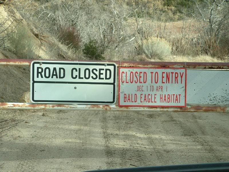
Some Bald Eagles use the area for a winter retreat and therefore it is currently closed to motorized traffic.
Heading south on 2N45 the trail becomes rutted and a high clearance vehicle is recommended. There are several springs along the way that have frozen over this time of year. The largest spot looked like this:
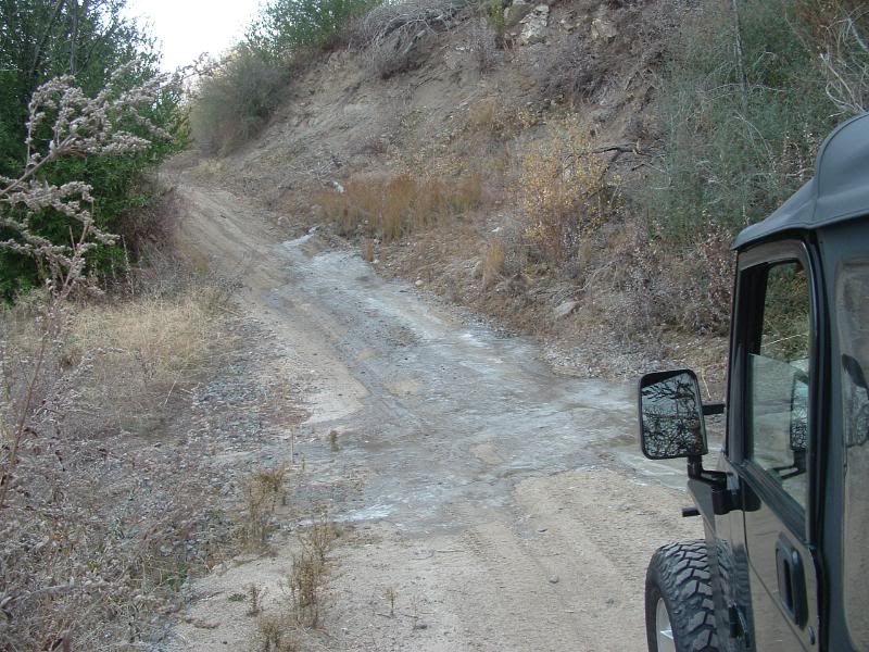
I lost traction and had to use 4WD to get past this obstacle. The trail soon split and I wasn't sure which way was the main trail. I stayed left and soon found that the trail was not well maintained:
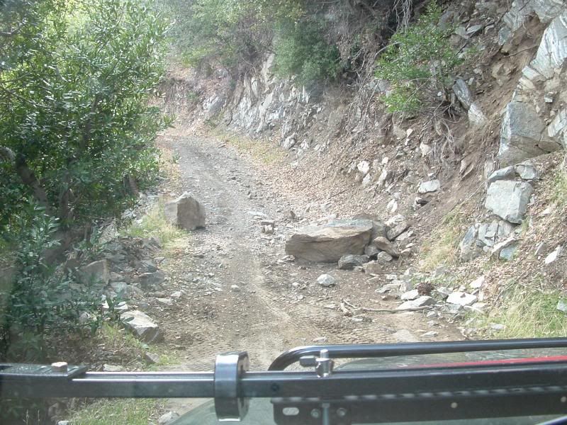
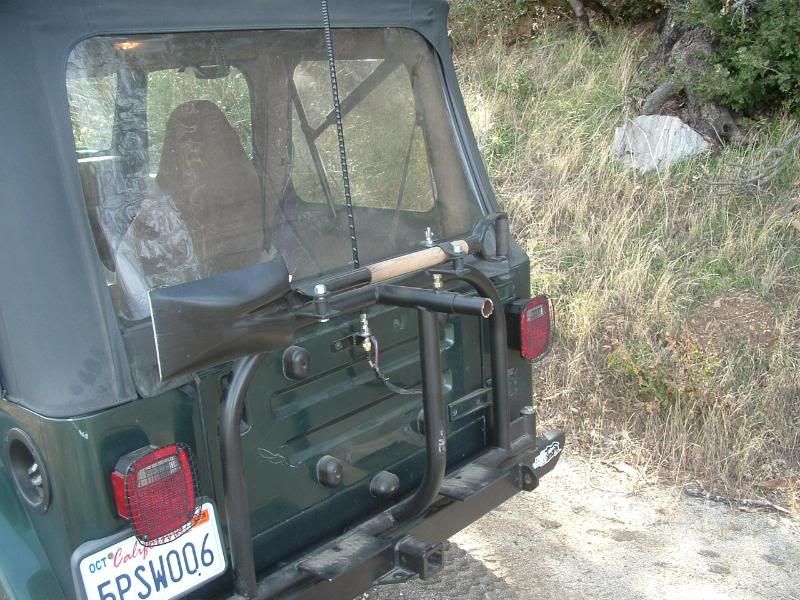
I made it through without climbing over the boulders, but it was a very tight squeeze. The trail headed up hill quickly and one part was steep and loose enough that it required 4WD. Exploring some side trails, I experienced some carnage. My tire carrier broke away and the spare fell off. For some reason, I have the most carnage on easy trails... I think that Mr. Green is in protest:
The trail climbs to the peak of Sugar Pine Mtn. The view of the I-15 is remarkable:
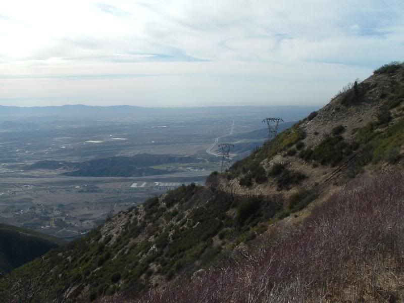
While on the ridge, I caught some great views of San Antonio Mtn:
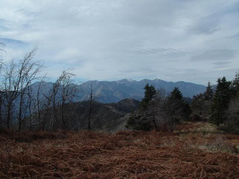
After I got down off the mountian, I realized that my map didn't have the trail that I climbed marked on it. I was confused by the trail that I took back down, but it turned out to be the designated trail for 2N45.
Since I was back on the trail that I started out from, I backtracked to the Sugar Pine Mtn Trail. I had seen a shelf that was carved into the side of Cleghorn Mtn from 3N49 (see pevious post on 3N49). I was curious about it. Vitual Earth website shows the trail as Old Cleghorn Road, so I wanted to know if it was still passible. It is not. The trail might be negotiated, but it is clearly not a designated trail any more:
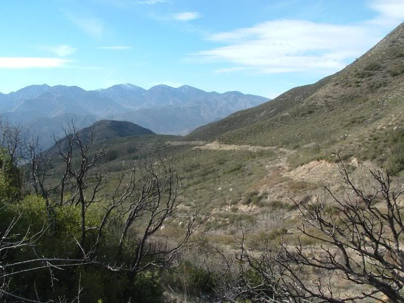
I went back out to the 138 and headed east. The first trail that I came to was gated due to the Bald Eagle habitat. But the next trail was open so I turned in and headed uphill on 2N03. The trails quickly became confusing but I found a wonderful view of Lake Silverwood:
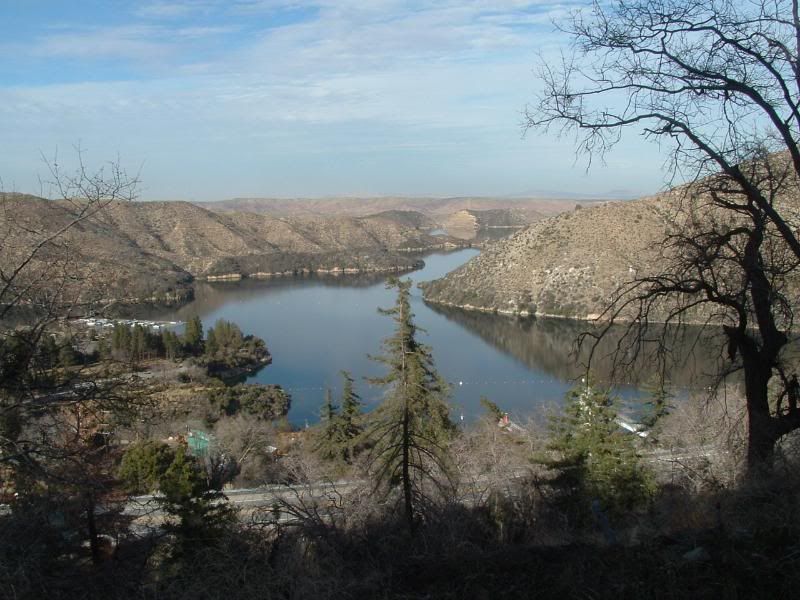
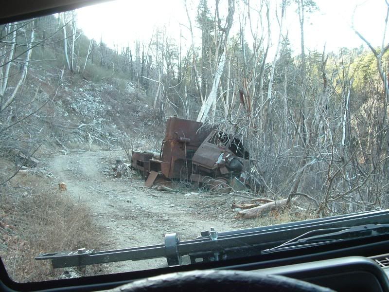
I think that I was starting to go into the Eagle habitat, so I turned around and headed uphill. Along the way I found this wreck that was left behind. No trail is complete without an abandoned vehicle:
I got very disoriented along the way and found myself passing through a gentleman's property. He was very kind and got me back on to the path to the 138. I discovered that I was in Cedarpines Park. I followed his directions back to the 138.
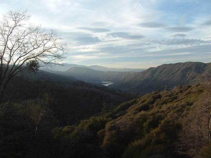
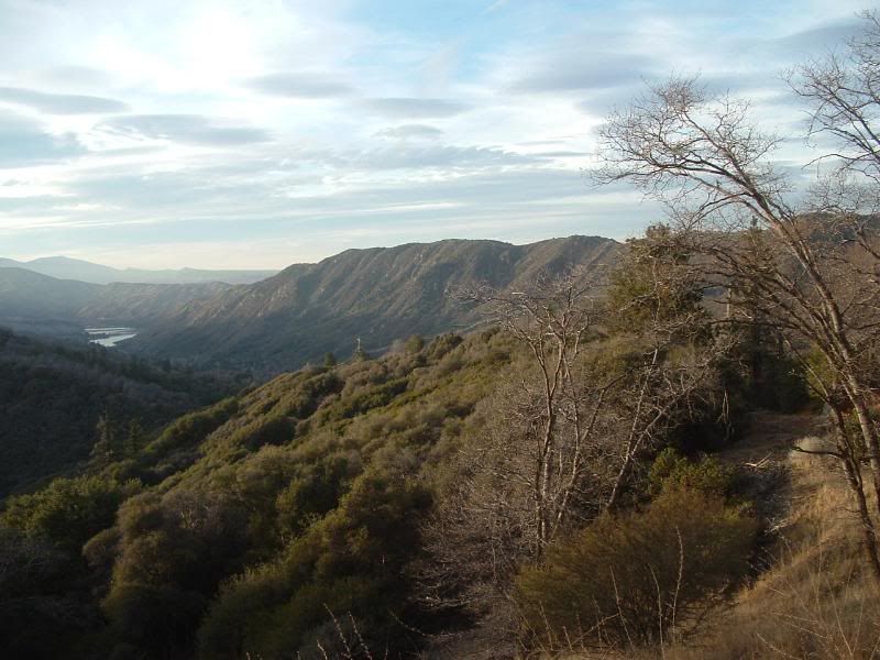
On the way back down the 138, I decided that there was enough daylight left to go check out 2N38. It is a trail that I have not explored yet and I really wanted to chalk one more trail off the list. 2N38 is a spur off of 2N37 in the Lake Silverwood basin area. It climbs up to give some great views of the the lake and the surrounding area:
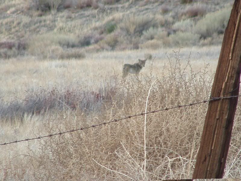
On the way back out, a coyote was kind enough to pose for the camera while he was hunting for his dinner:
It was a great day on the trail. Moreover, it was a great way for me to refocus for the New Year.
All of my pics can be seen at this link:
http://s139.photobucket.com/albums/q...20138/?start=0
In the near vicinity, there are only a very few trails that Mr. Green and I haven't traversed. Most of which are in the area around the 138 and south of Lake Silverwood.
Planning to rectify this, I started the day on 2N59 out of the Silverwood Lake State Recreation Area. I followed the trail uphill from the ranger station to the junction with 2N45. The trail north on 2N45 is washed out and the trail on 2N59 Eastward is gated:

Some Bald Eagles use the area for a winter retreat and therefore it is currently closed to motorized traffic.
Heading south on 2N45 the trail becomes rutted and a high clearance vehicle is recommended. There are several springs along the way that have frozen over this time of year. The largest spot looked like this:

I lost traction and had to use 4WD to get past this obstacle. The trail soon split and I wasn't sure which way was the main trail. I stayed left and soon found that the trail was not well maintained:

I made it through without climbing over the boulders, but it was a very tight squeeze. The trail headed up hill quickly and one part was steep and loose enough that it required 4WD. Exploring some side trails, I experienced some carnage. My tire carrier broke away and the spare fell off. For some reason, I have the most carnage on easy trails... I think that Mr. Green is in protest:

The trail climbs to the peak of Sugar Pine Mtn. The view of the I-15 is remarkable:

While on the ridge, I caught some great views of San Antonio Mtn:

After I got down off the mountian, I realized that my map didn't have the trail that I climbed marked on it. I was confused by the trail that I took back down, but it turned out to be the designated trail for 2N45.
Since I was back on the trail that I started out from, I backtracked to the Sugar Pine Mtn Trail. I had seen a shelf that was carved into the side of Cleghorn Mtn from 3N49 (see pevious post on 3N49). I was curious about it. Vitual Earth website shows the trail as Old Cleghorn Road, so I wanted to know if it was still passible. It is not. The trail might be negotiated, but it is clearly not a designated trail any more:

I went back out to the 138 and headed east. The first trail that I came to was gated due to the Bald Eagle habitat. But the next trail was open so I turned in and headed uphill on 2N03. The trails quickly became confusing but I found a wonderful view of Lake Silverwood:

I think that I was starting to go into the Eagle habitat, so I turned around and headed uphill. Along the way I found this wreck that was left behind. No trail is complete without an abandoned vehicle:

I got very disoriented along the way and found myself passing through a gentleman's property. He was very kind and got me back on to the path to the 138. I discovered that I was in Cedarpines Park. I followed his directions back to the 138.
On the way back down the 138, I decided that there was enough daylight left to go check out 2N38. It is a trail that I have not explored yet and I really wanted to chalk one more trail off the list. 2N38 is a spur off of 2N37 in the Lake Silverwood basin area. It climbs up to give some great views of the the lake and the surrounding area:


On the way back out, a coyote was kind enough to pose for the camera while he was hunting for his dinner:

It was a great day on the trail. Moreover, it was a great way for me to refocus for the New Year.
All of my pics can be seen at this link:
http://s139.photobucket.com/albums/q...20138/?start=0
 Thanks for sharing!

Comment