Announcement

Collapse
No announcement yet.

List of Closed Trails

Collapse

Forum Thread First Post

Collapse
X
 
  • Filter
  • Time
  • Show
Clear All
new posts

  • List of Closed Trails

    I'm hoping we can put our knowledge together and come up with a big list of closed trails. With the JV issue here locally, I've had a chance to talk about our sport more and it would be really powerful to have a list of everything that's been closed to make the message more powerful.

    When I notice a trail closure, I'll post it here. It will be a work in progress.

    If we have a lot of contributions, I can set up a form or something to make it easier.

    I'd like to see:
    1. Trail
    2. Area
    3. Link to proof/article about closure
    4. Date
    5. A sentence about it.


    Something like this:


    Carrizo Gorge Overlook Trail Closed
    Anza Borrego Desert State Park
    July 2013: When we got about 2/3 of the way to the Overlook there was a brand new State Park Sign stating that the trail was Open to Foot Travel Only.

    Sierra Nevada Trails THREATENED - From FishPoet
    June 2013: If this action passes OHV trails will be closed and lost forever. Rumor has it that if this critical habitat gets designated the Dusy will be among the closures.

    Johnson Valley OHV THREATENED from OlMan
    June 2013: Congressman Paul Cook has amended the NDAA to allow the marines use of Johnson Valley OHV area for 60-days (timeframes their choice) a year.

    Paria Canyon - "The Wave" - by $5 lottery permit only
    In the Spring and Fall they get over 500 people entering "the lottery" per day at $5.00 per person and the BLM only awards 10 lottery winners. More than 48,000 people applied in 2012 for 7,300 available permits, officials said. People die visiting due to unmarked trails and hike in extreme temps because of the rare chance to see the area.
    Last edited by sarah; 07-24-13, 01:23 PM.
    :gun:'99 TJ Sport:gun:

  • #2
    Is there a cutoff date in which you want to start. I know of trails closed as far back as the 1980s.
    Over 2500 hours donated to the San Bernardino National Forest. Life member of CA4WD, CORVA & BRC. Tread Lightly Trainer. Reforestation Supervisor. CASSP

    Comment


    • #3
      That'd be perfect. The more the better, so we can show the progression.

      I'm finding that most people, even the ones with jeeps, don't realize how fast these closures are happening. I'm tired of seeing politicians chip away at our access while the "off-road organizations" are doing little about it. It's time we step up!
      :gun:'99 TJ Sport:gun:

      Comment


      • #4
        Originally posted by sarah View Post
        That'd be perfect. The more the better, so we can show the progression.

        I'm finding that most people, even the ones with jeeps, don't realize how fast these closures are happening. I'm tired of seeing politicians chip away at our access while the "off-road organizations" are doing little about it. It's time we step up!
        Amen sista! I can contrbute...
        [CENTER][COLOR=#ff0000]Resistance Off Road
        [/COLOR]Join the Resistance...
        http://www.resistanceoffroad.us[/CENTER]

        Comment


        • #5
          One thing you would like to get is a copy of the map of California that Harry Baker maintains that shows how much of the state used to be open and is now closed.
          Rich

          Comment


          • #6
            Originally posted by Ol Man View Post
            One thing you would like to get is a copy of the map of California that Harry Baker maintains that shows how much of the state used to be open and is now closed.
            Thanks, I'll contact him! What really got me thinking on this was watching the map as we were driving from Vegas this past weekend. EVERYTHING out toward state line is wilderness, preserve or a "park." Pretty soon all we'll have left is freeway wheelin! I've been doing a lot of that lately and it's not that fun.
            :gun:'99 TJ Sport:gun:

            Comment


            • #7
              Originally posted by sarah View Post
              Thanks, I'll contact him! What really got me thinking on this was watching the map as we were driving from Vegas this past weekend. EVERYTHING out toward state line is wilderness, preserve or a "park." Pretty soon all we'll have left is freeway wheelin! I've been doing a lot of that lately and it's not that fun.
              I called my old contacts at the Sierra Club. They say they'll take me back if I burn my Jeep. Maybe I should give in huh?
              [CENTER][COLOR=#ff0000]Resistance Off Road
              [/COLOR]Join the Resistance...
              http://www.resistanceoffroad.us[/CENTER]

              Comment


              • #8
                Originally posted by RAT View Post
                I called my old contacts at the Sierra Club. They say they'll take me back if I burn my Jeep. Maybe I should give in huh?
                UH, NO! You're ours now. Too bad!
                :gun:'99 TJ Sport:gun:

                Comment


                • #9
                  Originally posted by sarah View Post
                  What really got me thinking on this was watching the map as we were driving from Vegas this past weekend. EVERYTHING out toward state line is wilderness, preserve or a "park." Pretty soon all we'll have left is freeway wheelin! I've been doing a lot of that lately and it's not that fun.
                  Every time I drive to Vegas I remember riding the Barstow to Vegas motorcycle races. A lot of the course was right along the freeway. Good memories of the times, but sucks to remember how much we used to have.
                  Rich

                  Comment


                  • #10
                    Originally posted by RAT View Post
                    I called my old contacts at the Sierra Club. They say they'll take me back if I burn my Jeep. Maybe I should give in huh?
                    Just give it away and say that you burned it. I am willing to take it off your hands if you would like....
                    [COLOR=#ff8c00]MYJEEP(crawls)ROCKS(again).com

                    I have finally stopped drinking for good.
                    Now I drink for evil..... :devil:
                    [/COLOR]

                    Comment


                    • #11
                      Originally posted by Ol Man View Post
                      Every time I drive to Vegas I remember riding the Barstow to Vegas motorcycle races. A lot of the course was right along the freeway. Good memories of the times, but sucks to remember how much we used to have.
                      Aww that's rough. And thats exactly what I'm talking about. Now you'll be thrilled to know that there's a bunch of solar panels! Subsidized, I'm sure.
                      :gun:'99 TJ Sport:gun:

                      Comment


                      • #12
                        Sarah, the "greens" have gone nuts with all they are supporting. Here is a video I took in June from a friend's property in Rigby, Idaho in June:

                        https://www.youtube.com/watch?featur...&v=jitpXOXOk2I

                        Pretty sad that when you try to get away from intrusions, along come those who know better.

                        The solar array at Primm would not have been so bad if they put them on the other side of the hills. They only have one of the three up and running (at least when I was by a couple of weeks ago) and it sure can slow traffic down as the gawkers look. I wonder what it will be like when all are up and running......and what if one of the mirrors gets directed towards the freeway.
                        Rich

                        Comment


                        • #13
                          Mojave desert Closures:
                          http://www.vvdailypress.com/articles...ve-trails.html

                          ELDORADO NATIONAL FOREST: The Eldorado will release their final decision regarding the closure of 42 roads and trails that cross small portion of meadows and/or wetlands On June 14th, 2013. CORVA held a Comments Project Workshop to teach enthusiasts how to effectively comment on this NEPA action, and submitted comments ourselves. However because of a previous court decision, it is likely that 19 or so of these routes will still remain closed pending mitigation work. The forest has applied for grants to start the mitigation work, however some of these projects will likely take years to complete. CORVA will appeal the decision.

                          WHY DID THIS HAPPEN? This decision is part of an ongoing lawsuit that stems from the early 2000s, and involves the analysis completed by the forest as part of their Travel Management Plan. In this part of the lawsuit, the forest was found to have done an incomplete analysis on trails and roads that cross even the smallest amount of meadows, under .10 of a mile. At that point the judge ordered these routes closed pending his official decision.

                          WHAT CAN YOU DO? CORVA has negotiated access to all the adopt-a-trails during this time period so maintenance work can continue, even though the trail is closed. We have also asked the Forest Service to notify us of any monitoring that will be taking place in order we can have OHV enthusiasts participate. We will also work closely with the forest to determine if any mitigation work may be needed to make sure these trails are reopened.

                          TAHOE NATIONAL FOREST: Congratulations to Friends of Tahoe Forest Access and Pacific Legal Foundation for filing suit over NEPA irregularities during the Travel Management process. As many know, Travel Management in California was a travesty, and this is a great example of the community fighting back. Please support Pacific Legal Foundation in these efforts.

                          FOR ALL FORESTS: Fire restrictions apply in all forests, be very careful when camping. Check before going to a forest to see if permits are needed, or camping stoves are allowed. Subpart A meetings are starting in many forests, check your local forest for more information. Forest Plan Revisions are starting for the Inyo, Sequoia and Sierra forests, if you love or recreate in those forest you MUST participate in these processes, otherwise your interests will not be fully represented!


                          BUREAU OF LAND MANAGEMENT

                          CLEAR CREEK MANAGEMENT AREA: CORVA submitted protest comments advocating more motorized access to Clear Creek to the BLM, and will also write appeals with the Record of Decision is released. CORVA and many others have been fighting the BLM over the perceived danger of naturally-occuring asbestos, and the battle is likely to continue in court.

                          JOHNSON VALLEY OHV AREA: Rep. Paul Cooks (R-Yucca Valley) plan to create the Johnson Valley National Off-Highway Vehicle (OHV) Recreation Area was included in the National Defense Authorization Act (NDAA). Originally introduced earlier this year as a stand-alone bill, the legislation was co-sponsored by Rep. Howard P. Buck McKeon (R-Santa Clarita), Chairman of the House Armed Services Committee. Big thanks to everyone who worked hard to make this bill possible, including Kim Carpenter and Steve Kuehl.

                          IMPERIAL SAND DUNES RECREATIONAL AREA: From the BLM - Off-roaders would have to pay more to use the popular Glamis off-highway vehicle area under a federal plan to halt a financial hemorrhage and maintain public safety services. Costs of managing the site have climbed over the past decade, while visitors and revenues have fallen steadily since 2007. We know weÃÓe not providing everything we should be providing now. WeÃÓe also overspending. Over the last three years, on average, we overspent by $562,000, said Neil Hamada, dunes manager for the U.S. Bureau of Land Management.

                          State Of California

                          With a new Director of State Parks - Major General Anthony L Jackson; a new Chief Deputy Director of State Parks - Aaron Robertson; and a new Deputy Director of the OHV Division of State Parks - Col. Christopher Conlin; there is a fresh breeze blowing in management of California State Parks. Please join CORVA in welcoming our new partners in State Parks. We welcome their guidance and dedication to transparency. For further information, please look at the new State Parks Strategic Action Plan for 2013-2014 found on the State Parks home page: http://www.parks.ca.gov/

                          Suit against Ocotillo Wells SVRA: The last week of May 2013 saw the filing of a lawsuit by Public Employees for Environmental Responsibility and the Desert Protection Council against California State Parks regarding the open area riding policy that has existed at Ocotillo Wells for more than 30 years. This lawsuit is similar to others that have been filed against popular OHV areas that rely on sketchy Sound-bite accusations with no basis in fact, and believe the true intent of these organizations to have all their fees paid by the State of California for filing suit. These lawsuits have become a means of financial existence for such organizations. Ocotillo Wells is the 2nd most popular park in the state, and has been recognized as an official California Watchable Wildlife Area in recognition of the excellent habitat maintenance and restoration work by the park.

                          WHAT CAN YOU DO? CORVA is meeting with representatives of State Parks and the OHV Division of State Parks to make sure the OHV publics concerns and interests are well represented. Should legal action be necessary, CORVA will be on the spot. One of the best things to do is to discredit those suing the state and spreading false rumors about off-road activity at the park. Thank those working hard in State Parks on our behalf, and use best trail practices wherever you travel.

                          CARNEGIE SVRA: Carnegie has been engaged in a long-range planning process that will result a General Plan document used to guide future management and operations. This planning process includes guidance for the use of new areas acquired by the OHV Division of State Parks many years ago to expand the park, which is very close to high population urban and suburban areas in order to meet the needs of enthusiasts. Unbeknownst to most off-road enthusiasts, local interests with property around Carnegie have been plotting behind the scenes with East Bay Regional Parks District to usurp the authority of State Parks and take over the expansion area. These interests have a ranch used for private hunting expeditions and the private sale of ranch-raised beef that start at $1000.00 an order. With that much money derived from their property, it is no wonder these entities want to remove legitimate recreation activity and expand their operations to earn more revenue.

                          WHAT CAN YOU DO? CORVA will be attending the next public meeting on June 10th, 2013 at Tracy High School to protest all efforts to STEAL the rights of legitimate recreation enthusiasts. We need your voice to be heard as well, please follow CORVAs lead, and if you are unable to attend a meeting in person, there will be times to respond in writing.

                          ADOPT A LEGISLATOR! Honoring a concept Ed Waldheim came up with many years ago - get to know your representatives. Schedule meetings at their district offices, it is both more relaxed and an easier way to get to know who represents you at the Capitol. Make sure they know how important motorized access is to you.


                          Johnson Valley OHV Area Guaranteed Temporary Protection from Marine Base Expansion

                          The California Motorized Recreation Council has succeeded in getting a bill passed in Congress mandating the Marine Corps to analyze the effects of their proposed expansion of the 29Palms Marine Corps base. They will now be required to determine the effects of the proposal on local communities both physically and financially, while also determining the impacts of displacing thousands of off-roaders who currently enjoy the unique topography the Johnson Valley OHV Area offers.

                          The passage of this bill presents a challenge to the Marines Corps which is hoped will delay the expansion while bringing to light more concrete information, exposing how devastating the expansion of the 29Palms Marine Base would be to visitors and residents alike.

                          CORVA is proud to be a contributing and working member of the California Motorized Recreation Council, along with 5 other off-road groups, as well as working with Partnership for Johnson Valley and local interests to fight against the withdrawal of the Johnson Valley OHV Area from public access.

                          Fordyce and the Rubicon in Peril as well-
                          http://www.pirate4x4.com/forum/land-...-out-frog.html

                          And I have just skimmed the surface here. we are in big trouble. As far as the yellow legged frog, funny how it seems to like the areas where our trails are located, but nowhere else. Could it be the the little froggie dude likes off roading?
                          Last edited by RAT; 07-31-13, 04:09 PM.
                          [CENTER][COLOR=#ff0000]Resistance Off Road
                          [/COLOR]Join the Resistance...
                          http://www.resistanceoffroad.us[/CENTER]

                          Comment


                          • #14
                            1. Surprise Canyon
                            2. Death Valley
                            3. The closure:
                            http://www.basinandrangewatch.org/Su...20closure.html
                            Articles about closure/attempts to reopen
                            http://articles.latimes.com/2006/nov.../me-surprise28
                            http://www.nationalparkstraveler.com...canyon-lawsuit
                            Center for Biological Diversity's opinion about the extreme off-roaders who are trying to reopen the trail:
                            http://www.biologicaldiversity.org/p...rprise_canyon/
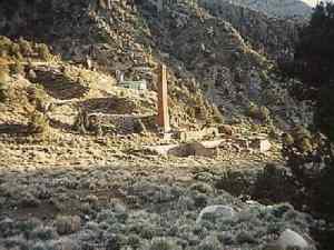
                            4. Date: 2001
                            5. Surprise Canyon leads to Panamint City. Every few years the road would be closed due to damage from flash floods. In 2001 the BLM decided to close the road instead of reopening it.

                            Last edited by Russ Chung; 08-01-13, 12:53 AM.
                            If you don't like the way I drive, stay out of the bushes!
                            KI6MLU

                            Comment


                            • #15
                              1. Coyote Canyon
                              2. Anza Borrego Desert State Park
                              3. Link to attempts to reopen the trail:
                              http://articles.latimes.com/1996-07-..._coyote-canyon
                              http://www.advrider.com/forums/showthread.php?t=115276
                              4. Date: 1995
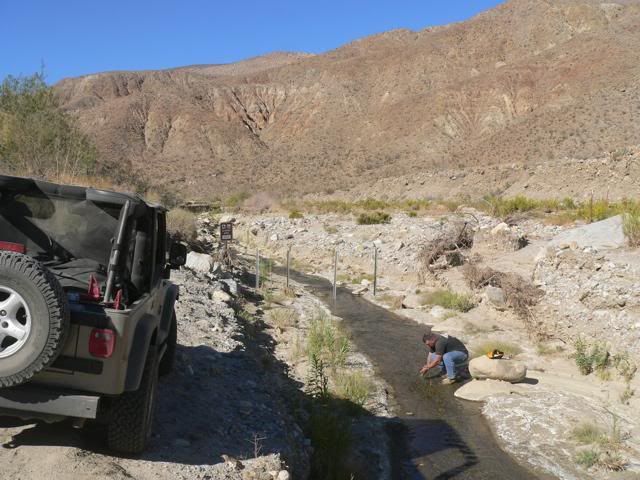
                              5. A 3-mile section of road in the middle of the canyon was closed to motorized vehicles, leaving two dead-end roads at the north and south ends of the canyon. The south end of the canyon can be reached from Borrego Springs; the north end can be reached from Anza, but you cannot drive through the canyon from end-to-end. Here's the fence at the end of the south portion of the road:

                              Last edited by Russ Chung; 08-01-13, 09:54 AM.
                              If you don't like the way I drive, stay out of the bushes!
                              KI6MLU

                              Comment

                              Working...
                              X