San Juan Public Lands Map
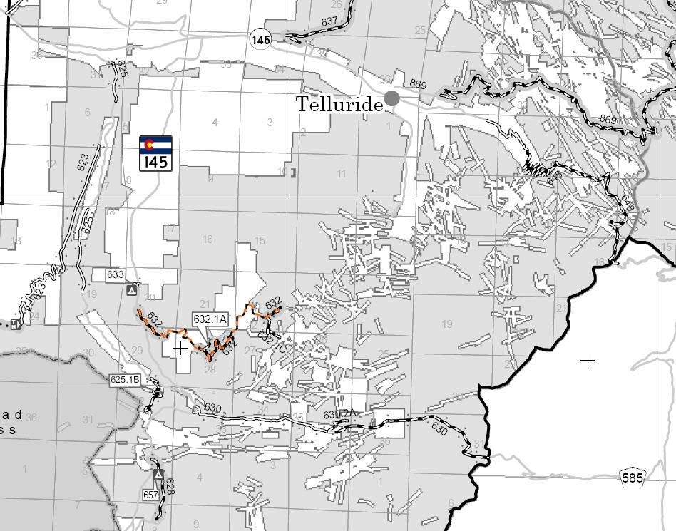
Uncompahgre National Forest Mountain Division MVUM
http://www.traildamage.com/trails/index.php?id=262
The traildamage site contains an extensive write up, photographs, videos, gpx files, kmz files, etc.
http://www.narrowgauge.org/4x4/html/alta_lake.html
The 4x4 Adventures in the San Juan Mountains website contains maps, a trail report and pictures.
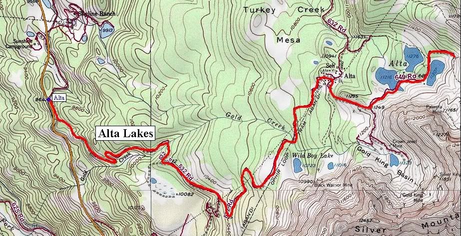
Uncompahgre National Forest Route 632
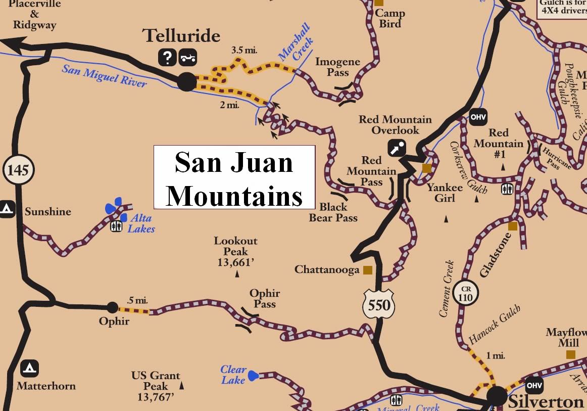
Alta Lakes
Length: 5 miles
Elevation: 9666' to 11,500'
Trail rating: Blue Square Moderate - Street legal vehicles and unlicensed off-highway vehicles allowed
Special Notes Operators of unlicensed vehicles must have a valid drivers license and carry proof of liability insurance. Unlicensed off-highway vehicles are not allowed from 1/2 mile East of Ophir to Hwy 145.
Entrance on Hwy 145 at N37� 53.031 W107� 53.290
Lat/Lon format is hddd� mm.mmm WGS84 datum
It is always a good idea to call ahead and get a current conditions report. San Juan Public Lands Office (970) 247-4874. Uncompahgre National Forest Norwood Ranger District (970) 327-4261.