 Tweet
Tweet
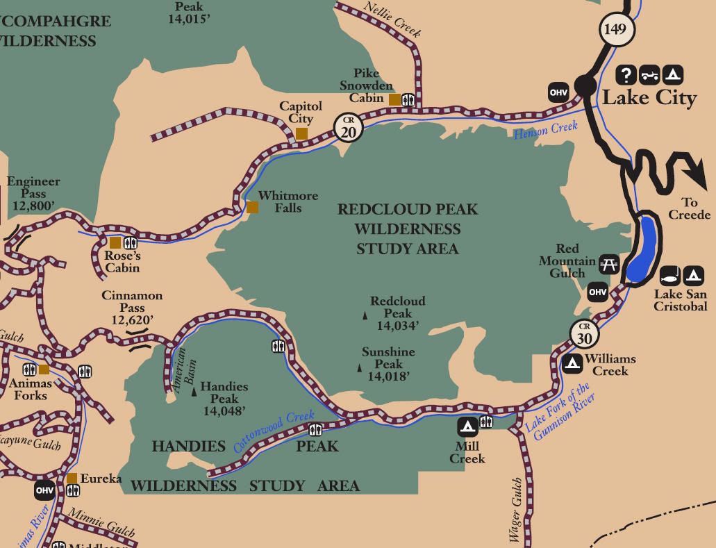
San Juan Public Lands Map
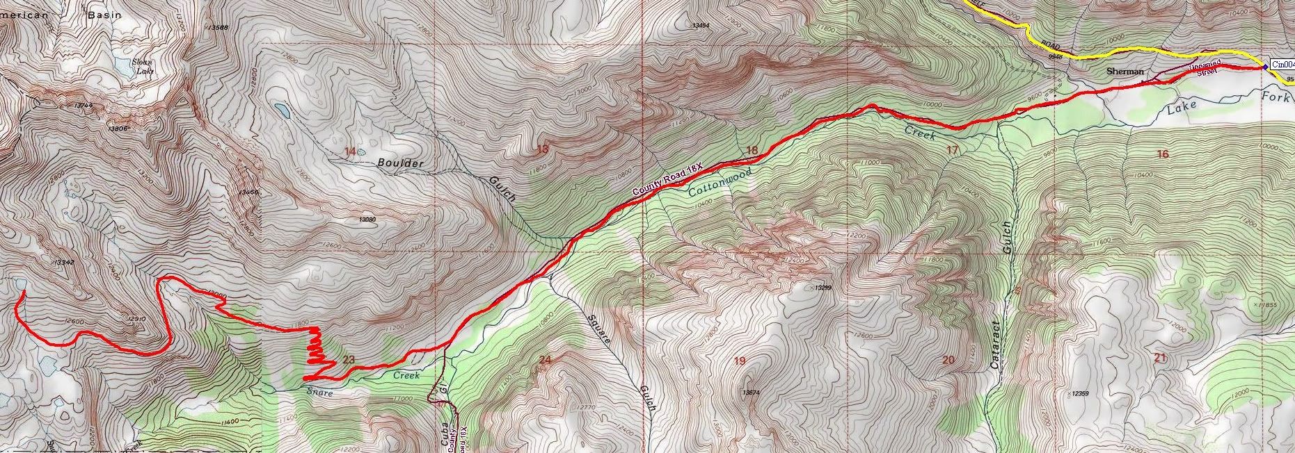
Hinsdale County Road 18X
Cottonwood Creek
Length: 8 miles
Elevation: 9500' to 12,800'
Trail rating: Green Circle Easiest - Street legal vehicles and unlicensed off-highway vehicles allowed.
Special Note Operators of unlicensed vehicles must have a valid drivers license and carry proof of liability insurance.
Entrance on Cinnamon Pass at N37� 54.225 W107� 24.706
Lat/Lon format is hddd� mm.mmm WGS84 datum
It is always a good idea to call ahead and get a current conditions report. San Juan Public Lands Office (970) 247-4874. Gunnison Field Office BLM (970) 642-4940.