 Tweet
Tweet
San Juan Public Lands Map
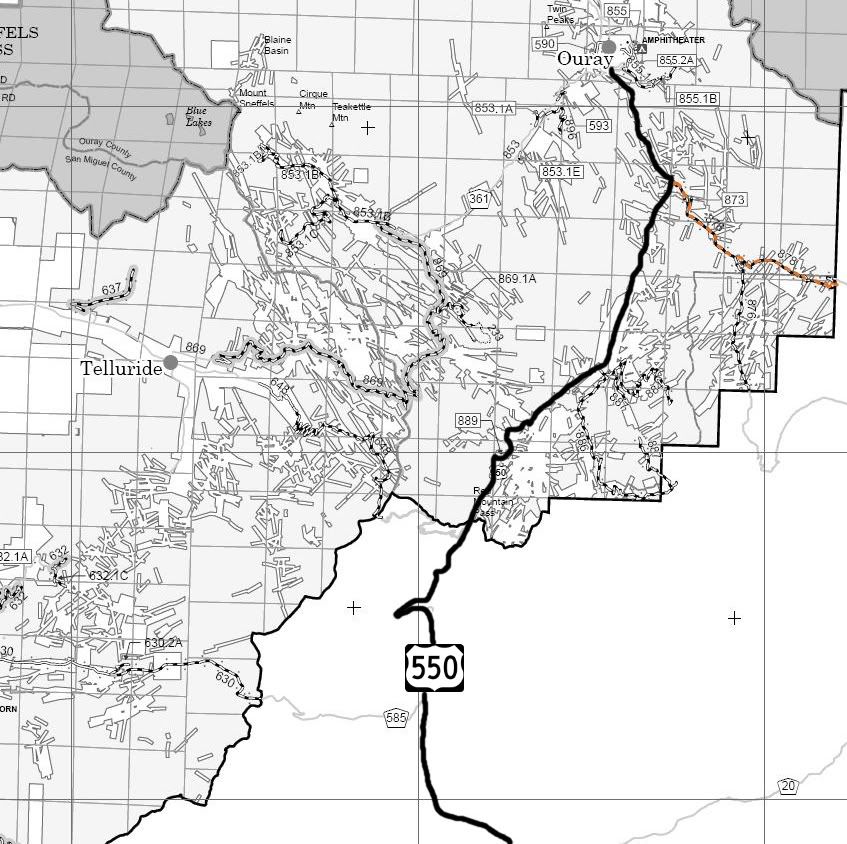
San Juan National Forest Columbine District MVUM
http://www.traildamage.com/trails/index.php?id=76
The traildamage site contains an extensive write up, photographs, videos, gpx files, kmz files, etc.
http://www.narrowgauge.org/4x4/html/engineer.html
4x4 Adventures in Colorado calls this trail "Lower Engineer Pass Road"
4x4 Adventures in the San Juan Mountains website contains pictures.
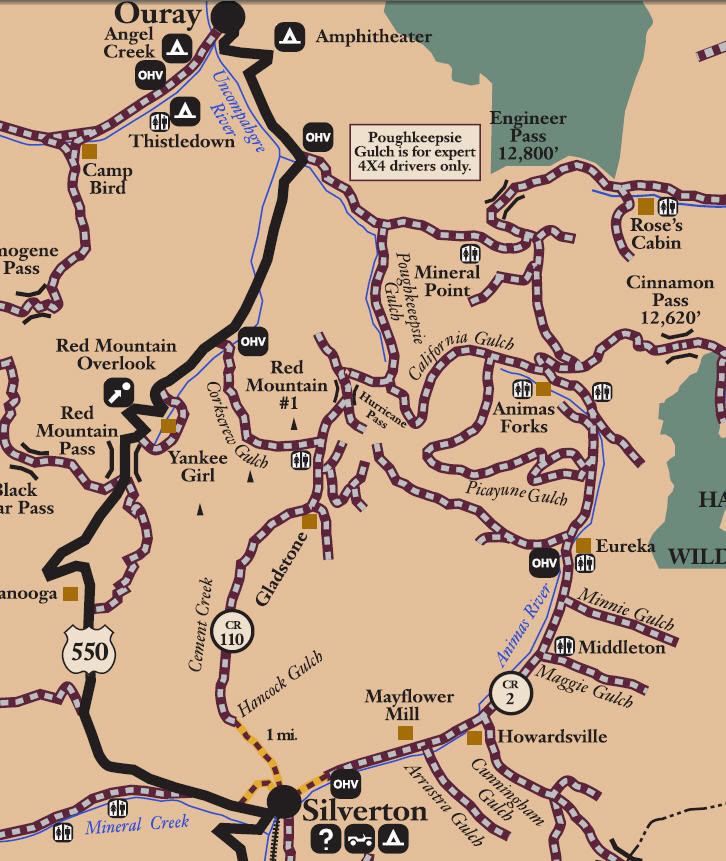
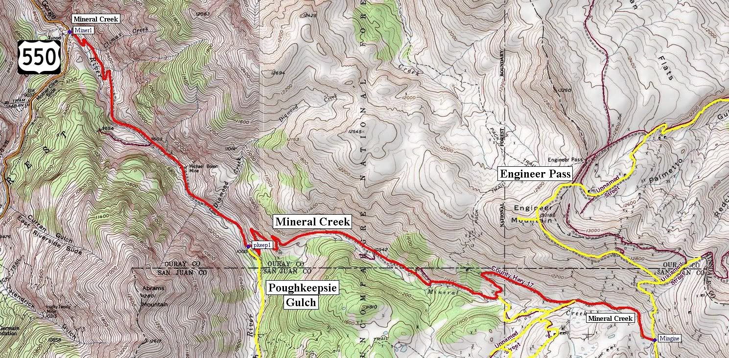
San Juan National Forest Route 878
San Juan County Road 17
Mineral Creek
Length: 6.5 miles
Elevation: 9700' to 11,500'
From Highway 550 to Poughkeepsie Gulch this trail adopted by: Western Slope 4 Wheelers
Trail rating: Blue Square More Difficult - Street legal vehicles and unlicensed off-highway vehicles allowed.
Special Note Operators of unlicensed vehicles must have a valid drivers license and carry proof of liability insurance.
West Entrance on Hwy 550 at N37� 59.312 W107� 38.973
Poughkeepsie Gulch entrance at N37� 58.031 W107� 37.614
San Juan Chief Mine loop at N37� 57.724 W107� 35.719
San Juan Chief Mine loop at N37� 57.699 W107� 35.141
East Entrance on Engineer Pass at N37� 57.466 W107� 34.528
Lat/Lon format is hddd� mm.mmm WGS84 datum
It is always a good idea to call ahead and get a current conditions report. San Juan Public Lands Office (970) 247-4874. San Juan National Forest Columbine Ranger District (970) 884-2512.
Comment