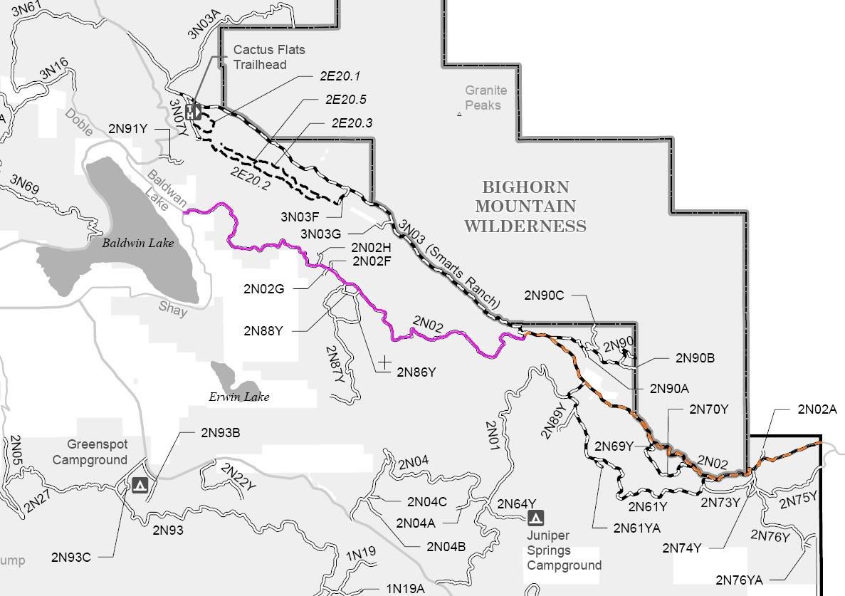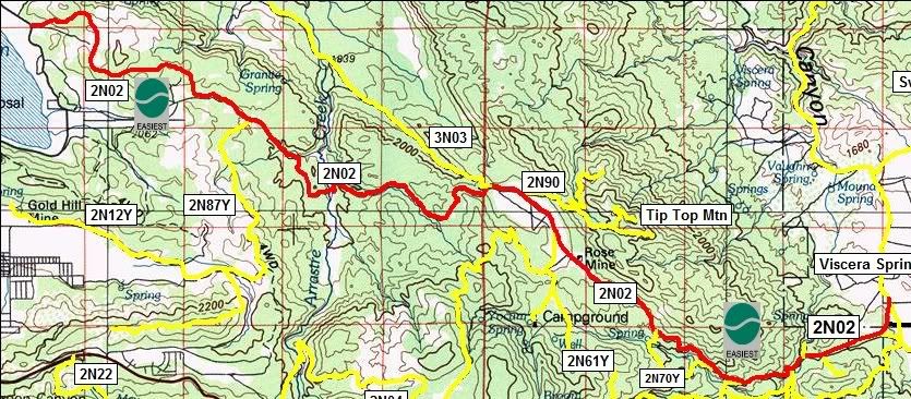

2N02 Arrastre Creek
Length: 12.5 miles
Trail Rating: Green Circle Easiest
Street legal vehicles ONLY allowed northwest of the intersection with 3N03
Street legal vehicles and green sticker vehicles allowed southeast of the intersection with 3N03
Elevation: 5750' - 7000'
Northwest entrance on Baldwin Lake Rd at N34° 16.766 W116° 47.825
Middle spur exit on 2N02H at N34° 16.161 W116° 45.919
Middle spur exit on 2N02G at N34° 16.120 W116° 45.804
Middle spur exit on 2N02F at N34° 16.114 W116° 45.756
Middle spur exit on 2N87Y at N34° 15.943 W116° 45.544
Middle spur exit on 2N86Y at N34° 15.854 W116° 45.351
Middle entrance on 3N03 at N34° 15.364 W116° 43.009
[COLOR="red"]East of this point 2N02 is open to green sticker vehicles[/COLOR]
Middle spur exit on 2N90 at N34° 15.300 W116° 42.654
Middle entrance on 2N01 at N34° 14.968 W116° 42.304
Middle northwest loop exit on 2N07Y at N34° 14.091 W116° 41.231
Middle southeast loop exit on 2N07Y at N34° 13.763 W116° 40.614
Middle northwest loop exit on 2N73Y at N34° 13.645 W116° 40.349
Middle southeast loop exit on 2N73Y at N34° 13.770 W116° 39.790
Middle spur exit on 2N02A at N34° 13.875 W116° 39.691
East entrance on Burns canyon Rd/Viscera Springs Rd at N34° 14.021 W116° 38.667
Lat/Lon format is hddd° mm.mmm WGS84 datum
It is always a good idea to call the ranger station before heading in to the forest and get a current conditions report. Big Bear Ranger Station & Discovery Center (909) 382-2790
SBNF Motor Vehicle Use Map (MVUM)
SBNF Google Earth file
2N02 Track.gpx
2N02 Waypoints.gpx