SBNF Motor Vehicle Use Map (MVUM)
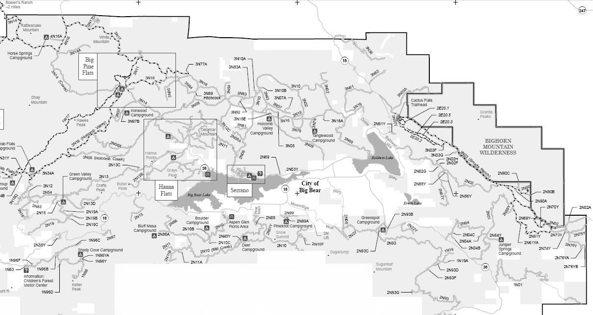
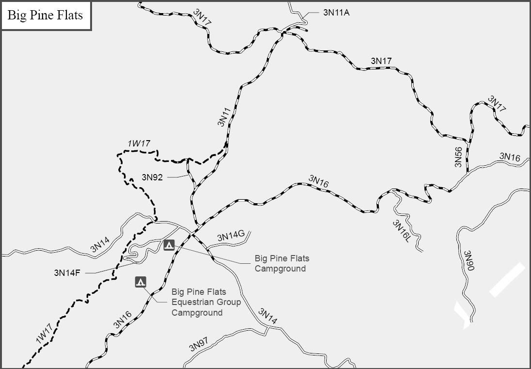
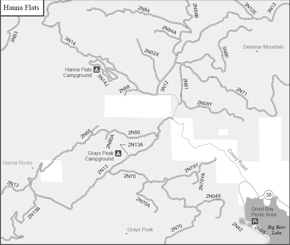
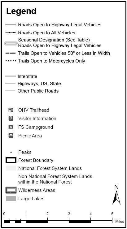
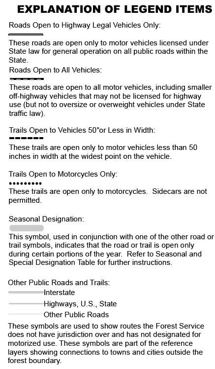
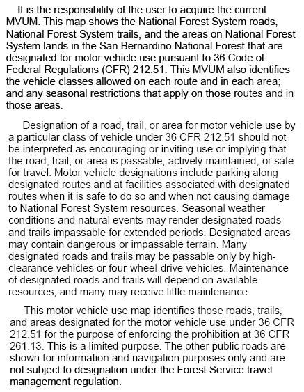
Big Bear Area of the San Bernardino National Forest
Borders:
Crab Flats to the West
Lucerne Valley to the North
Johnson Valley to the East
2N10 Skyline to the South
1N01 Pipes Canyon
1N19
1N19A
1N63 Children’s Forest
1N96 Keller Peak
1N96B
1N96C Snow Valley
1N96F
1N96Y Shady Cove
1N96YA Shady Cove
1W17 Redonda Ridge
2E20.1 Joshua Loop Trail
2E20.2 Vista Trail
2E20.3 Pinyon Trail
2E20.5
2N01 Broom Flat
2N02 Arrastre Creek/Rose Mine
2N02A
2N02F
2N02G
2N02H
2N02X
2N03
2N03Y
2N04 Balky Horse
2N04A
2N04B
2N04C
2N04X
2N05 Sawmill Canyon
2N06X Lower Larga
2N06XA
2N08 Knickerbocker
2N08Y
2N09 Polique
2N09A
2N09E
2N10 Skyline
2N10B Boulder Group
2N10F Gold Mine
2N11 Siberia Creek
2N11A
2N11B
2N12 Nordic Rim
2N12Y Deadmans Ridge
2N13 Snowslide
2N13A Grays Peak Group
2N13B Butler Peak
2N13C
2N13D Crafts Peak
2N14 Serrano
2N15 Glory Ridge
2N16 Green Valley Campground
2N17 Pooh Land
2N19 Little Green Valley
2N19A
2N19B
2N19C
2N22Y May Van Canyon
2N27 Sand Canyon
2N32 Meadows Edge
2N35 Grout Bay
2N35Y Deep Creek
2N42 Grays Peak Trailhead
2N45Y Deer Campground
2N51Y
2N54
2N61Y Round Valley
2N61YA
2N62 Discovery Center
2N64Y Juniper Springs
2N68
2N69 BBRS
2N69Y
2N70 Grout Creek
2N70A
2N70Y
2N71
2N73Y
2N74Y
2N75Y
2N75YA
2N76Y Antelope Creek
2N76YA
2N76YB
2N79Y
2N79YA
2N80 Hanna Rocks
2N80A
2N81
2N83 Green Valley Lake
2N84 Little Bear Spring
2N84A Little Bear Peak
2N84B
2N86 Castle Rock
2N86A Bluff Mesa
2N86Y
2N87Y
2N88Y
2N89Y
2N90 Tip Top Mountain
2N90A
2N90B Tip Top Mine
2N90C
2N91Y
2N93 Wildhorse
2N93B
2N93C Greenspot
2N93D
2N93F
2N93G
2N97 Camp Creek
2N97Y
2N98Y Cougar Crest
2N99 Pine Knot
2N99A Pine Knot Campground
3N02 Burnt Flat
3N03 Smarts Ranch
3N03A Horsethief Canyon
3N03F
3N03G
3N05 Hangman’s Tree
3N07
3N07A The Squeeze
3N07Y Upper Cactus Flats
3N08 Upper Holcomb Creek
3N09 Van Duesen
3N10 John Bull
3N10A
3N10B
3N11 Big Pine Flat
3N11A Wright Mine
3N12 Fawnskin Valley
3N12C
3N12E
3N14 Coxey Creek
3N14A Dawn O’Day
3N16 Holcomb Valley
3N16A
3N16E Holcomb Valley Campground
3N16L
3N17 White Mountain
3N17D White Mountain Peak
3N19
3N32
3N36 Silver Peak/Blackhawk Mountain
3N43 Upper Holcomb Valley
3N54 Furnace Mine
3N61 Jacoby Canyon
3N62 Cactus Flat
3N69 Gold Mountain
3N76
3N77A
3N79 Tanglewood
3N80 Delamar Mountain
3N81 Old Baldy
3N82
3N83
3N83A
3N84
3N89 Hitchcock Spring
3N90 Greenlead Mine
3N93 Holcomb Creek
3N97 Cienega Larga
3N97A Ironwood
4N16 Grapevine Canyon
4N16A Horse Spring
Rattlesnake Canyon
Big Bear North Yellow Post Sites
Big Bear South Yellow Post Sites
Big Bear Northwest Yellow Post Sites
Keller Peak Yellow Post Sites
SBNF Motor Vehicle Use Map (MVUM)
SBNF Google Earth file

Comment