SBNF Motor Vehicle Use Map (MVUM)

San Jacinto Area of the San Bernardino National Forest
Borders:
Hemet to the West
Banning/Beaumont to the North
Palm Springs the East
Hwy 371 to the South
2E43 Hixon Trail
2E44 Alesandro Trail
3E27
3S08
3S09
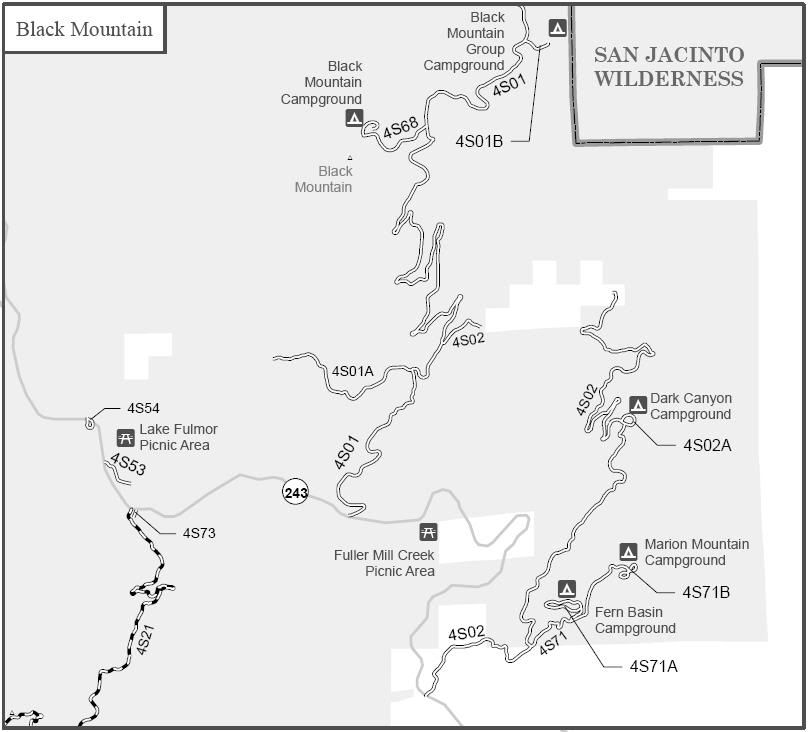
4S01 Black Mountain
4S01A Trailfinders
4S01B Black Mountain Group
4S01C PCT Trail Camp
4S02 Pine Wood
4S02A Dark Canyon
4S05
4S06 Poppet Flat
4S10 Indian Creek
4S19 Angelus Hill
4S21 Indian Mountain
4S53
4S54 Lake Fulmor
4S57
4S68 Boulder Basin
4S70
4S71
4S71A Fern Basin
4S71B Marion Mountain
4S73 Indian Lookout
5S06 Old Control
5S07 Bee Canyon
5S09 San Jacinto Ridge
5S10 Red Hill
5S11 South Ridge
5S11A
5S11B
5S12 Bonita Vista Ranch
5S13 Chimney Flats
5S14 Humber Park
5S15 Rouse Hill
5S21 May Valley
5S26
5S27 Cranston
5S28
6S05 Fobes Ranch
6S11
6S13 Thomas Mountain
6S13A Tool Box Springs
6S13B Ramona
6S13D Thomas Mountian Peak
6S15 Lake Hemet
6S15A
6S16
6S18
6S22 Red Mountain
6S53 Goff Flat
6S53A Martinez Creek
6S89
7S01 Pidgeon Springs
7S02 Santa Rosa Mountain
7S02A Santa Rosa Radio Facility
7S02B Santa Rosa Peak
7S02C Stump Spring
7S04 Juan Diego Flats
7S05
7S08 Pinyon Flat
7S11
7S14
7S14A Ribbonwood
San jacinto Yellow Post Sites
Thomas Mountain Yellow Post Sites
7S02 Yellow Post Sites
SBNF Motor Vehicle Use Map (MVUM)
SBNF Google Earth file
It is always a good idea to call the ranger station before heading in to the forest and get a current conditions report. Idyllwild Ranger Station (909) 382-2921
