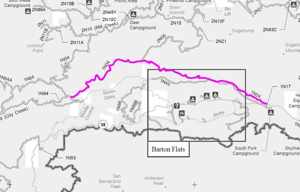

1N04 Radford Front Line
Maintenance Level 3: Maintained for travel by prudent drivers in a standard passenger car. User comfort and convenience are low priorities.
1N04 is a multi-use road open to street legal vehicles, mechanized vehicles (bicycles), equestrian travel and foot travel. Motorized vehicles yield to all other users.
Trail Rating: Green Circle Easiest
Length: 11 miles
Elevation: 5000’ to 6300’
Trail adopted by: 4x4 Him
West entrance on 1N54 at 11S 503710E 3781574N
Middle entrance on 2N06 at 11S 508126E 3783744N
West Y with 1N45 at 11S 512470E 3782614N
East Y with 1N45 at 11S 512961 3782470N
East entrance on Hwy 38 at 11S 516025E 3781109N
UTM coordinates acquired using Google Earth (WGS84 datum)
It is always a good idea to call the ranger station before heading in to the forest and get a current conditions report. Mill Creek Ranger Station (909) 382-2882
SBNF Motor Vehicle Use Map (MVUM)
SBNF Google Earth file