 Tweet
Tweet
http://www.fs.usda.gov/Internet/FSE_...rdb5202572.pdf
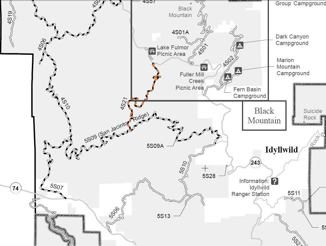

4S21 Indian Mountain
Length: 4 miles
Trail Rating: Black Diamond Most Difficult - Street legal vehicles and green sticker vehicles allowed
Elevation: 4700’ to 5450’
North entrance on Hwy 243 at N33� 47.835 W116� 46.664
South entrance on 5S09 at N33� 46.032 W116� 47.363
Lat/Lon format is hddd� mm.mmm WGS84 datum
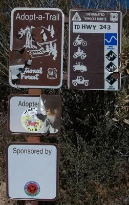
4S21 is adopted by: http://www.hemetjeepclub.com/
It is always a good idea to call the ranger station before heading in to the forest and get a current conditions report. Idyllwild Ranger Station (909) 382-2921
4S21 Indian Mountain
Length: 4 miles
Trail Rating: Black Diamond Most Difficult - Street legal vehicles and green sticker vehicles allowed
Elevation: 4700’ to 5450’
North entrance on Hwy 243 at N33� 47.835 W116� 46.664
South entrance on 5S09 at N33� 46.032 W116� 47.363
Lat/Lon format is hddd� mm.mmm WGS84 datum
4S21 is adopted by: http://www.hemetjeepclub.com/
It is always a good idea to call the ranger station before heading in to the forest and get a current conditions report. Idyllwild Ranger Station (909) 382-2921