Announcement

Collapse
No announcement yet.

Bullfrog Trail

Collapse

Forum Thread First Post

Collapse
X
 
  • Filter
  • Time
  • Show
Clear All
new posts

  • Bullfrog Trail

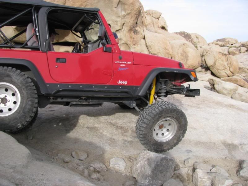
    BullFrog Trail is a difficult trail in the JV OHV area.

    The obstacles are technical and are easier with at least one locker, but open diff vehicles have made it through.

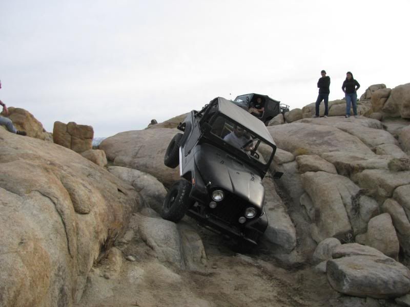
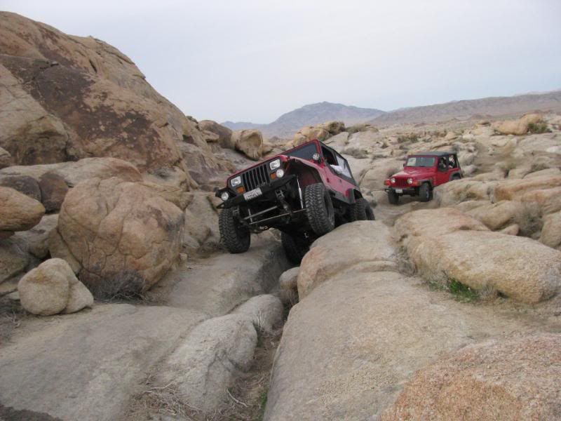
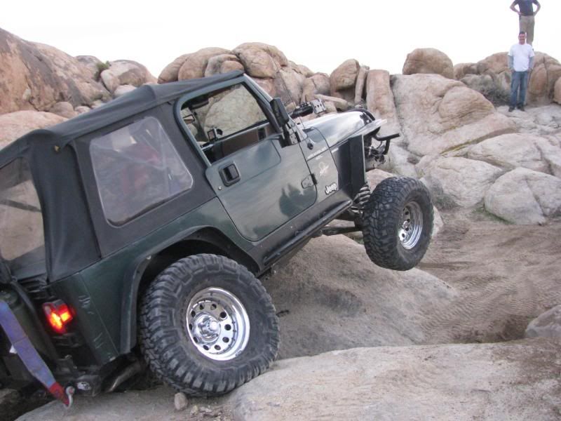
    Great Obstacles:
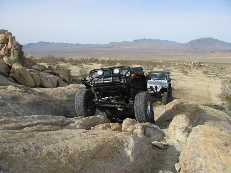


    With the infamous Jeepeater being one of the visually noteworthy ones:


    There are plenty of challenges along the way:


    A great trail!
    Attached Files
    [COLOR=#ff8c00]MYJEEP(crawls)ROCKS(again).com

    I have finally stopped drinking for good.
    Now I drink for evil..... :devil:
    [/COLOR]

  • #2
    Mike,

    Your reports always ROCK!!! Thanks for taking the time to do this. A GPS thingy just made it onto my list. What would be a good userfriendly GPS unit for the trails? I don't care much about the street maps although I'm sure they'll come in handy from time to time, but really would like one where trails are loaded in or where I could save trails I've done before and download trails routes into it. Any suggestions? Hope you, Sharon, and Mr. Green are all doing well!
    That which does not kill me postpones the inevitable.

    Comment


    • #3
      I remeber that run. I love this trail!
      Those left standing
      Will make millions
      Writing books on ways
      It should have been
      -Incubus "Warning"

      Comment


      • #4
        Hey Joe! I haven't run into you in a while!

        Sharon wanted a GPS, so we talked to several folks including FishPOET and narrowed our selection down to the Garmin nuvi 500. It has topo maps pre-loaded and is a cross-over GPS so it allows you to use it on or off-road, hiking or biking. It is a touch screen type as well.

        Sharon and I are pretty happy with it so far.
        [COLOR=#ff8c00]MYJEEP(crawls)ROCKS(again).com

        I have finally stopped drinking for good.
        Now I drink for evil..... :devil:
        [/COLOR]

        Comment


        • #5
          [COLOR="Blue"]We're slowly working on getting some better route markings on these trails. Sidekick off-road has done some GPS points on their new Johnson Valley map. If anyone does GPS.

          Another new feature is there are now Carsonite markes through-out the trail at critical intersections. In the fall we'll go out and rework the wooden markers that are already in place. The other source is a lot of vehicle tracks. Or stacking rock carins, if anyone wants to do that while runing the trail.

          Another thing I'm working on is to put GPS waypoints on a Google Earth arial photo that can be e-mailed. I have the trails already charted, I'm just waiting for some cool weather to go out and get the co-ordinates.

          BTW there are 5 trails that will be charted:
          - Hammerdown
          - Bullfrog
          - Cakewalk I - Difficult
          - Cakewalk II - an easy version of the area for near stock vehicles.
          - Boulder Bash - the newest trail.

          I can e-mail anyone the charts for now - GPS co-ordinates a little later.

          MK[/COLOR]

          Comment


          • #6
            Originally posted by mkjeepers View Post
            Or stacking rock carins, if anyone wants to do that while runing the trail.
            Sounds like family day! My kids love making cairns. All I ask that we keep them on the same side of the trail all the way through.
            Off road adventure photography:

            TreadLightly Trainer
            Wilderness First Aid (WFA)
            HAM - KI6PFO

            2005 Rubicon Unlimited + trailer

            Comment


            • #7
              GPS thingy

              Originally posted by Schmo View Post
              Mike,

              Your reports always ROCK!!! Thanks for taking the time to do this. A GPS thingy just made it onto my list. What would be a good userfriendly GPS unit for the trails? I don't care much about the street maps although I'm sure they'll come in handy from time to time, but really would like one where trails are loaded in or where I could save trails I've done before and download trails routes into it. Any suggestions? Hope you, Sharon, and Mr. Green are all doing well!
              Hey Schmo,
              I bought this one for my daughter because she loves to go hiking.
              You can save trails and waypoints etc.
              It would really be cool for Jeepin too though. I'm gonna get one for me.
              Check it out as an option.
              http://www.bushnell.com/gps/gps_features_tech_talk.cfm

              Scott

              Comment


              • #8
                Originally posted by nwoods View Post
                Sounds like family day! My kids love making cairns. All I ask that we keep them on the same side of the trail all the way through.
                [COLOR="Blue"]Deal! You choose the side[/COLOR].

                Comment


                • #9
                  Originally posted by mkjeepers View Post
                  [COLOR="Blue"]We're slowly working on getting some better route markings on these trails. Sidekick off-road has done some GPS points on their new Johnson Valley map. If anyone does GPS.

                  Another new feature is there are now Carsonite markes through-out the trail at critical intersections. In the fall we'll go out and rework the wooden markers that are already in place. The other source is a lot of vehicle tracks. Or stacking rock carins, if anyone wants to do that while runing the trail.

                  Another thing I'm working on is to put GPS waypoints on a Google Earth arial photo that can be e-mailed. I have the trails already charted, I'm just waiting for some cool weather to go out and get the co-ordinates.

                  BTW there are 5 trails that will be charted:
                  - Hammerdown
                  - Bullfrog
                  - Cakewalk I - Difficult
                  - Cakewalk II - an easy version of the area for near stock vehicles.
                  - Boulder Bash - the newest trail.

                  I can e-mail anyone the charts for now - GPS co-ordinates a little later.

                  MK[/COLOR]
                  Can I get some trailhead co-ordinates? Planning going out there soon
                  thanks

                  Comment


                  • #10
                    Originally posted by Mikegyver1 View Post
                    Can I get some trailhead co-ordinates? Planning going out there soon
                    thanks
                    [COLOR="Blue"]Mike, the Bullfrog trailhead is located at:
                    34 28 49.20N 116 48 46.46W
                    From there the trail is marked fairly well. The Cakewalk trail will cross it in a few places. Both trails make a loop and take you back to the trailhead.[/COLOR]

                    Comment


                    • #11
                      Originally posted by Mike View Post
                      BullFrog Trail is a difficult trail in the JV OHV area.

                      The obstacles are technical and are easier with at least one locker, but open diff vehicles have made it through.

                      Great Obstacles:
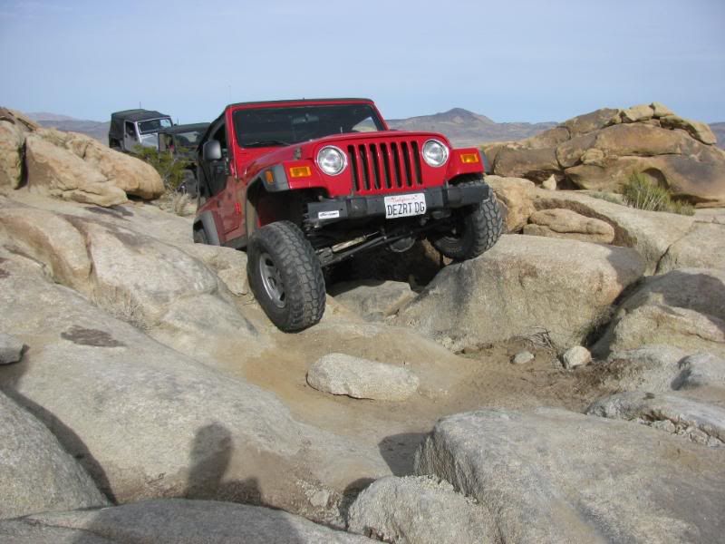
                      With the infamous Jeepeater being one of the visually noteworthy ones:
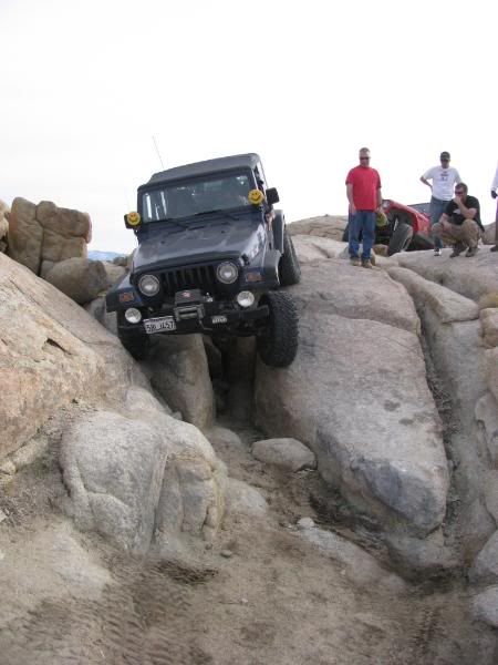


                      A great trail!
                      This was the first time meeting MJR and on the rocks,the Jeep did better then I did.
                      Dennis and Tammy
                      Its as much fun getting dirty as it is being dirty in a Jeep!

                      Comment


                      • #12
                        Originally posted by mkjeepers View Post
                        [COLOR="Blue"]Mike, the Bullfrog trailhead is located at:
                        34 28 49.20N 116 48 46.46W
                        From there the trail is marked fairly well. The Cakewalk trail will cross it in a few places. Both trails make a loop and take you back to the trailhead.[/COLOR]
                        We found it.. got lost.. found it.. got lost.. etc.. lol

                        Comment


                        • #13
                          Originally posted by Mikegyver1 View Post
                          We found it.. got lost.. found it.. got lost.. etc.. lol
                          [COLOR="Blue"]Route finding is pretty difficult on these trails. You should join us on one of the runs and get the full trail. We're doing On the Rocks this Sat.[/COLOR]

                          Comment

                          Working...
                          X