 Tweet
Tweet


Black Canyon Rd Trail
Distance: 35 miles
Driving time: 2.5 hours
Difficulty rating �High clearance 4wds are preferred, but any high clearance vehicle should be acceptable. Expect a rough road surface, mud and sand are possible, but will be easily passable. You may encounter small rocks and loose road surfaces. Shelf roads will be wide enough for passing or have adequate pull offs.�
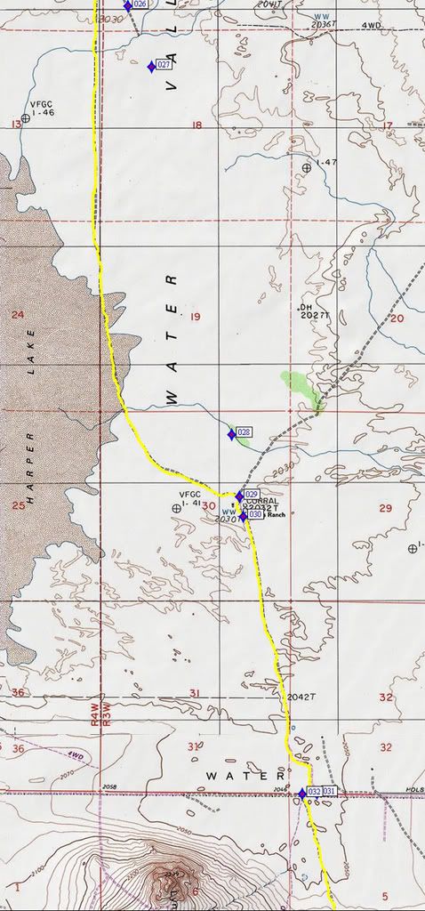
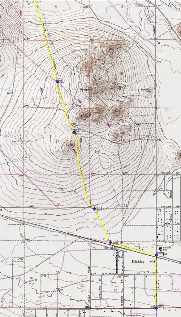
Lat/Lon format is hddd� mm.mmm and WGS84 datum
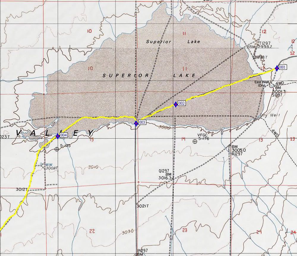
Start at Goldstone Rd 19.5 miles North of Copper City Rd at N35� 14.809 W117� 00 174
D21 001 - N35� 14.809 W117� 00.174
D21 002 - N35� 14.469 W117� 01.335
D21 003 - N35� 14.290 W117� 01.789
D21 004 - N35� 14.170 W117� 02.689
D21 005 - N35� 13.081 W117� 03.700
D21 006 - N35� 12.838 W117� 03.471
D21 007 - N35� 12.853 W117� 04.832
D21 008 - N35� 12.854 W117� 06.256
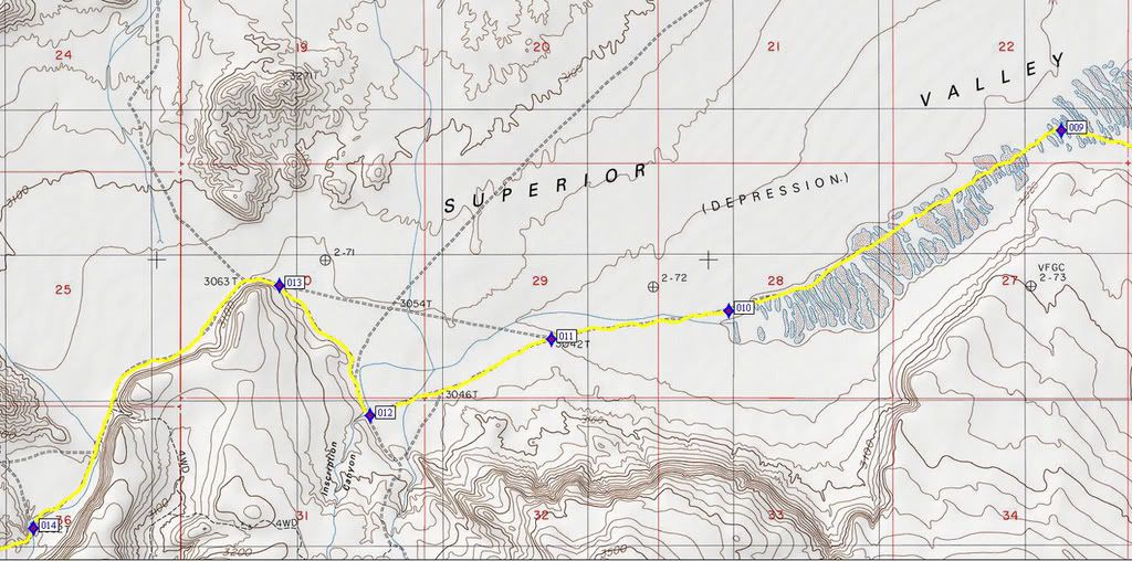
D21 009 - N35� 12.980 W117� 08.450
D21 010 - N35� 12.309 W117� 09.957
D21 011 - N35� 12.204 W117� 10.760
D21 012 - N35� 11.920 W117� 11.581
D21 013 - N35� 12.403 W117� 11.992
D21 014 - N35� 11.499 W117� 13.109
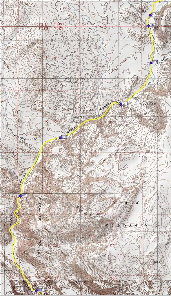
D21 015 - N35� 11.239 W117� 13.352
D21 016 - N35� 11.089 W117� 13.377
D21 017 - N35� 10.565 W117� 13.338
D21 018 - N35� 09.979 W117� 13.856
D21 019 - N35� 09.508 W117� 14.899
D21 020 - N35� 08.683 W117� 15.578
D21 021 - N35� 07.344 W117� 15.304
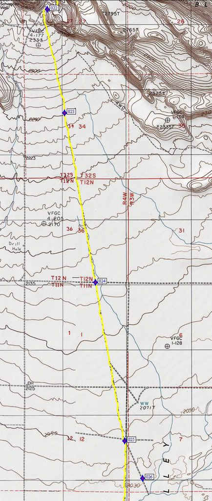
D21 022 - N35� 07.230 W117� 15.339
D21 023 - N35� 06.369 W117� 15.164
D21 024 - N35� 04.959 W117� 14.850
D21 025 - N35� 03.639 W117� 14.554
D21 026 - N35� 03.328 W117� 14.372
D21 027 - N35� 03.050 W117� 14.240
D21 028 - N35� 01.370 W117� 13.793
D21 029 - N35� 01.086 W117� 13.750
D21 030 - N35� 00.995 W117� 13.729
D21 031 - N34� 59.729 W117� 13.320
D21 032 - N34� 59.726 W117� 13.402
D21 033 - N34� 58.279 W117� 12.924
D21 034 - N34� 57.611 W117� 12.652
D21 035 - N34� 56.606 W117� 12.326
D21 036 - N34� 56.161 W117� 12.066
D21 037 - N34� 55.997 W117� 11.330
D21 038 - N34� 55.299 W117� 11.333
Trail ends on Highway 58, 7 miles West of Barstow
I have never done this trail. All information is from the internet and books. I will be running this trail on 12-30-07 and updating the thread after I get back.
Comment