Announcement

Collapse
No announcement yet.

keller peak coverage shown in google earth

Collapse

Forum Thread First Post

Collapse
X
 
  • Filter
  • Time
  • Show
Clear All
new posts

  • keller peak coverage shown in google earth

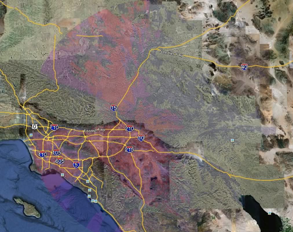
    kinda neat but a few of the repeaters have the antenna hight and power outputs in a database and then the expected coverage can be plotted on google earth. keller is the best example i could find. i got it from this website
    http://k5ehx.net/index.php?option=co...tpage&Itemid=1

    KB1UTG (keep being one ultimate tough guy)

  • #2
    That is the sight I use most often. I use Google earth to plan most of my back country trips. I have a plug-in that overlays USGS 7.5minute topos and I use K5EHX's site to export the repeaters to a KML file. That way I have all the info I need on one map. It’s very useful.
    Those left standing
    Will make millions
    Writing books on ways
    It should have been
    -Incubus "Warning"

    Comment


    • #3
      nice! what file are you using to overlay the topos? mine just recently stopped working
      KB1UTG (keep being one ultimate tough guy)

      Comment


      • #4
        Ill look when I get home. I'm on OSX(apple) though.
        Those left standing
        Will make millions
        Writing books on ways
        It should have been
        -Incubus "Warning"

        Comment


        • #5
          Originally posted by OU812 View Post
          Ill look when I get home. I'm on OSX(apple) though.
          Doesn't matter. One of the beautiful things about google earth, it even works on linux! Just share the KML/KMZ file!

          EDIT:
          Not sure what Scott uses, but I use this: http://www.gelib.com/usgs-topographic-maps-2.htm
          Last edited by Materdaddy; 10-27-10, 03:44 PM. Reason: add link
          If we aren't supposed to eat animals, then why are they made out of meat?

          http://jeep.matandtiff.com/

          Truth is treason in the empire of lies. -Ron Paul

          Comment


          • #6
            Yep that what I use. I was thinking more about the plug-in for the topos not working. It is very useful. I also use GPS Babble to transfer tracks and waypoints from Google Earth to my Garmin. They are very accurate too. My last two backpacking trips I went on I used the topos on Google Earth to lay down tracks and waypoints. They were off by 30-40 feet at the most.
            Those left standing
            Will make millions
            Writing books on ways
            It should have been
            -Incubus "Warning"

            Comment


            • #7
              thanks that add-on is nice! i dont think there is a easy way to store these for offline use though. my other add-on couldnt do that either. recently ive needed some topos while on the trail. i wouldnt mind more inside google earth, but the garmin program is looking good for a secondary
              KB1UTG (keep being one ultimate tough guy)

              Comment


              • #8
                Originally posted by troyboy162 View Post
                thanks that add-on is nice! i dont think there is a easy way to store these for offline use though. my other add-on couldnt do that either. recently ive needed some topos while on the trail. i wouldnt mind more inside google earth, but the garmin program is looking good for a secondary
                Once you've downloaded a map, it will put an item on the "Temporary Places" list. You can save/name it. Once you have it saved to "My Places" you can put it in a folder, view it, export it, etc.

                I don't use google earth offline, but does that not work?
                If we aren't supposed to eat animals, then why are they made out of meat?

                http://jeep.matandtiff.com/

                Truth is treason in the empire of lies. -Ron Paul

                Comment

                Working...
                X