Announcement

Collapse
No announcement yet.

Mineral Creek, Colorado

Collapse

Forum Thread First Post

Collapse
X
 
  • Filter
  • Time
  • Show
Clear All
new posts

  • Mineral Creek, Colorado


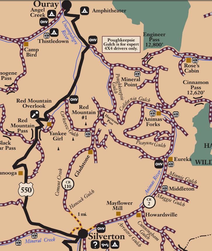
    San Juan Public Lands Map
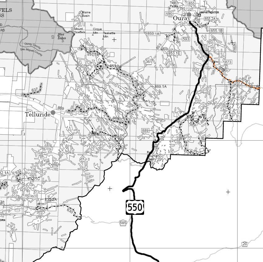


    San Juan National Forest Columbine District MVUM
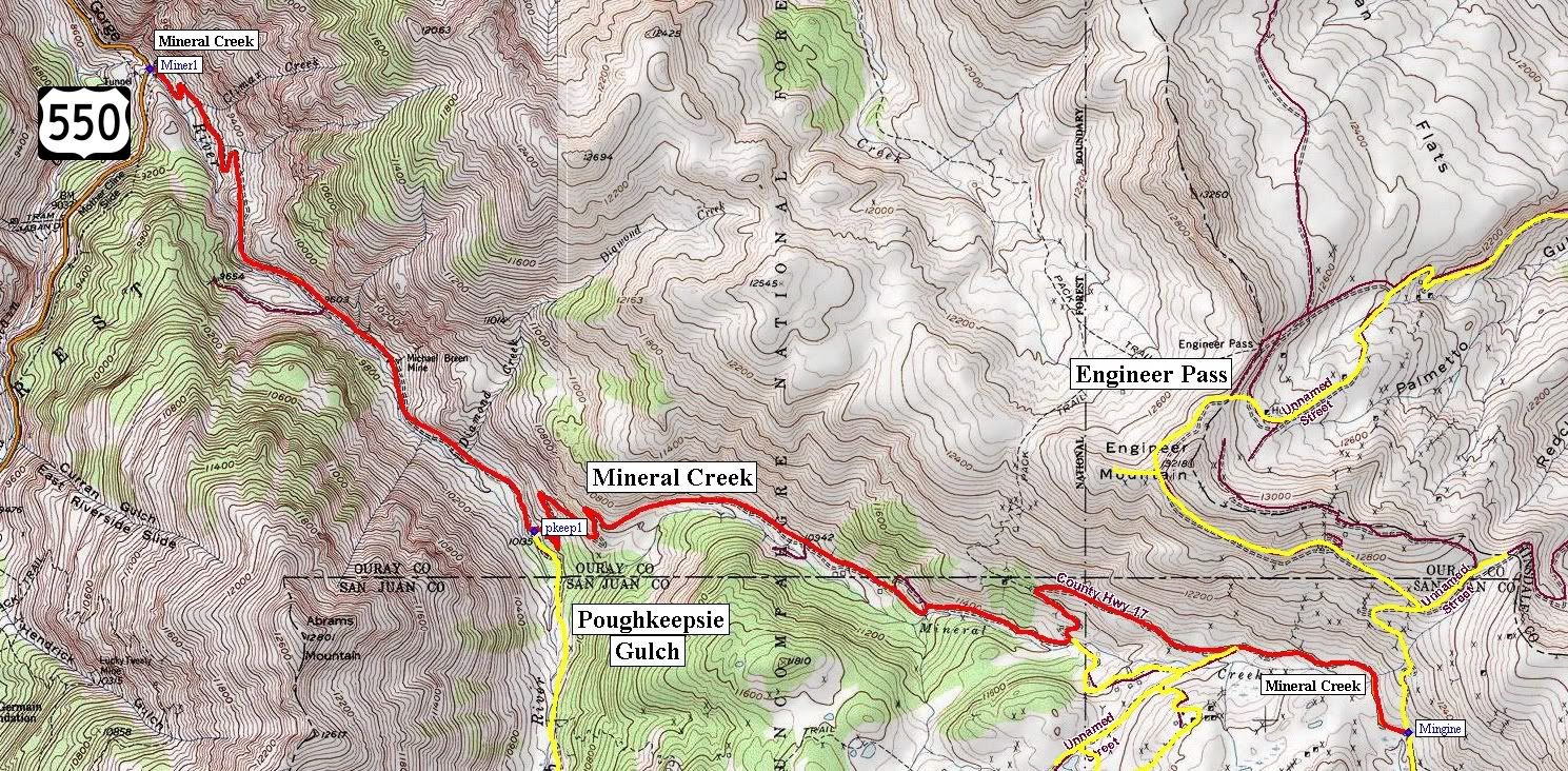


    http://www.traildamage.com/trails/index.php?id=76
    The traildamage site contains an extensive write up, photographs, videos, gpx files, kmz files, etc.

    http://www.narrowgauge.org/4x4/html/engineer.html
    4x4 Adventures in Colorado calls this trail "Lower Engineer Pass Road"
    4x4 Adventures in the San Juan Mountains website contains pictures.

    San Juan National Forest Route 878
    San Juan County Road 17
    Mineral Creek

    Length: 6.5 miles

    Elevation: 9700' to 11,500'

    From Highway 550 to Poughkeepsie Gulch this trail adopted by: Western Slope 4 Wheelers

    Trail rating: Blue Square More Difficult - Street legal vehicles and unlicensed off-highway vehicles allowed.
    Special Note Operators of unlicensed vehicles must have a valid drivers license and carry proof of liability insurance.

    West Entrance on Hwy 550 at N37° 59.312 W107° 38.973

    Poughkeepsie Gulch entrance at N37° 58.031 W107° 37.614

    San Juan Chief Mine loop at N37° 57.724 W107° 35.719

    San Juan Chief Mine loop at N37° 57.699 W107° 35.141

    East Entrance on Engineer Pass at N37° 57.466 W107° 34.528

    Lat/Lon format is hddd° mm.mmm WGS84 datum

    It is always a good idea to call ahead and get a current conditions report. San Juan Public Lands Office (970) 247-4874. San Juan National Forest Columbine Ranger District (970) 884-2512.
    Last edited by FishPOET; 05-06-15, 07:51 PM.
    Over 2500 hours donated to the San Bernardino National Forest. Life member of CA4WD, CORVA & BRC. Tread Lightly Trainer. Reforestation Supervisor. CASSP

  • #2
    Doug,

    This was somewhat confusing until I realized that there are TWO Mineral Creeks in the area.
    1. Your post shows a map of Mineral Creek accompanied by a description from the Traildamage site with Mineral Creek starting near Engineer Pass and flowing into the Uncompaghre River near Ouray.

    2. The San Juan Public Lands Map shows a Mineral Creek starting west of Silverton, flowing into the Animas River.

    This is the map of the Mineral Creek described in the post:


    This is the San Juan Public Lands Map showing Mineral Creek near Silverton


    Russ
    If you don't like the way I drive, stay out of the bushes!
    KI6MLU

    Comment


    • #3
      San Juan National Forest Road 585 - San Juan County Road 7 is on the South Fork of Mineral Creek and the locals call it South Mineral Creek. This is the route West of Silverton.

      San Juan National Forest Route 878 - San Juan County Road 17 is on Mineral Creek and half the locals call it Mineral Creek and the other half call it Lower Engineer Pass even though Engineer Pass is San Juan County Road 2 that clearly goes through Animas Forks, Eureka, Middleton, Howardsville and Silverton.

      Welcome to the nightmare that it has been trying to figure out which agency (4 counties, 4 national forests or BLM) manages the area and produces the correct map with legal open routes.
      Over 2500 hours donated to the San Bernardino National Forest. Life member of CA4WD, CORVA & BRC. Tread Lightly Trainer. Reforestation Supervisor. CASSP

      Comment

      Working...
      X