 Tweet
Tweet
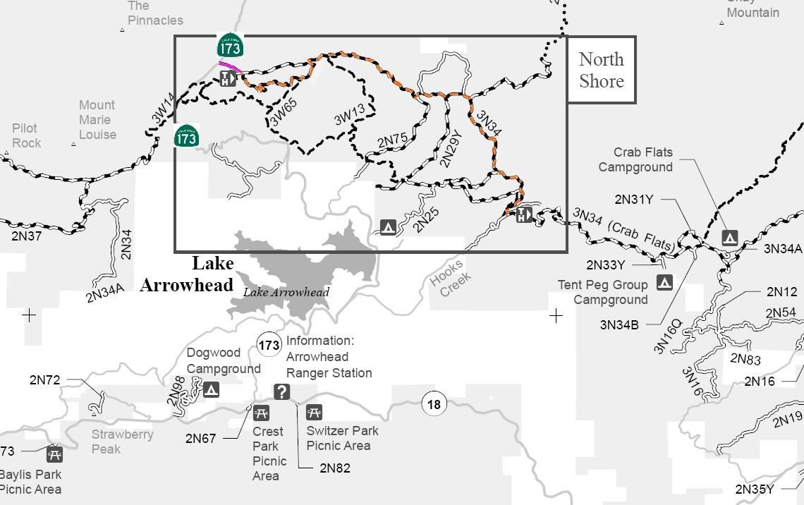
3N34 Willow Creek
Length: 7 miles
Trail Rating: Green Circle Easiest - Street legal vehicles and green sticker vehicles allowed
Elevation: 4400’ to 4900’
West entrance on Hwy 173 at N34� 18.015 W117� 12.301
3N34X loop West entrance at N34� 17.889 W117� 11.965
3W65 North entrance at N34� 17.838 W117� 11.037
3N34X loop East entrance at N34� 18.033 W117� 11.027
3W13 North entrance at N34� 18.099 W117� 10.639
2N75 North entrance at N34� 17.604 W117� 09.478
3N38 loop West entrance at N34� 17.661 W117� 09.413
2N29Y North entrance at N34� 17.613 W117� 09.064
3N38 loop East entrance at N34� 17.646 W117� 08.830
3N34D spur exit at N34� 17.594 W117� 08.724
2N25 North entrance at N34� 16.724 W117� 08.329
2N27Y East entrance at N34� 16.509 W117� 08.008
3N34C spur exit at N34� 16.289 W117� 08.162
2W11 South entrance at N34� 16.258 W117� 08.221
South entrance on 2N26Y at N34� 16.199 W117� 08.251
Lat/Lon format is hddd� mm.mmm WGS84 datum
It is always a good idea to call the ranger station before heading in to the forest and get a current conditions report. Arrowhead Ranger Station (909) 382-2782
SBNF Motor Vehicle Use Map (MVUM)
SBNF Google Earth file
3N34W Track.gpx
3N34W Waypoints.gpx