 Tweet
Tweet
SBNF Motor Vehicle Use Map (MVUM)
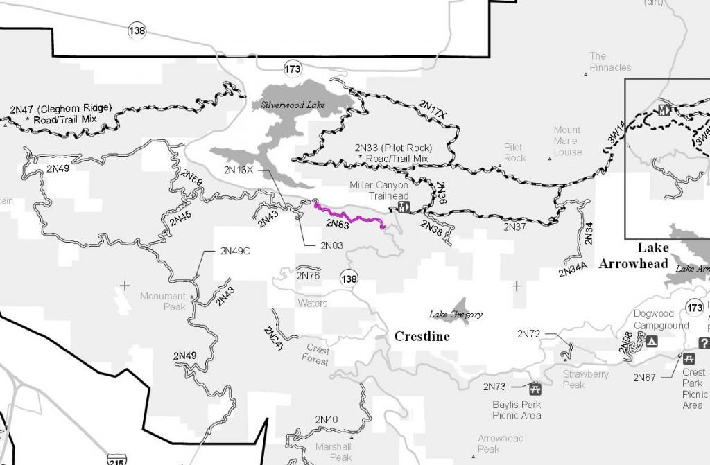
2N63
Length: 1.85 miles
Trail Rating: Green Circle Easiest - Street legal vehicles ONLY
Elevation: 3650’ to 4000’
East entrance on Highway 138 at N34° 15.963 W117° 17.542
West entrance on Highway 138 at N34° 16.339 W117° 17.542
Lat/Lon format is hddd° mm.mmm WGS84 datum
It is always a good idea to call the ranger station before heading in to the forest and get a current conditions report. Arrowhead Ranger Station (909) 382-2782
SBNF Google Earth file
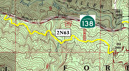