 Tweet
Tweet
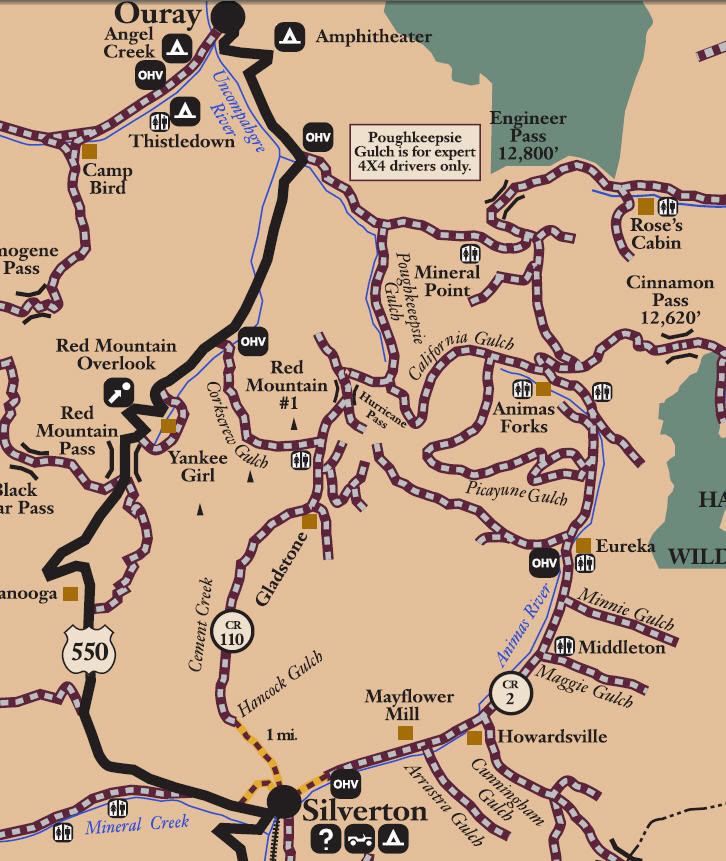
San Juan Public Lands Map
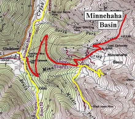
Minnehaha Basin
Length: 1 mile
Elevation: 10,500' to 12,450'
Trail rating: Blue Square More Difficult - Street legal vehicles and unlicensed off-highway vehicles allowed.
Special Note Operators of unlicensed vehicles must have a valid drivers license and carry proof of liability insurance.
Entrance on San Juan County Road 110 at N37� 53.449 W107� 38.996
Lat/Lon format is hddd� mm.mmm WGS84 datum
It is always a good idea to call ahead and get a current conditions report. San Juan Public Lands Office (970) 247-4874.

Comment