 Tweet
Tweet
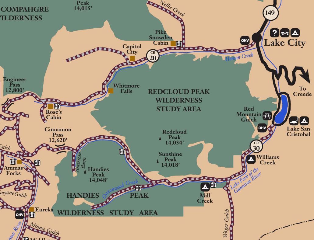
San Juan Public Lands Map

Gunnison National Forest South MVUM
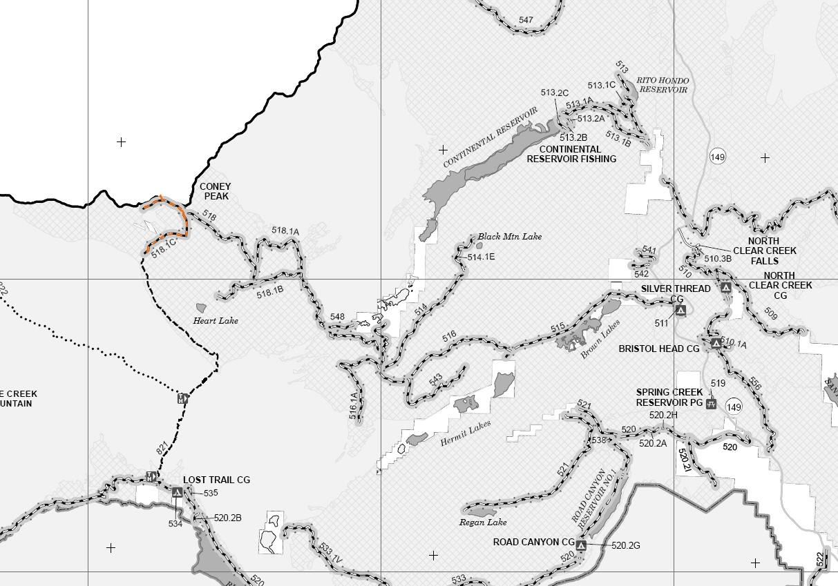
Rio Grande National Forest Divide District West MVUM
http://www.traildamage.com/trails/index.php?id=299
The traildamage site contains an extensive write up, photographs, videos, gpx files, kmz files, etc.
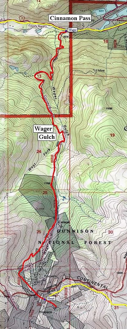
Hinsdale County Road 9
Gunnison District BLM route 3308
Gunnison National Forest route 568
Rio Grande National Forest route 518.1C
Wager Gulch
Length: 5 miles
Elevation: 9300' to 12,300'
Trail rating: Green Circle Easiest - Street legal vehicles and unlicensed off-highway vehicles allowed.
Special Note Operators of unlicensed vehicles must have a valid drivers license and carry proof of liability insurance.
North Entrance on Cinnamon Pass at N37� 54.369 W107� 21.656
South Entrance on Heart Lake Trail at N37� 51.318 W107� 21.959
Lat/Lon format is hddd� mm.mmm WGS84 datum
It is always a good idea to call ahead and get a current conditions report. San Juan Public Lands Office (970) 247-4874. Gunnison Field Office BLM (970) 642-4940. Rio Grande National Forest Divide Ranger District (719) 657-3321. Gunnison National Forest Lake City Office (970) 641-0471 or (970) 944-2500