 Tweet
Tweet
San Juan Public Lands Map
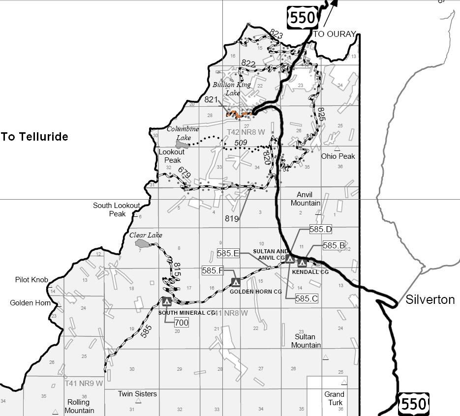
San Juan National Forest Columbine Ranger District MVUM
San Juan National Forest Road 821
Mill Creek
Length: 1 mile
Elevation: 10,500' to 11,350'
Trail rating: Blue Square Moderate - Street legal vehicles and unlicensed off-highway vehicles allowed
Special Notes Operators of unlicensed vehicles must have a valid drivers license and carry proof of liability insurance.
Entrance on US 550 at N37� 52.387 W107� 44.177
Lat/Lon format is hddd� mm.mmm WGS84 datum
It is always a good idea to call ahead and get a current conditions report. San Juan Public Lands Office (970) 247-4874. San Juan National Forest Columbine Ranger District (970) 884-2512.