 Tweet
Tweet
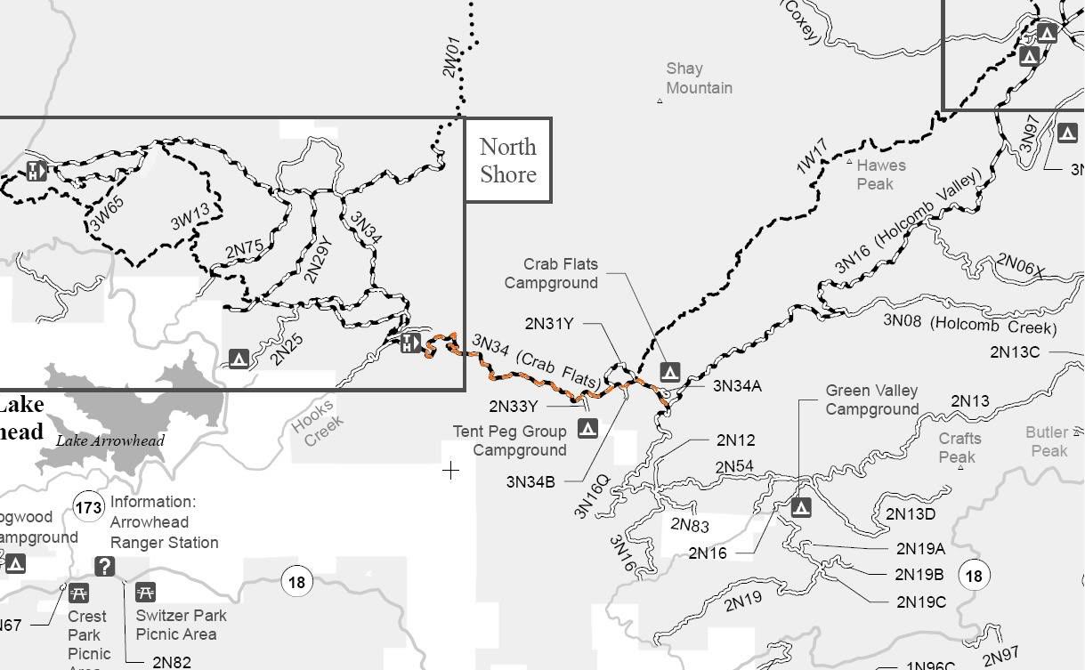
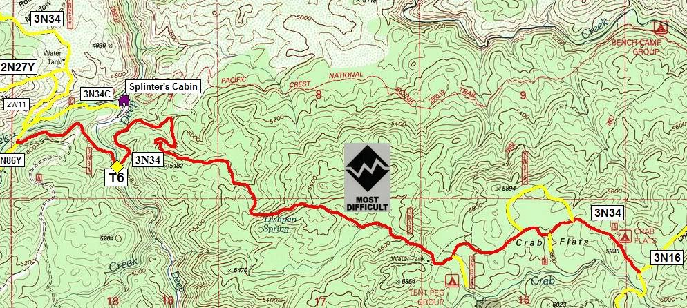
3N34 Dishpan
Length: 5 miles
Trail Rating: Black Diamond Most Difficult - Street legal vehicles and green sticker vehicles allowed
Elevation: 6000� to 7700�
Trail adopted by: Dirt Devils OffRoad Club
West entrance on 2N26Y at N34� 16.197 W117� 08.252
East entrance on 3N16 at N34� 15.654 W117� 05.077
Lat/Lon format is hddd� mm.mmm WGS84 datum
It is always a good idea to call the ranger station before heading in to the forest and get a current conditions report. Arrowhead Ranger Station (909) 382-2782
SBNF Motor Vehicle Use Map (MVUM)
SBNF Google Earth file
Comment