 Tweet
Tweet
http://www.fs.usda.gov/Internet/FSE_...rdb5202572.pdf
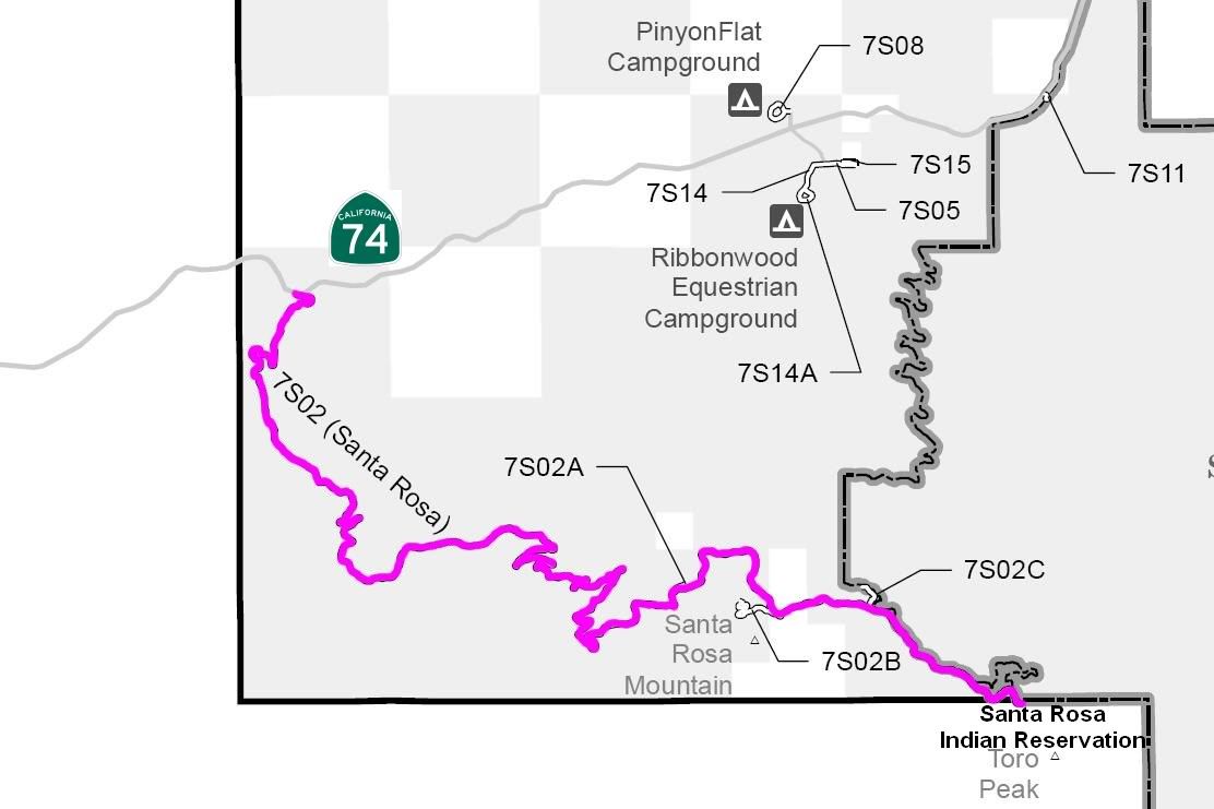

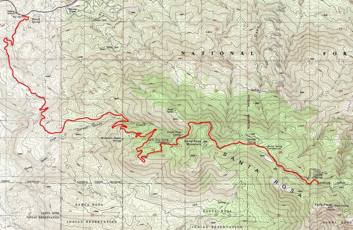
7S02 Santa Rosa
Length: 12 miles
Trail Rating: Green Circle Easiest
Street legal vehicles ONLY
Elevation: 4500� to 8000�
North entrance on Hwy 74 at
N33� 34.068 W116� 30.693
Lat/Lon format is hddd� mm.mmm
WGS84 datum
It is always a good idea to call the ranger station before heading in to the forest and get a current conditions report. Idyllwild Ranger Station (909) 382-2921